East Bloomington in Hennepin County, Minnesota — The American Midwest (Upper Plains)
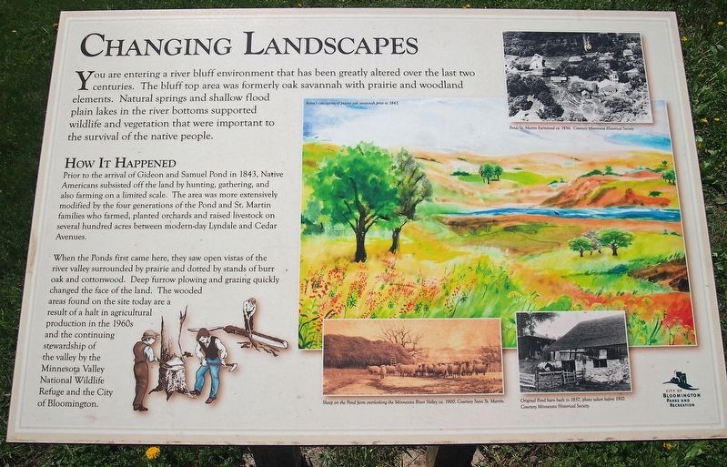
Changing Landscapes
How It Happened
Prior to the arrival of Gideon and Samuel Pond in 1843, Native Americans subsisted off the land by hunting, gathering, and also farming on a limited scale. The area was more extensively modified by the four generations of the Pond and St. Martin families who farmed, planted orchards and raised livestock on several hundred acres between modern-day Lyndale and Cedar Avenues. When the Ponds first came here, they saw open vistas of the river valley surrounded by prairie and dotted by stands of burr oak and cottonwood. Deep furrow plowing and grazing quickly changed the face of the land. The wooded areas found on the site today are a result of a halt in agricultural production in the 1960s and the continuing stewardship of the valley by the Minnesota Valley National Wildlife Refuge and the City of Bloomington.
Erected by City of Bloomington Parks and Recreation.
Topics. This historical marker is listed in these topic lists: Agriculture • Environment • Native Americans • Settlements & Settlers. A significant historical year for this entry is 1843.
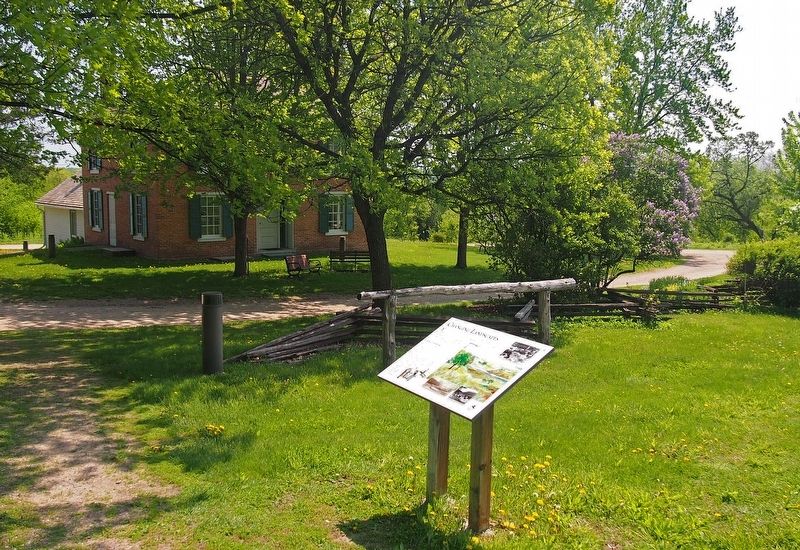
Location. 44° 48.804′ N, 93° 16.301′ W. Marker is in Bloomington, Minnesota, in Hennepin County. It is in East Bloomington. Marker can be reached from 104th St E. In Pond-Dakota Mission Park on footpath just west of Gideon Pond House. Touch for map. Marker is at or near this postal address: 401 104th St E, Minneapolis MN 55420, United States of America. Touch for directions.
Other nearby markers. At least 8 other markers are within walking distance of this marker. Samuel W. and Gideon H. Pond (within shouting distance of this marker); Gideon and Agnes Pond House (within shouting distance of this marker); 1856 Federal Style Gideon H. Pond House (within shouting distance of this marker); Pond Family Heritage Timeline (within shouting distance of this marker); Missionaries to the Dakota (within shouting distance of this marker); Dakota Missions on the Frontier (within shouting distance of this marker); Oak Grove Mission (within shouting distance of this marker); Dakota Life (about 500 feet away, measured in a direct line). Touch for a list and map of all markers in Bloomington.
Credits. This page was last revised on February 12, 2023. It was originally submitted on May 18, 2018, by McGhiever of Minneapolis, Minnesota. This page has been viewed 223 times since then and 8 times this year. Photos: 1, 2. submitted on May 18, 2018, by McGhiever of Minneapolis, Minnesota. • Bill Pfingsten was the editor who published this page.

