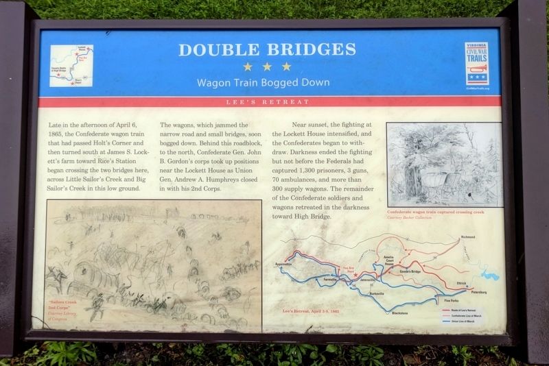
Near Rice in Prince Edward County, Virginia — The American South (Mid-Atlantic)
Double Bridges
Wagon Train Bogged Down
ó Lee's Retreat ó
The wagons, which jammed the narrow road and small bridges, soon bogged down. Behind this roadblock, to the north, Confederate Gen. John B. Gordonís corps took up positions near the Lockett House as Union Gen. Andrew A. Humphreys closed in with his 2nd Corps.
Near sunset, the fighting at the Lockett House intensified, and the Confederates began to withdraw. Darkness ended the fighting but not before the Federals had captured 1,300 prisoners, 3 guns, 70 ambulances, and more than 300 supply wagons. The remainder of the Confederate soldiers and wagons retreated in the darkness toward High Bridge.
Erected by Virginia Civil War Trails.
Topics and series. This historical marker is listed in this topic list: War, US Civil. In addition, it is included in the Virginia Civil War Trails series list. A significant historical date for this entry is April 6, 1865.
Location. 37° 19.603′ N, 78° 15.514′ W. Marker is near Rice, Virginia, in Prince Edward County. Marker is on Lockett Road (County Route 619) 1.4 miles west of James Town Road (County Route 618), on the left when traveling west. Touch for map. Marker is in this post office area: Rice VA 23966, United States of America. Touch for directions.
Other nearby markers. At least 8 other markers are within 3 miles of this marker, measured as the crow flies. A different marker also named Double Bridges (approx. 0.2 miles away); Lockett House (approx. 0.6 miles away); Sailorís Creek (approx. 0.6 miles away); a different marker also named Lockett House (approx. 0.6 miles away); Crossing Little Sailor's Creek (approx. 2.3 miles away); Assaulting the Confederate Battle Line (approx. 2.3 miles away); Battle of Sailor's (Sayler's) Creek (approx. 2.3 miles away); Hillsman House (approx. 2.3 miles away). Touch for a list and map of all markers in Rice.
Also see . . .
1. Sailor's Creek Battlefield State Park. Virginia Department of Conservation and Recreation (Submitted on November 11, 2021.)
2. Sailor's Creek (Saylor's Creek). American Battlefield Trust (Submitted on November 11, 2021.)
Credits. This page was last revised on November 11, 2021. It was originally submitted on May 20, 2018, by Bernard Fisher of Richmond, Virginia. This page has been viewed 471 times since then and 56 times this year. Photo 1. submitted on May 20, 2018, by Bernard Fisher of Richmond, Virginia.
Editor’s want-list for this marker. Wide shot of marker and its surroundings. • Can you help?
