Ellery in Chautauqua County, New York — The American Northeast (Mid-Atlantic)
Farming and Industrial Development
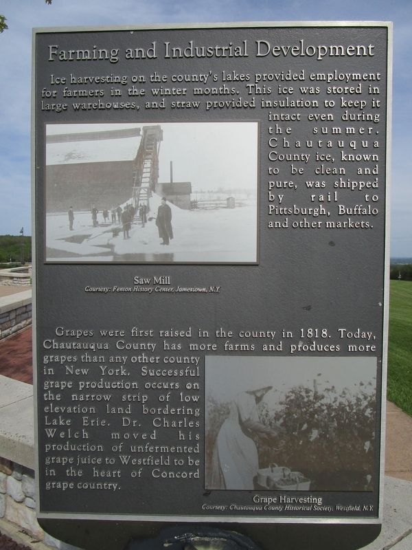
Ice harvesting on the county's lakes provided employment for farmers in the winter months. This ice was stored in large warehouses, and straw provided insulation to keep it intact even during the summer. Chautauqua County ice, known to be clean and pure, was shipped by rail to Pittsburgh, Buffalo and other markets.
Saw Mill. Courtesy: Fenton History Center, Jamestown, N.Y.
Grapes were first raised in the county in 1818. Today, Chautauqua County has more farms and produces more grapes that any other county in New York. Successful grape production occurs on the narrow strip of low elevation land bordering Lake Erie. Dr. Charles Welch moved his production of unfermented grape juice to Westfield to be in the heart of Concord grape country.
Grape Harvesting. Courtesy: Chautauqua County Historical Society, Westfield, N.Y.
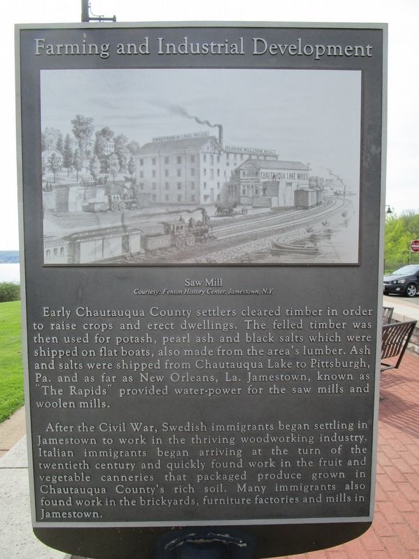
Saw Mill
Early Chautauqua County settlers cleared timber in order to raise crops and erect dwellings. The felled timber was then used for potash, pearl ash and black salts which were shipped on flat boats, also made from the area's lumber. Ash and salts were shipped from Chautauqua Lake to Pittsburgh, Pa. and as far New Orleans, La. Jamestown, known as "The Rapids" provided water-power for the saw mills and woolen mills.
After the Civil War, Swedish immigrants began settling in Jamestown to work in the thriving woodworking industry. Italian immigrants began arriving at the turn of the twentieth century and quickly found work in the fruit and vegetable canneries that packaged produce grown in Chautauqua County's rich soil. Many immigrants also found work in the brickyards, furniture factories and mills in Jamestown.
Topics. This historical marker is listed in these topic lists: Agriculture • Industry & Commerce. A significant historical year for this entry is 1818.
Location. 42° 8.042′ N, 79° 20.949′ W. Marker is in Ellery, New York, in Chautauqua County. Marker is at the intersection of Chautauqua Lake Rest Area and Interstate 86, on the right when traveling east on Chautauqua Lake Rest Area. This is the 2nd of four markers at the Chautauqua Lake Rest Area between exits 10 & 11 on I-86; eastbound access only. Touch for map. Marker is in this post office area: Bemus Point NY 14712, United States of America. Touch for directions.
Other nearby markers. At least 8 other markers are within 3 miles of this marker, measured as the crow flies. The Land Around Us (here, next to this marker); What Does "Chautauqua" Mean? (about 300 feet away, measured in a direct line); Transportation (about 300 feet away); Packard Mansion (approx. 2.3 miles away); Lakeview House, Sterlingworth Hotel and Lakewood Country Club (approx. 2.3 miles away); First Kent House and Second Kent House (approx. 2.3 miles away); Lakewood Honor Roll (approx. 2.3 miles away); Paul Sorg Mansion (approx. 2.3 miles away). Touch for a list and map of all markers in Ellery.
Credits. This page was last revised on August 27, 2018. It was originally submitted on May 20, 2018, by Anton Schwarzmueller of Wilson, New York. This page has been viewed 251 times since then and 16 times this year. Last updated on August 22, 2018, by Douglass Halvorsen of Klamath Falls, Oregon. Photos: 1, 2, 3, 4. submitted on May 20, 2018, by Anton Schwarzmueller of Wilson, New York. • Andrew Ruppenstein was the editor who published this page.


