La Trinidad in Tequisquiapan, Querétaro, Mexico — The Central Highlands (North America)
La Trinidad Natural Protected Area
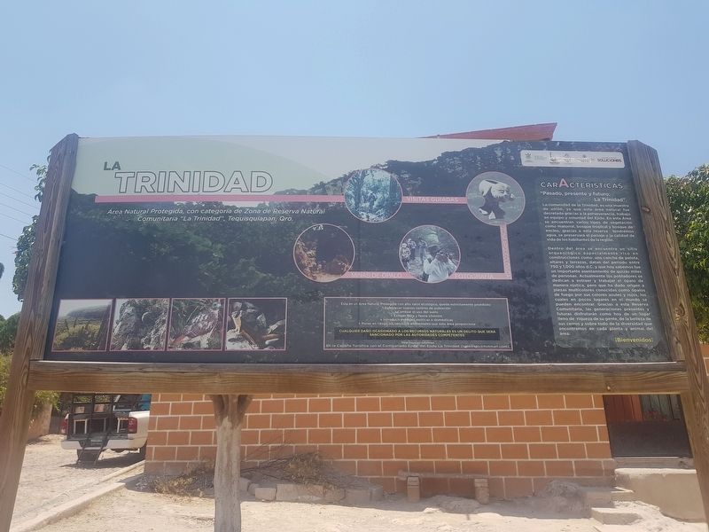
Área Natural Protegida, con categoría de Zona de Reserva Natural Comunitaria “La Trinidad”, Tequisquiapan, Qro.
"Pasado, presente y futuro: La Trinidad".
La comunidad de la Trinidad, es una muestra de unión, ya decretada gracias a la perseverancia, trabajo en equipo y voluntad del Ejido. En esta Área se encuentran varios tipos de vegetación como matorral, bosque tropical y bosque de encino, gracias a esta reserva tendremos agua, se preservará el paisaje y la calidad de vida de los habitantes de la región.
Dentro del área se encuentra un sitio arqueológico especialmente rico en construcciones como: una cancha de pelota, altares y terrazas, datan del periodo entre 750 y 1,000 años d.C. y que hoy sabemos fue un importante asentamiento de quizás miles de personas. Actualmente los pobladores se dedican a extraer y trabajar el ópalo de manera rústica, pero que ha dado origen a piezas multicolores conocidas como ópalos de fuego por sus colores azules y rojos, los cuales en pocos lugares en el mundo se pueden encontrar. Gracias a esta Reserva Comunitaria, las generaciones presentes y futuras disfrutarán como hoy de un lugar lleno de riqueza de su gente, de la belleza de sus cerros y sobre todo de la diversidad que encontramos en cada planta y animal del área.
¡Bienvenidos!
Esta es un Área Natural Protegida con alto valor ecológico, queda estrictamente prohibido:
- Establecer nuevos centros de población
- Cambiar el uso del suelo
- Extraer flora y fauna silvestre
- Introducir especies exóticas o domésticas
- Poner en riesgo los servicios ambientales que esta área proporciona
Cualquier daño ocasionado a los recursos naturales es un delito que será sancionado por las autoridades competentes
Para mayores informes: En la Cabaña Turística con el Comisariado Ejidal del Ejido La Trinidad ([email protected])
A Natural Protected Area, categorized as the “La Trinidad” Community Natural Reserve Zone, Tequisquiapan, Querétaro
Characteristics
"Past, present and future: La Trinidad".
The community of the La Trinidad is united and has been legalized thanks to the perseverance, teamwork and the will of the Ejido (community property). In this area there are several types of vegetation such as scrub, tropical forest and oak forest. Thanks to this reserve this community is provide

Photographed By J. Makali Bruton, May 20, 2018
2. La Trinidad Natural Protected Area Marker
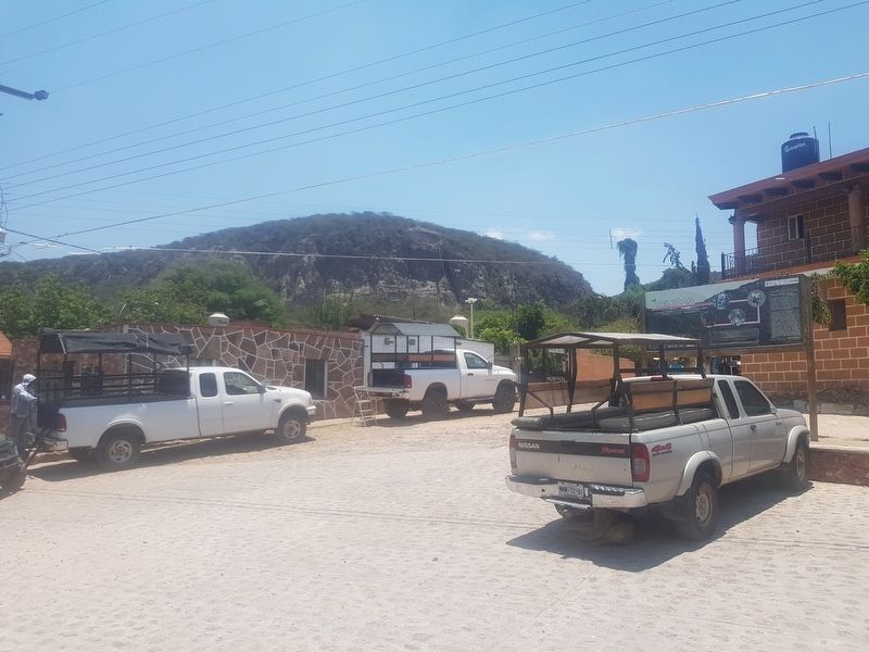
The marker can be seen here to the right, near vehicles used to tour opal mines. At the time of this visit, however, it was not possible to visit the Reserve's archaeological areas mentioned in the marker text.
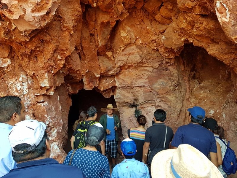
Within this area there is an archaeological site especially rich in buildings such as: a ball court, altars and terraces, dating from the period between 750 and 1000 AD. Today we know it was an important settlement of perhaps thousands of people. Currently, the inhabitants are dedicated to extracting and working opal minerals in a rustic way. This work given rise to multicolored pieces known as fire opals, for their blue and red colors, which in few places in the world can be found. Thanks to this Community Reserve, present and future generations will enjoy it today as a place full of the wealth of its people, the beauty of its hills and above all, the diversity found in every plant and animal in the area. Welcome!
This is a Protected Natural Area with high ecological value, it is strictly prohibited:
- Establish new populated places
- Change the land use
- Extract flora and fauna
- Introduce exotic or domestic species
- Put at risk the environmental services that this area provides
Any damage caused to natural resources is a crime that will be sanctioned by the competent authorities.
For more information please locate the Tourist Services Cabin of the Commissioner of the Ejido La Trinidad ([email protected])
Erected by
Ejido La Trinidad.
Topics. This historical marker is listed in these topic lists: Anthropology & Archaeology • Industry & Commerce • Native Americans • Parks & Recreational Areas.
Location. 20° 30.786′ N, 99° 57.8′ W. Marker is in La Trinidad, Querétaro, in Tequisquiapan. Marker is on Calle 1 de Junio just west of Calle 24 de Octubre, on the right. The marker is a few meters north of the Hector Montes Opal Tours office in La Trinidad. Touch for map. Marker is in this post office area: La Trinidad QUE 76774, Mexico. Touch for directions.
Other nearby markers. At least 8 other markers are within 8 kilometers of this marker, measured as the crow flies. Electricity in La Llave (approx. 6.1 kilometers away); The Geographical Center of Mexico (approx. 7.3 kilometers away); The Legend of the Baroness (approx. 7.3 kilometers away); First Public Education in Tequisquiapan (approx. 7.5 kilometers away); Municipal Auditorium (approx. 7.5 kilometers away); Plaza Reforma (approx. 7.5 kilometers away); Miguel Hidalgo y Costilla (approx. 7.6 kilometers away); Parish of Santa María de la Asunción (approx. 7.6 kilometers away).
Credits. This page was last revised on June 10, 2018. It was originally submitted on June 10, 2018, by J. Makali Bruton of Accra, Ghana. This page has been viewed 481 times since then and 54 times this year. Photos: 1, 2, 3, 4. submitted on June 10, 2018, by J. Makali Bruton of Accra, Ghana.


