City of London in Greater London, England, United Kingdom — Northwestern Europe (the British Isles)
London Bridge
London Bridge
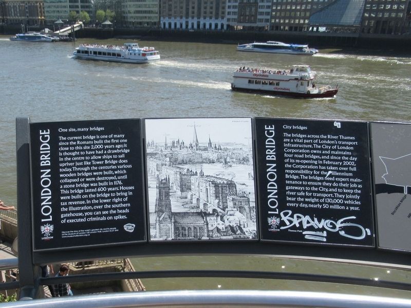
One site, many bridges
The current bridge is one of many since the Romans built the first one close to this site 2,000 years ago; it is thought to have had a drawbridge in the centre to allow ships to sail upriver just like Tower Bridge does today. Through the centuries various wooden bridges were built, which collapsed or were destroyed, until a stone bridge was built in 1176. This bridge lasted 600 years. Houses were built on the bridge to bring in tax revenue. In the lower right of the illustration, over the southern gatehouse, you can see the heads of executed criminals on spikes.
Discover the story of the world's greatest city and its people at the Museum of London 150 London Wall London EC2Y 5HN www.museumoflondon.org.uk
City bridges
The bridges across the River Thames are a vital part of London's transport infrastructure. The City of London Corporation owns and maintains four road bridges, and since the day of its re-opening in February 2002, the Corporation has taken over full responsibility for the Millennium Bridge. The bridges need expert maintenance to ensure they do their job as gateways to the City, and to keep the river safe for transport. They jointly bear the weight of 130,000 vehicles every day, nearly 50 million a year.
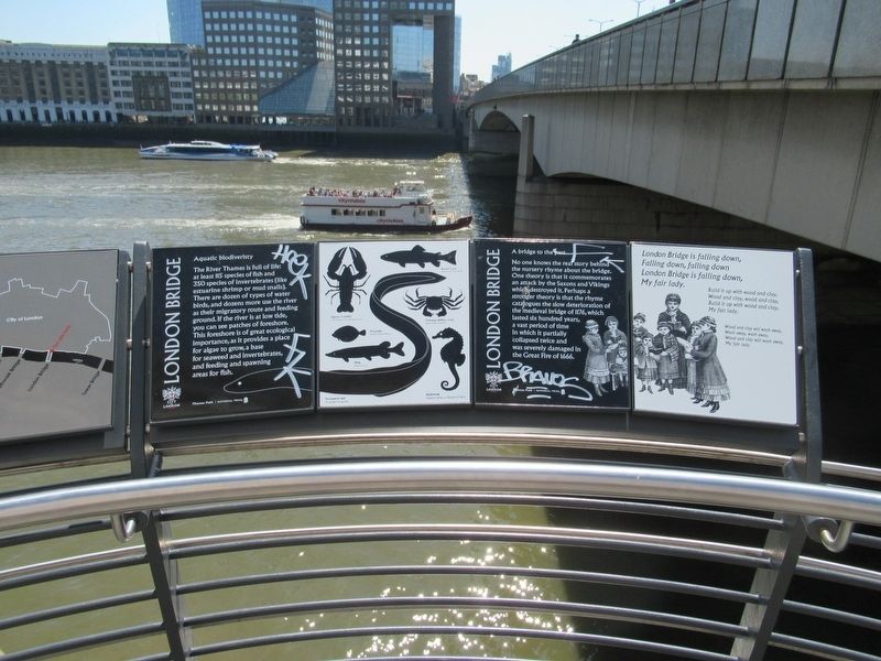
Aquatic biodiversity
The River Thames is full of life: at least 115 species of fish and350 species of invertebrates (like estuarine shrimp or mud snails). There are dozen of types of water birds, and dozens more use the river as their migratory route and feeding ground. If the river is at low tide, you can see patches of foreshore. This foreshore is of great ecological importance, as it provides a place for algae to grow, a base for seaweed and invertebrates, and feeding and spawning areas for fish.
A bridge to the past
No one knows the real story behind the nursery rhyme about the bridge. One theory is that it commemorates an attack by the Saxons and Vikings which destroyed it. Perhaps a stronger theory is that the rhyme catalogues the slow deterioration of the medieval bridge of 1176, which lasted six hundred years, a vast period of time in which it partially collapsed twice and was severely damaged in the Great Fire of 1666.
Thames Path National Trail
London Bridge is falling down,
Falling down, falling down
London Bridge is falling down,
My fair lady.
Build it up with wood and clay,
Wood and clay, wood and clay,
Build it up with wood and clay,
My fair lady.
Wood and clay will wash away,
Wash away, wash away,
Wood and clay will wash away,
My fair lady.
Topics. This historical marker is listed in this topic list: Bridges & Viaducts.
Location. 51° 30.532′ N, 0° 5.223′ W. Marker is in City of London, England, in Greater London. Marker is at the intersection of King William Street and Lower Thames Street, on the left when traveling south on King William Street. Located next to London Bridge on the north shore. Touch for map. Marker is in this post office area: City of London, England EC4R 3TR, United Kingdom. Touch for directions.
Other nearby markers. At least 8 other markers are within walking distance of this marker. The Monument (about 150 meters away, measured in a direct line); The King’s Baker’s Shop (about 180 meters away); St. Margaret Fish Street Hill (about 180 meters away); St. Leonard Eastcheap (about 210 meters away); Sixty Years of Peace (approx. 0.3 kilometers away); The Glaziers Hall (approx. 0.3 kilometers away); William Nicholson (approx. 0.3 kilometers away); The Church of St. Olave (approx. 0.3 kilometers away). Touch for a list and map of all markers in City of London.
Also see . . . London Bridge on Wikipedia. (Submitted on June 11, 2018, by Michael Herrick of Southbury, Connecticut.)
Credits. This page was last revised on January 27, 2022. It was originally submitted on June 11, 2018, by Michael Herrick of Southbury, Connecticut. This page has been viewed 174 times since then and 22 times this year. Photos: 1, 2, 3. submitted on June 11, 2018, by Michael Herrick of Southbury, Connecticut.


