Brownsville in Cameron County, Texas — The American South (West South Central)
Cameron County
Since 1535 men of all nations of the earth sailed
the blue waters of the Gulf of Mexico to the green
valley of the Rio Grande in search of happiness,
and each found it in his own time and in his own way.
1535 Alvar Nunez Cabeza de Vaca
1686 Alonzo de Leon, Fr. Damian Manzanet
1749 Jose de Escandon
1771 Jose Salvador de la Garza
1787 Jose Goseascochea
1794 Nicolas Balli
1818 Manuel Yturria, Cristobal Longoria, Jose Antonio Esparza
1823 Martin de Leon, Ramon Lafon
1828 Charles Stillman, James McGloin
1834 William Neale, Reuben M. Potter
1846 Zachary Taylor, George B. McClellan, Ulysses S. Grant, Mariano Arista, Mifflin Kennedy
1847 Jefferson Davis, Winfield Scott, Thomas J. Jackson, Stephen Powers, Richard King, John S. Ford
1849 Simon Mussina, John Young
1850 John R. Butler, Franklin Cummings, Joseph Kleiber, Francis W. Latham, Jose San Roman, Simon Celaya
1855 Edmund J. Davis,
1856 Robert E. Lee,
1859 Samuel P. Heintzelman
1863 John B. Magruder, Hamilton P. Bee
1864 Raphael Semmes
1865 Phillip H. Sheridan, Lew Wallace
1872 Richard Henry Savage, John L. Haynes
1875 Lee H. McNelly
1876 Porfirio Diaz
1878 James B. Wells
1881 William C. Gorgas, Enoch H. Crowder
Erected 1936 by State of Texas. (Marker Number 641.)
Topics and series. This historical marker is listed in these topic lists: Exploration • Settlements & Settlers. In addition, it is included in the Former U.S. Presidents: #12 Zachary Taylor, the Former U.S. Presidents: #18 Ulysses S. Grant, and the Texas 1936 Centennial Markers and Monuments series lists. A significant historical date for this entry is February 12, 1848.
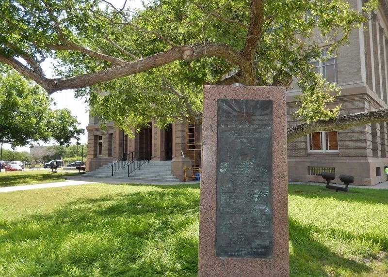
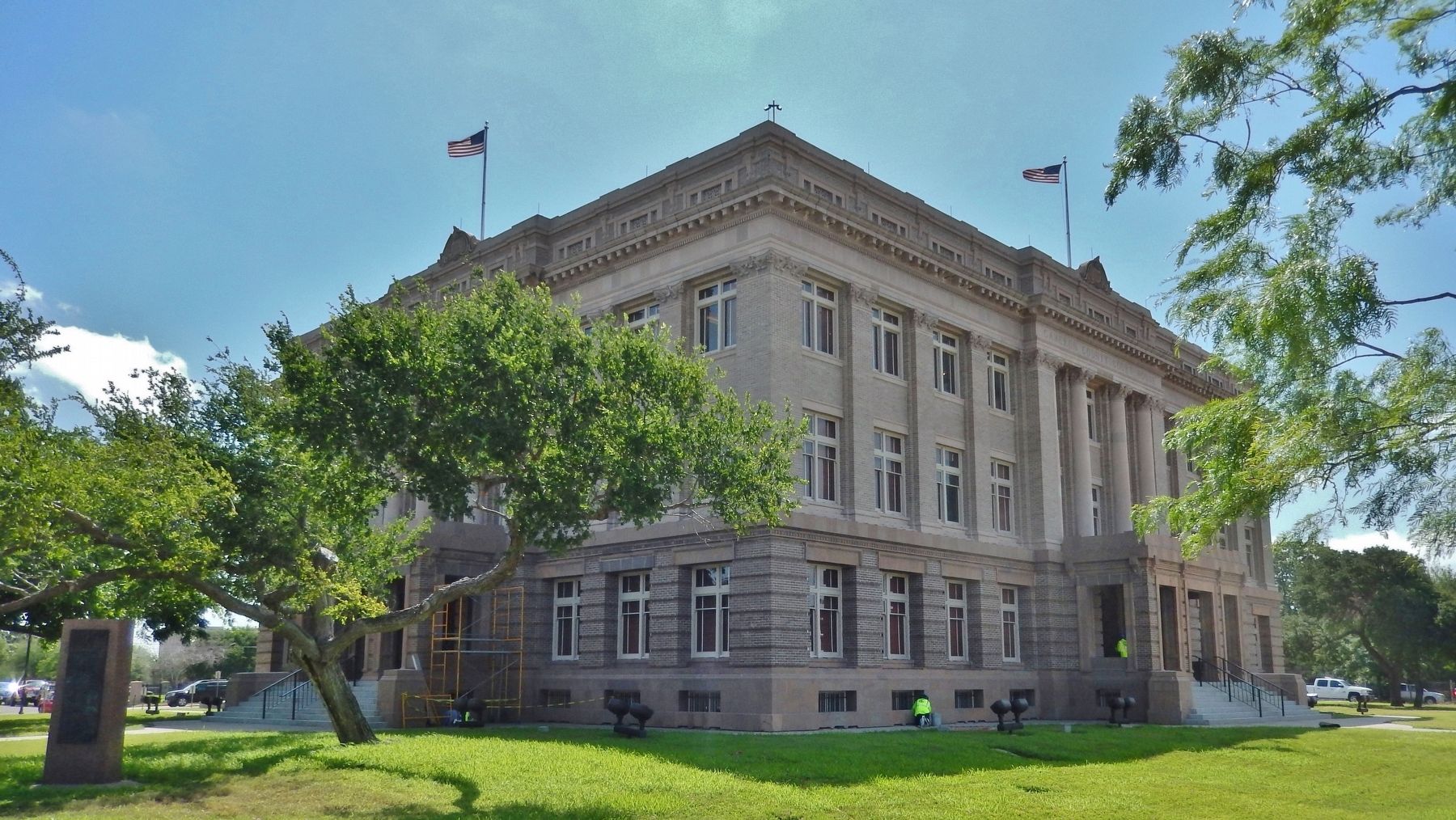
Location. 25° 54.257′ N, 97° 29.744′ W. Marker is in Brownsville, Texas, in Cameron County. Marker is on East 11th Street north of East Madison Street, on the right when traveling north. Marker is located near the northwest corner of the Old (1912) Cameron County Courthouse, (now known as the Dancy Building), under a huge tree. Touch for map. Marker is at or near this postal address: 1150 E Madison St, Brownsville TX 78520, United States of America. Touch for directions.
Other nearby markers. At least 8 other markers are within walking distance of this marker. 1912 Cameron County Courthouse (within shouting distance of this marker); Cameron County Courthouse (within shouting distance of this marker); Old Cameron County Courthouse/Dancy Building (within shouting distance of this marker); Field/Pacheco Complex (within shouting distance of this marker); a different marker also named Field-Pacheco Complex (about 300 feet away, measured in a direct line); Old Jail (about 300 feet away); Campo Santo Viejo (about 300 feet away); Old County Jail / Fernandez Building (about 300 feet away). Touch for a list and map of all markers in Brownsville.
More about this marker. Marker is a 1936 Texas Centennial monument. Marker is a tall, polished pink granite slab, with an oblong engraved metal plaque. The plaque has some bas-relief sculpture in addition to the engraved words. The plaque is severely weathered and somewhat difficult to read.
Also see . . .
1. Cameron County. In 1687 Alonso De León, on his second journey to find the location of Fort St. Louis, crossed the Rio Grande and proceeded north. Beginning in January 1747, Miguel de la Garza Falcón reconnoitered the north bank of the Rio Grande. He listed the numerous Indian groups in the area and described the land as unfit for settlement because of the inadequate fresh water supply. On February 27, 1747, José de Escandón built a
raft to sound the Rio Grande north of present-day Matamoros, Tamaulipas, and crossed into what is now Cameron County. (Submitted on June 11, 2018, by Cosmos Mariner of Cape Canaveral, Florida.)
2. Cameron County. The county was founded in 1848 and is named for Captain Ewen Cameron, a soldier during the Texas Revolution and in the ill-fated Mier Expedition. During the later 19th century and through World War II, Fort Brown was a US Army outpost here, stimulating the development of the city of Brownsville. (Submitted on June 11, 2018, by Cosmos Mariner of Cape Canaveral, Florida.)
Credits. This page was last revised on June 12, 2018. It was originally submitted on June 11, 2018, by Cosmos Mariner of Cape Canaveral, Florida. This page has been viewed 392 times since then and 18 times this year. Photos: 1, 2, 3. submitted on June 11, 2018, by Cosmos Mariner of Cape Canaveral, Florida. • Bernard Fisher was the editor who published this page.


