Anderson in Grimes County, Texas — The American South (West South Central)
Grimes County, C.S.A.
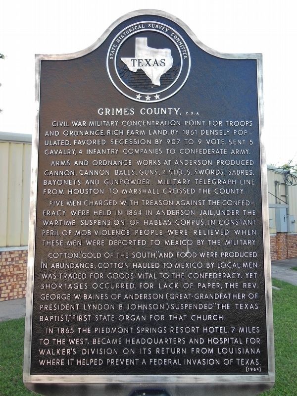
Civil War military concentration point for troops and ordnance. Rich farm land. By 1861 densely populated. Favored secession by 907 to 9 vote. Sent 5 cavalry, 4 infantry companies to Confederate Army.
Arms and ordnance works at Anderson produced cannon, cannon balls, guns, pistols, swords, sabers, bayonets, and gunpowder. Military telegraph line from Houston to Marshall crossed the county.
Five men charged with treason against the Confederacy were held in 1864 in Anderson Jail, under the wartime suspension of habeas corpus, in constant peril of mob violence. People were relieved when these men were deported to Mexico by the military.
Cotton, "Gold of the South,” and food were produced in abundance. Cotton hauled to Mexico by local men was traded for goods vital to the Confederacy. Yet shortages occurred. For lack of paper, The Rev. George W. Baines of Anderson (great-grandfather of President Lyndon B. Johnson) suspended "The Texas Baptist,” first state organ for that church.
In 1865 the Piedmont Springs Resort Hotel, 7 miles to the west, became headquarters and hospital for Walker's division on its return from Louisiana where it helped prevent a Federal invasion of Texas.
Erected 1964 by State Historical Survey Committee. (Marker Number 8586.)
Topics. This historical marker is listed in these topic lists: Agriculture • Industry & Commerce • War, US Civil.
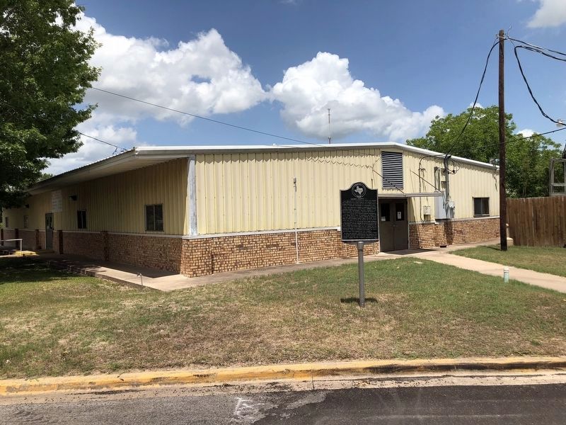
Location. 30° 29.335′ N, 95° 59.227′ W. Marker is in Anderson, Texas, in Grimes County. Marker is at the intersection of South Main Street (Loop State Highway 429) and Buffington Avenue, on the right when traveling south on South Main Street. Marker is located on east side of the Grimes County Court Annex building. Touch for map. Marker is at or near this postal address: 114 West Buffington Avenue, Anderson TX 77830, United States of America. Touch for directions.
Other nearby markers. At least 8 other markers are within walking distance of this marker. A different marker also named Grimes County (within shouting distance of this marker); Grimes County Courthouse (within shouting distance of this marker); Veterans Memorial (within shouting distance of this marker); In Memory of Jesse Grimes and Mathew Caldwell (within shouting distance of this marker); Rocky Creek Bridge (approx. 0.2 miles away); Steinhagen Log Cabin (approx. 0.2 miles away); La Bahia Road (approx. ¼ mile away); Fanthorp Inn (approx. 0.4 miles away). Touch for a list and map of all markers in Anderson.
Related markers. Click here for a list of markers that are related to this marker.
Also see . . . Grimes County. There was virtually no voice in Grimes County raised in opposition to the secessionist movement during the crisis of 1860 and 1861. Hundreds of county residents volunteered for service in Confederate and state military units. State formations to which local companies were attached included the Second, Fourth, Eighth, and Fourteenth Texas Infantry and the Twenty-first Texas Cavalry. In 1861 a munitions factory specializing in small armaments was constructed two miles west of Anderson, employing dozens of adults and a number of children. (Submitted on December 24, 2017, by Cosmos Mariner of Cape Canaveral, Florida.)
Credits. This page was last revised on June 25, 2018. It was originally submitted on December 24, 2017, by Cosmos Mariner of Cape Canaveral, Florida. This page has been viewed 509 times since then and 42 times this year. Last updated on June 19, 2018, by Brian Anderson of Humble, Texas. Photos: 1. submitted on December 24, 2017, by Cosmos Mariner of Cape Canaveral, Florida. 2. submitted on June 19, 2018, by Brian Anderson of Humble, Texas. 3. submitted on December 24, 2017, by Cosmos Mariner of Cape Canaveral, Florida. • Bernard Fisher was the editor who published this page.


