South Haven in Van Buren County, Michigan — The American Midwest (Great Lakes)
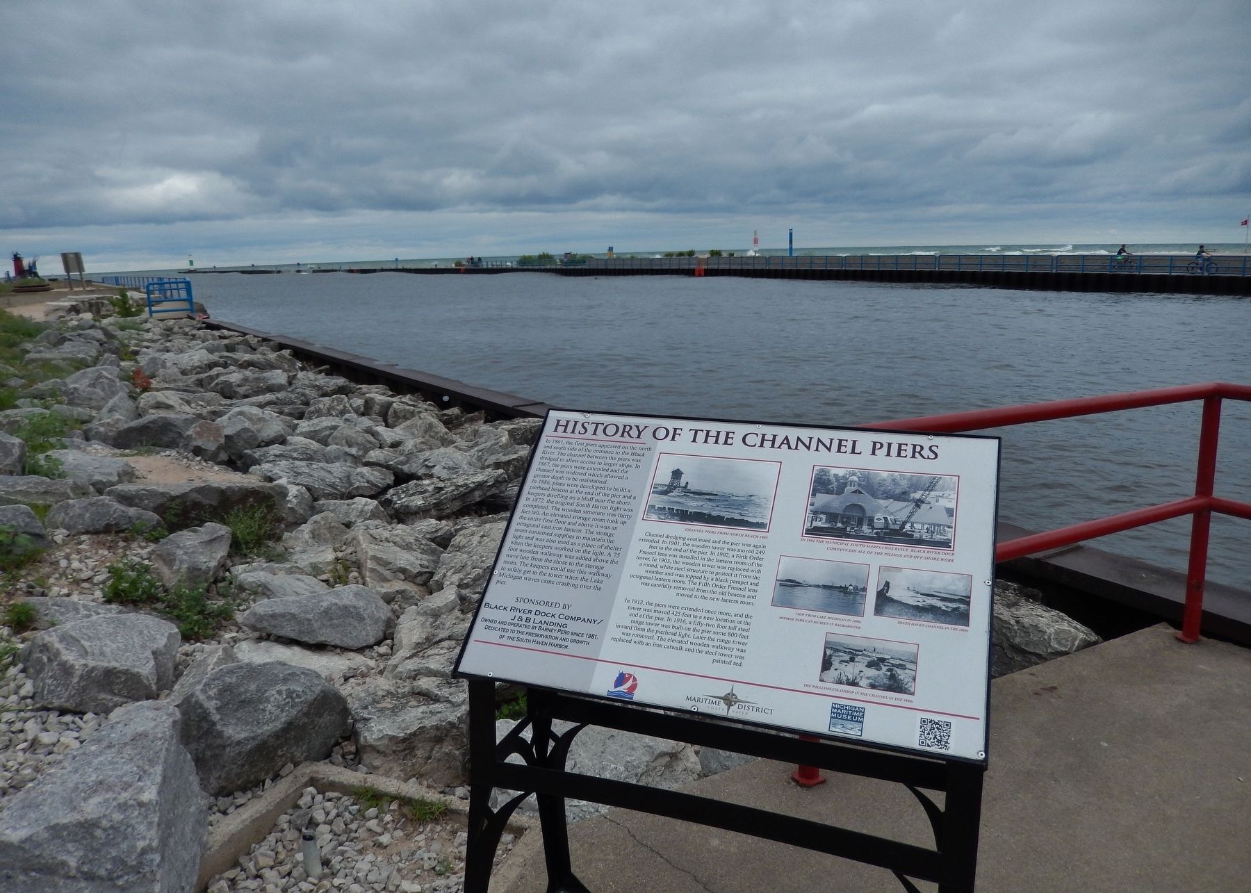
History of the Channel Piers
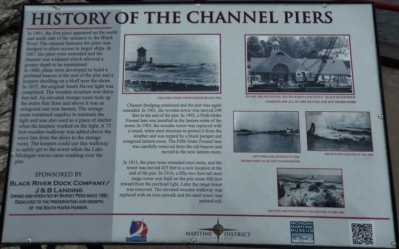
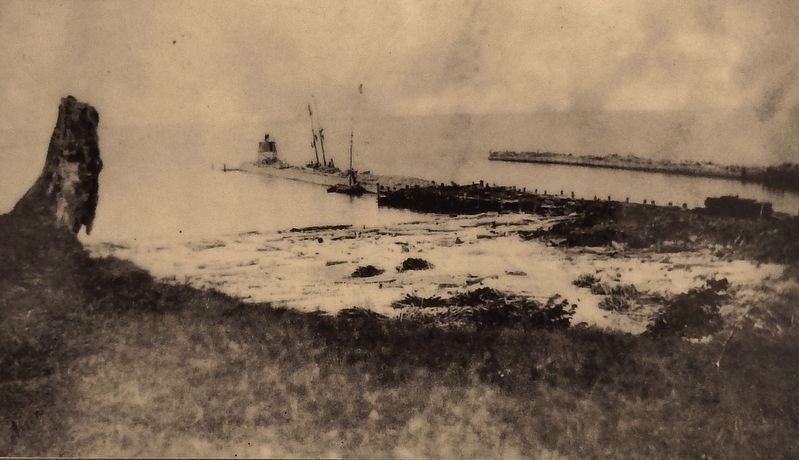
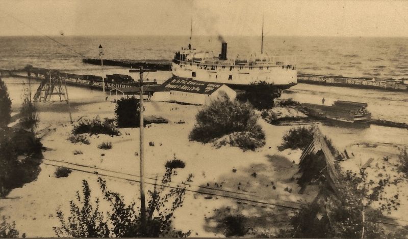
In 1861, the first piers appeared on the north and south side of the entrance to the Black River. The channel between the piers was dredged to allow access to larger ships. In 1867, the piers were extended and the channel was widened which allowed a greater depth to be maintained.
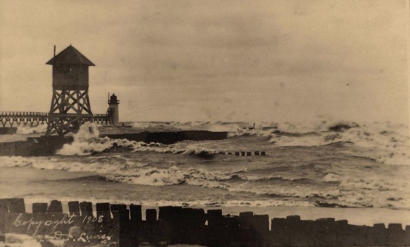
In 1886, plans were developed to build a pierhead beacon at the end of the pier and a keepers dwelling on a bluff near the shore. In 1872, the original South Haven light was completed. The wooden structure was thirty feet tall. An elevated storage room took up the entire first floor and above it was an octagonal cast iron lantern. The storage room contained supplies to maintain the light and was also used as a place of shelter when the keepers worked on the light. A 75 foot wooden walkway was added above the wave line from the shore to the storage room. The keepers could use this walkway to safely get to the tower when the Lake Michigan waves came crashing over the pier.
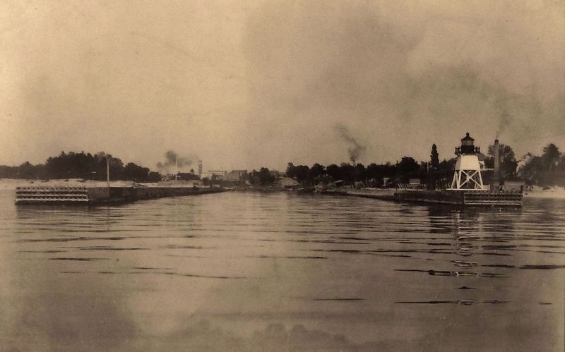
Channel dredging continued and the pier was again extended. In 1901, the wooden tower was moved 249 feet to the end of the pier. In 1902, a Fifth Order Fresnel lens was installed in the lantern room of the tower. In 1903, the wooden tower was replaced with a round, white steel structure to protect it from the weather and was topped by a black parapet and octagonal lantern room. The Fifth Order Fresnel lens was carefully removed from the old beacon and moved to the new lantern room.
In 1913, the piers were extended once more, and the tower was moved 425 feet to a new location at the end of the pier. In 1916, a fifty-two foot tall steel range tower was built on the pier some 800 feet inward from the pierhead light. Later the range tower was removed. The elevated wooden walkway was replaced with an iron catwalk and the steel tower was painted red.
Owned and operated by Barney Pero Since 1981
Dedicated to the preservation and growth
of the South Haven Harbor
Erected by Black River Dock Company/J & B Landing & Michigan Maritime Museum.
Topics. This historical marker is listed in this topic list: Waterways & Vessels. A significant historical year for this entry is 1861.
Location. 42° 24.12′ N, 86° 16.955′ W. Marker is in South Haven, Michigan, in Van Buren County. Marker can be reached from Water Street, 0.1 miles west of St. Joseph Street, on the right when traveling west. Marker is located on the South Haven Harbor Walk, east of South Beach Park, overlooking the Black River channel. Touch for map. Marker is at or near this postal address: 10 Water Street, South Haven MI 49090, United States of America. Touch for directions.
Other nearby markers. At least 8 other markers are within walking distance of this marker. Birth of City Utilities (within shouting distance of this marker); Lifesaving Station (within shouting distance of this marker); Resort Industry (within shouting distance of this marker); Over a Century of Tourism (within shouting distance of this marker); South Haven Lighthouse (about 300 feet away, measured in a direct line); The Lightkeeper's Dwelling (about 300 feet away); Lumber Industry (about 500 feet away); Entertainment Around the Harbor (approx. ¼ mile away). Touch for a list and map of all markers in South Haven.
More about this marker. Marker is a large composite plaque, mounted horizontally on waist-high posts. Marker is part of South Haven's Harbor Walk series.
Related markers. Click here for a list of markers that are related to this marker. South Haven Harbor Walk
Also see . . .
1. South Haven Lighthouse. (This link presents a good photo of the south pier and lighthouse, taken from Lake Michigan.) (Submitted on June 26, 2018, by Cosmos Mariner of Cape Canaveral, Florida.)
2. South Haven Harbor Walk. This South Haven Harbor Walk map shows the location of this and other historical markers in South Haven. (Submitted on June 26, 2018, by Cosmos Mariner of Cape Canaveral, Florida.)
3. South Haven Light. A Fifth order Fresnel lens manufactured by Parisian glass makers Barbier and Fenestre was installed in the lantern. The U.S. Lighthouse Service elected to tear down the wooden lighthouse and replace it. On October 6, 1903 ten workers arrived on the USLHS tender Hyacinth and began the project. It took a little more than a month to complete the project. According to The Daily Tribune (October 14, 1903) the lantern room was brought from Muskegon, Michigan where it had spent forty years on duty. In 1913, the location was deemed unsatisfactory, and the cast iron lighthouse was moved 425 feet (130 m) to the end of the pier. (Submitted on June 26, 2018, by Cosmos Mariner of Cape Canaveral, Florida.)
4. Black River flowing into Lake Michigan. (This link presents a winter photo of the channel, south pier, catwalk and lighthouse.) The Black River is a 4.2-mile-long river in the southwest part of Michigan that empties into Lake Michigan in South Haven, where it discharges past the South Pier Lighthouse. (Submitted on June 26, 2018, by Cosmos Mariner of Cape Canaveral, Florida.)
Credits. This page was last revised on August 28, 2022. It was originally submitted on June 25, 2018, by Cosmos Mariner of Cape Canaveral, Florida. This page has been viewed 320 times since then and 31 times this year. Photos: 1, 2, 3, 4, 5. submitted on June 26, 2018, by Cosmos Mariner of Cape Canaveral, Florida. 6. submitted on August 18, 2022, by Joel Seewald of Madison Heights, Michigan. 7. submitted on June 26, 2018, by Cosmos Mariner of Cape Canaveral, Florida. • Andrew Ruppenstein was the editor who published this page.
