Near Big Springs in Deuel County, Nebraska — The American Midwest (Upper Plains)
Keith County Nebraska
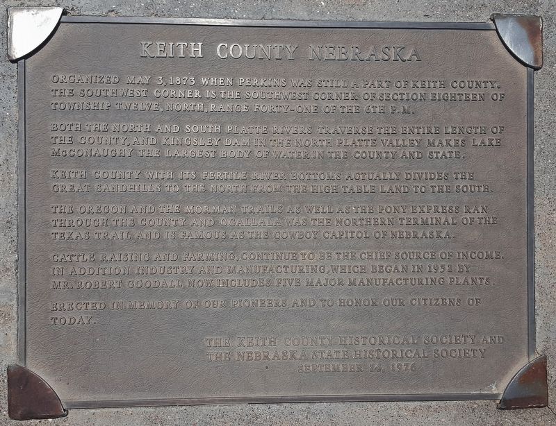
Organized May 3, 1873, when Perkins was still a part of Keith County. The southwest corner is the southwest corner section eighteen of township twelve, north, range forty-one of the 6th P.M.
Both the north and south Platte Rivers traverse the entire length of the county and Kingsley Dam in the North Platte Valley makes Lake McConaughy the largest body of water in the county and state.
Keith County with its fertile river bottoms actually divides the great sand hills to the north from the high table land to the south.
The Oregon and the Mormon Trails as well as the Pony Express ran through the County and Ogallala was the northern terminal of the Texas Trail and is famous as the Cowboy Capitol of Nebraska.
Cattle raising and farming continue to be the chief source of income. In addition, industry and manufacturing, which began in 1932 by Mr. Robert Goodall, now includes five major manufacturing plants.
Erected in memory of our pioneers and to honor our citizens of today.
Erected 1976 by The Keith County Historical Society and the Nebraska State Historical Society.
Topics. This historical marker is listed in these topic lists: Agriculture • Industry & Commerce • Settlements & Settlers • Waterways & Vessels. A significant historical date for this entry is May 3, 1873.
Location. 41° 0.142′ N, 102° 3.094′ W. Marker is near Big Springs, Nebraska, in Deuel County. Marker is at the intersection of County Highway 36 and County Highway 63.2, on the left when traveling south on County Highway 36. Marker is located 4.3 miles southeast of Interstate 80 from the Big Springs, Nebraska exit, at the intersection of Nebraska's Deuel County Road 36 and Colorado's Sedgwick County Road 63.2. Touch for map. Marker is in this post office area: Big Springs NE 69122, United States of America. Touch for directions.
Other nearby markers. At least 8 other markers are within 5 miles of this marker, measured as the crow flies. Sedgwick County Colorado (here, next to this marker in Colorado); Colorado's Northeast Corner (here, next to this marker in Colorado); Perkins County Nebraska (here, next to this marker); Deuel County Nebraska (within shouting distance of this marker); Sam Bass and the Big Springs Robbery (approx. 4.3 miles away); Waterman Sod House (approx. 4.3 miles away); Phelps Hotel (approx. 4.4 miles away); The Pony Express (approx. 4.4 miles away). Touch for a list and map of all markers in Big Springs.
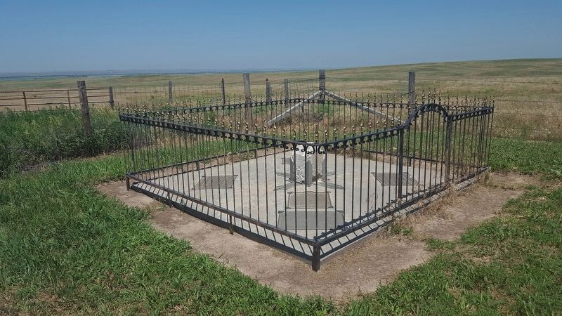
More about this marker. The marker is adjacent to a weathered stone post and directional
arrows marking the Colorado/Nebraska boundary and Colorado's Northeast Corner. The post is embedded in a concrete pad and surrounded by a wrought iron fence. The fenced enclosure also contains directional arrows and historical markers from each of the four surrounding counties - Sedgwick (CO), Perkins (NE), Keith (NE) and Deuel (NE).
Related markers. Click here for a list of markers that are related to this marker. Colorado/Nebraska Border Counties
Credits. This page was last revised on March 5, 2023. It was originally submitted on June 29, 2018, by Cosmos Mariner of Cape Canaveral, Florida. This page has been viewed 213 times since then and 8 times this year. Photos: 1, 2. submitted on June 29, 2018, by Cosmos Mariner of Cape Canaveral, Florida. • Bill Pfingsten was the editor who published this page.

