Cumberland Township near Gettysburg in Adams County, Pennsylvania — The American Northeast (Mid-Atlantic)
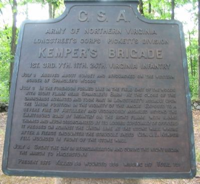
Kemper's Brigade
Pickett's Division - Longstreet's Corps
— Army of Northern Virginia —
Army of Northern Virginia
Longstreet's Corps Pickett's Division
Kemper's Brigade
1st. 3rd. 7th. 11th. 24th. Virginia Infantry
July 2 Arrived about sunset and bivouacked on the western border of Spanger's Woods.
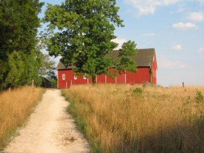
July 3 In the forenoon formed line in the field east of the woods with right flank near Spangler's Barn. At the close of the cannonade advanced and took part in Longstreet's assault upon the Union position in the vicinity of the Angle. Exposed to a severe fire of Artillery and vigorously assailed beyond the Emmitsburg road by Infantry on the right flank. With ranks thinned and much disorganized by its losses especially of officers it pressed on against the Union line at the stone wall where after a fierce encounter the struggle ended. Gen. J.L. Kemper fell wounded in front of the stone wall.
July 4 Spent the day in reorganization and during the night began the march to Hagerstown.
Present 1575. Killed 58. Wounded 356. Missing 317. Total 731.
Erected 1910 by Gettysburg National Military Park Commission.
Topics. This historical marker is listed in this topic list: War, US Civil. A significant historical month for this entry is July 1965.
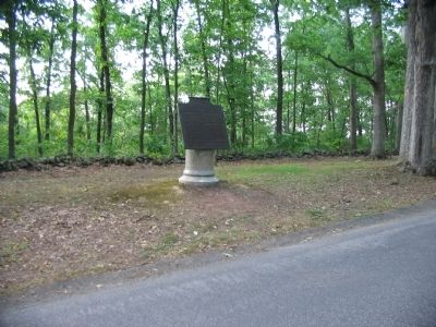
Location. 39° 48.736′ N, 77° 15.135′ W. Marker is near Gettysburg , Pennsylvania, in Adams County. It is in Cumberland Township. Marker is on West Confederate Avenue, on the right when traveling south. Located in Spangler's Woods, south of the Virginia State Memorial (Driving Tour Stop 5) on Seminary Ridge in Gettysburg National Military Park. Touch for map. Marker is in this post office area: Gettysburg PA 17325, United States of America. Touch for directions.
Other nearby markers. At least 8 other markers are within walking distance of this marker. Armistead's Brigade (within shouting distance of this marker); Perry's Brigade (about 300 feet away, measured in a direct line); Pickett's Division (about 400 feet away); Garnett's Brigade (about 600 feet away); Wright's Brigade (about 800 feet away); The Storm of Battle (approx. 0.2 miles away); Army of Northern Virginia (approx. 0.2 miles away); Virginia Memorial (approx. 0.2 miles away). Touch for a list and map of all markers in Gettysburg.
Credits. This page was last revised on February 7, 2023. It was originally submitted on September 30, 2008, by Craig Swain of Leesburg, Virginia. This page has been viewed 1,086 times since then and 38 times this year. Photos: 1, 2, 3. submitted on September 30, 2008, by Craig Swain of Leesburg, Virginia.


