Taylors Falls in Chisago County, Minnesota — The American Midwest (Upper Plains)
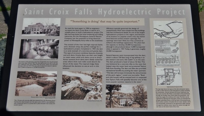
Saint Croix Falls Hydroelectric Project
"'Something is doing' that may be quite important."
This stretch of the river had high traprock banks and a dramatic drop, the perfect makings for a hydroelectric project. Completed in 1907, the dam is an early example of a concrete-arch gravity dam. This type of structure combines features of gravity and arch dams. Gravity dams use their own weight to retain water, while arch dams curve to direct forces outward. Arch dams were ideally suited for areas where thick rock walls could absorb the thrust of the water. The traprock ledge likely influenced the decision to use an arch in this location.
Efficiency typically governed the design of powerhouses. Most were simple box-like buildings with few architectural details. As one of the largest hydroelectric projects in the region, and because of its location in a popular scenic area, the station here featured arched window openings. The openings were later filled, but they continue to enhance the building's appearance. The plant had the capacity to develop 25,000 horsepower, although it only produced about 12,000 horsepower when it opened in I907. Today, it generates roughly 34,000 horsepower.
Several features were incorporated into the dam, which is about 750 feet long. A log spillway is at the western end and a fish ladder is on the east. The dam produced a head of about 56 feet. This was bolstered by a concrete dike to the west that helped raise the water level and protected Taylors Falls from flooding. The dam and dike also provided recreational benefits by pooling the water upstream. "This lake will increase immensely the attractiveness of the park region," noted one journalist. "Boat and club houses will be erected and it is expected that Taylors Falls will speedily become one of the most popular summer resorts in the west."
Topics. This historical marker is listed in these topic lists: Architecture • Charity & Public Work • Industry & Commerce • Waterways & Vessels. A significant historical year for this entry is 1904.
Location. 45° 25.055′ N, 92° 39.184′ W. Marker is in Taylors Falls, Minnesota, in Chisago County. Marker is on St Croix Trail (State Highway 95) 0.3 miles south of Mulberry Street (County Highway 34), on the left when traveling south. Marker is located in Taylor Falls Heritage Park, at the east end of the parking lot, close to the St Croix River overlook. Touch for map

Year Book of the Engineers’ Society, University of Minnesota, 1907
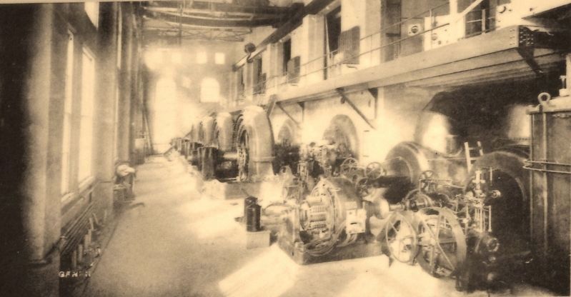
2. Marker detail: Generator room, c. 1907
The interior of the generator room has changed little since the photograph above was taken around 1907. The same generators are still in use, and four additional units were added when the power station was expanded between 1913 and 1917. The new units bumped the station's capacity from 12,000 horsepower to 25,000 horsepower.
Other nearby markers. At least 8 other markers are within one mile of this marker, measured as the crow flies. Where are the Falls? (approx. 0.3 miles away in Wisconsin); Gaylord Nelson (approx. 0.4 miles away in Wisconsin); River Spirit (approx. half a mile away in Wisconsin); Thompson–Boughton Mill (approx. half a mile away in Wisconsin); Where Are The Falls of the St. Croix? (approx. half a mile away in Wisconsin); St. Croix Falls Lions Park (approx. 0.8 miles away in Wisconsin); The Battle of St. Croix Falls (approx. 0.8 miles away in Wisconsin); Chisago Hotel (approx. 1.1 miles away).
More about this marker. Marker is a large composite plaque, mounted horizontally on waist-high posts.
Also see . . .
1. Saint Croix Falls Dam. Once the logging era was nearly played out, Northern States Power gained rights to the falls. They constructed the concrete arched dam that we see today. It has a 675 foot long arched dam 59 feet tall, one wide gate that serves both as a log sluice and overflow gate, a power plant that is 291 feet wide, and a secondary dike on the Minnesota side that is 785 feet long. The dam went on-line in 1907. It produces 25-megawatts

Minnesota Historic Property Record No. CH•TFC-054-026 by Jerry Mathiason 2015
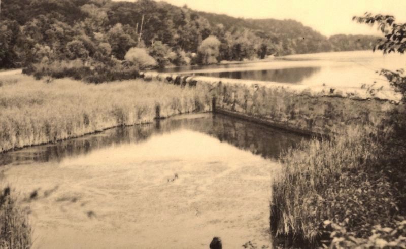
3. Marker detail: Concrete dike
The 110-year-old concrete dike that extends from the Minnesota shore had become deteriorated over the years, and in 2015 it was stabilized with compacted earth. It is preserved in place beneath rock riprap and seeded topsoil.
2. St. Croix Falls Hydro Generating Station. The St. Croix Falls Hydro partial peaking plant is the only existing dam on the St. Croix River. The plant was built to provide electricity for the Twin Cities. Construction involved hundreds of laborers who worked day and night shifts seven days a week. For two years, blasting shook buildings and shattered windows in St. Croix Falls and in Taylors Falls, MN just across the river. The spillway provides a scenic view from overlooks on both the Minnesota and Wisconsin sides of the river. A feature that separates the St. Croix Falls plant from other hydroelectric units is its "S" shaped spillway. The spillway was constructed as a curve to increase its crest area, since the river at that spot forms a gorge through which passes a large volume of water. (Submitted on July 18, 2018, by Cosmos Mariner of Cape Canaveral, Florida.)

Photographed By Engineering Record 55 (June 29, 1907)
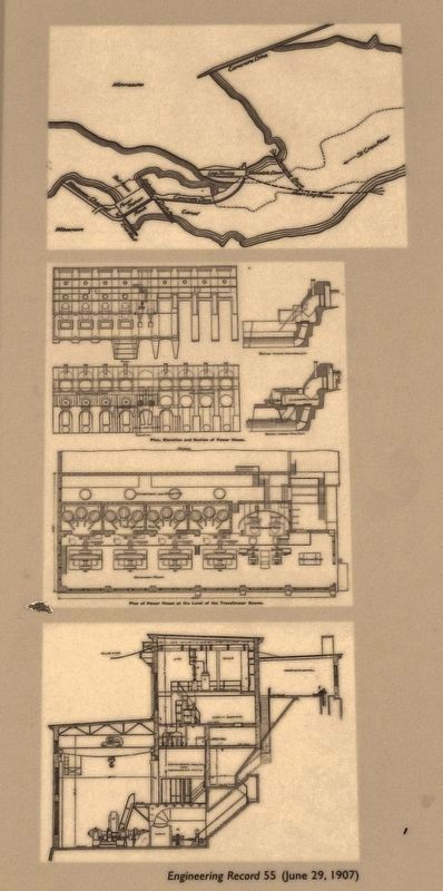
4. Marker detail: Engineering Record 55
The map shows the layout of the dam and power station, as well as other features of the hydroelectric project including the wastewater channel, fishway, drift boom, log boom, log sluice, and concrete dike.
Water is channeled to the powerhouse through the forebay canal, which feeds the penstocks—the tubes that supply the turbines with water. The flow can be regulated by adjusting the head gates, which are lowered from the gate operating house on the top level of the powerhouse. Each turbine consists of double 36-inch water wheels, which are horizontally connected to the generators. After passing through the turbines, water leaves the station through the tail races at the lower level of the river.
Credits. This page was last revised on December 9, 2020. It was originally submitted on July 13, 2018, by Cosmos Mariner of Cape Canaveral, Florida. This page has been viewed 647 times since then and 58 times this year. Photos: 1, 2, 3, 4, 5, 6. submitted on July 18, 2018, by Cosmos Mariner of Cape Canaveral, Florida. • Bill Pfingsten was the editor who published this page.


