16th Street Heights in Northwest Washington in Washington, District of Columbia — The American Northeast (Mid-Atlantic)
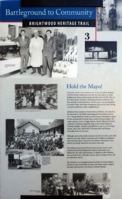
Hold the Mayo!
Battleground to Community
— Brightwood Heritage Trail —
English, Irish and German settlers, as well as enslaved and free African Americans, were the first non-natives to claim Brightwood. Farmers dominated until the Civil War. Then in the 1890s electric streetcars allowed government workers to live here and ride to jobs downtown. By the 1940s, sons and daughters of Jewish, Greek, and Italian immigrants had arrived, often leaving crowded conditions in older neighborhoods.
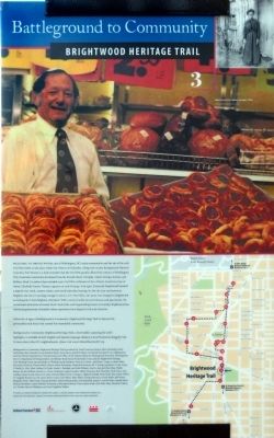
Abraham Posin, founder of Posin's Deli and Bakery, was typical of the newcomers. His family had immigrated from Russia around 1910. Young Abraham visited an uncle living in Washington, where he met and married Gertrude Rose, another Russian émigré. The couple opened a store in Foggy Bottom. Posin's followed its Jewish customers' northward migration, first to the Arcade Market in Columbia Heights. Finally it opened here in 1947 at 5657 Georgia Avenue. Abe's sons, World War II veterans Max and Hyman, eventually took over the store.
Although most of his Jewish customers moved on in the 1950s, Max stayed to serve the African Americans and Caribbean immigrants who took their places. Everyone was welcome. Max died in 1995, and his son Randy closed the store three years later.
The Firehouse just beyond Posin's is here because, back in 1891, residents formed the Brightwood Citizens' Association and lobbied for city-style improvements. In addition to the firehouse, they secured sewers, sidewalks, streets, electric and gas service, and an elementary school.
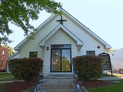
The church at 5714 Georgia became the home of Canaan Baptist Church in 1956. In less than ten years, the robust church outgrew the space and moved to 16th Street in Mount Pleasant.
Erected 2008 by Cultural Tourism DC. (Marker Number 3.)
Topics and series. This historical marker is listed in these topic lists: African Americans • Churches & Religion • Industry & Commerce • Settlements & Settlers. In addition, it is included in the Brightwood Heritage Trail series list. A significant historical year for this entry is 1910.
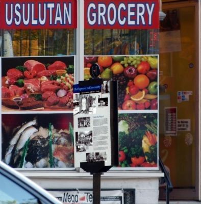
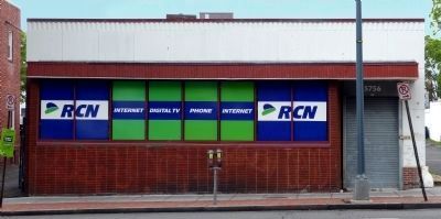
Location. Marker has been reported missing. It was located near 38° 57.611′ N, 77° 1.693′ W. Marker was in Northwest Washington in Washington, District of Columbia. It was in 16th Street Heights. Marker was on Georgia Avenue Northwest (U.S. 29) south of Missouri Avenue Northwest, on the right when traveling south. The marker is on the sidewalk between 5768 Georgia Avenue (Usulutan Grocery) and 5764 (Papa John's Pizza). Touch for map. Marker was at or near this postal address: 5764 Georgia Avenue Northwest, Washington DC 20011, United States of America. Touch for directions.
Other nearby markers. At least 8 other markers are within walking distance of this location. Crossroads Create Community (about 300 feet away, measured in a direct line); Build It And They Will Come (about 500 feet away); A Streetcar Named Brightwood (approx. 0.2 miles away); School Days (approx. ¼ mile away); The Rock on Brightwood Avenue (approx. ¼ mile away); “Get Down You Fool” (approx. ¼ mile away); Aunt Betty's Story (approx. ¼ mile away); Military Road School (approx. ¼ mile away). Touch for a list and map of all markers in Northwest Washington.
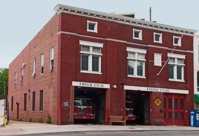
Photographed By Allen C. Browne, May 19, 2013
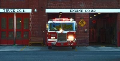
6. Engine Company 22 Firehouse
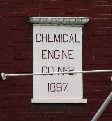
This 1897 building is the oldest firehouse still in use in the Washington. The south bay (Truck Company 11) was added in 1908 and the east facade was rebuilt in the 1940s for larger trucks. William VanZandt Cox who owned Emory Place across the street and the Brightwood Citizen's Association were instrumental in getting the firehouse built.
Credits. This page was last revised on January 30, 2023. It was originally submitted on May 29, 2013, by Allen C. Browne of Silver Spring, Maryland. This page has been viewed 1,143 times since then and 39 times this year. Last updated on August 3, 2018, by Devry Becker Jones of Washington, District of Columbia. Photos: 1, 2, 3, 4, 5, 6, 7, 8. submitted on May 29, 2013, by Allen C. Browne of Silver Spring, Maryland. • Andrew Ruppenstein was the editor who published this page.
