Deadwood in Lawrence County, South Dakota — The American Midwest (Upper Plains)
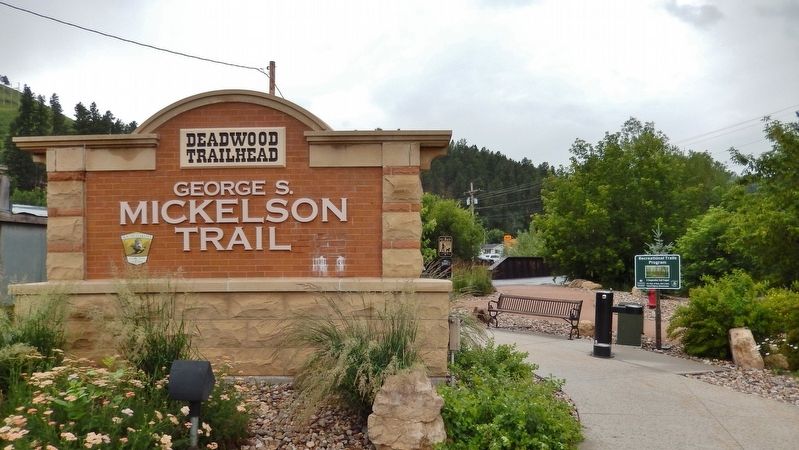
George S. Mickelson Trail
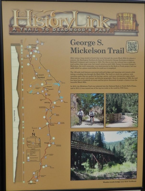
After using a long stretch of track that went through the scenic Black Hills for almost a century, the Burlington Northern & Santa Fe (formerly Chicago Burlington & Quincy Railroad Company) quit running in 1983. The idea to turn the railroad into a multi-use trail surface that same year, but wasn't acted on until 1986. Former Governor George S. Mickelson, the trail's namesake, was instrumental in the Rails-to-Trails project, but was sadly killed in a plane crash before he could see it completed.
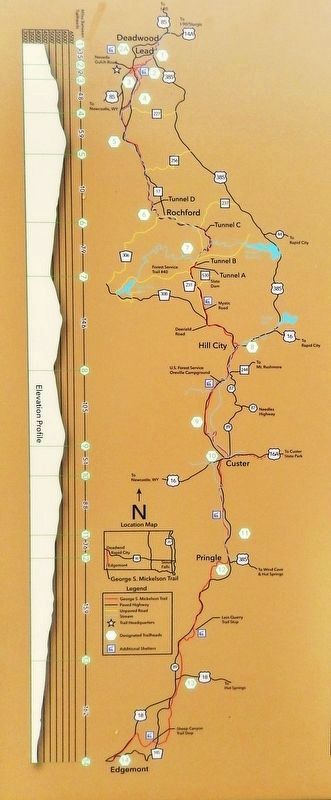
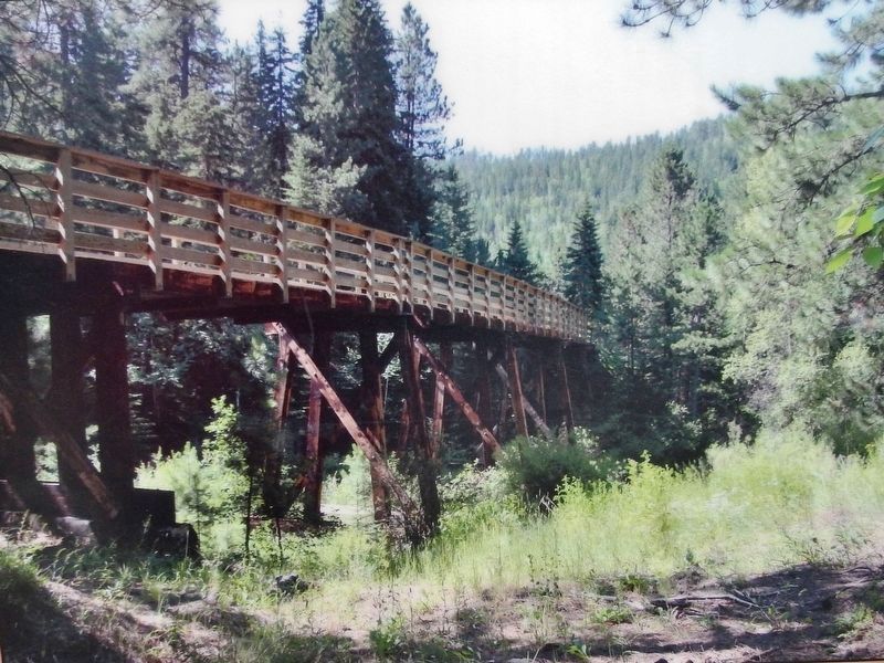
The 109-mile trail features converted railroad bridges and imposing rock tunnels while taking a winding trip through the Black Hills. The trail is a multi-use pathway with countless spots that are perfect for having a picnic, and many interpretive signs which illustrate the area's rich history and diverse geography. Since its opening in 1998, the trail has been host to hundreds of events and has given thousands of people a chance to see the beautiful Black Hills.
In 2012, the Mickelson Trail was inducted into the National Rails-to-Trails Hall of Fame, and in 2013, it was named one of the top ten trails in the world by FOX News.
Erected by The Deadwood Historic Preservation Commission.
Topics. This historical marker is listed in these topic lists: Parks & Recreational Areas • Railroads & Streetcars.
Location. 44° 22.235′ N, 103° 43.722′ W. Marker is in Deadwood, South Dakota, in Lawrence County. Marker can be reached from the intersection of Charles Street (CanAm Highway) (U.S. 85) and Cedar Lane, on the right when traveling south. Marker is located at the Deadwood Trailhead of the George S. Mickelson Trail, at the south end of the parking lot. Touch for map. Marker is at or near this postal address: 32 Charles Street, Deadwood SD 57732, United States of America. Touch for directions.
Other nearby markers. At least 8 other markers are within walking distance of this marker. Chicago Burlington & Quincy Railroad Yard (here, next to this marker); The Resilient Whitewood Creek (within shouting distance of this marker); McGovern Hill (within shouting distance of this marker); Burlington Interurban Power Plant (within shouting distance of this marker); Interurban Trolley (about 300 feet away, measured in a direct line); Radial Brick Smokestack (about 300 feet away); The Presidential District (about 500 feet away); The Smokestack - Reconstructed (about 500 feet away). Touch for a list and map of all markers in Deadwood.
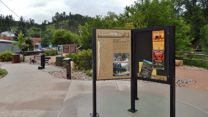
More about this marker. This is a large, "kiosk-style" marker.
Related markers. Click here for a list of markers that are related to this marker. George S. Mickelson Trail
Also see . . .
1. George S. Mickelson Trail. Black Hills and Badlands website entry:
Many of the old railroad trestles, about 100 of them, are still in place. All have been restored, as have four hard rock tunnels, blasted long ago through hillsides. Watch for the remains of old cabins and ghost mines. There are also 35 interpretive signs along the trail. (Submitted on August 4, 2018, by Cosmos Mariner of Cape Canaveral, Florida.)
2. George S. Mickelson Trail. Wikipedia entry:
The main trail route extends 108.8 miles (175.1 km), from Edgemont to Deadwood, with approximately nine miles of additional branch trails, including a three-mile (5 km) paved link from Custer to the Custer State Park completed in 2007. Intermediate points along the route include the towns of Custer and Hill City, and a short branch provides access to the city of Lead. Nearly all of the trail follows the route of an abandoned railroad branch line constructed by the Chicago, Burlington and Quincy Railroad in 1890-91 and last operated by the Burlington Northern Railroad in 1986. (Submitted on August 4, 2018, by Cosmos Mariner of Cape Canaveral, Florida.)
Credits. This page was last revised on April 12, 2024. It was originally submitted on August 3, 2018, by Cosmos Mariner of Cape Canaveral, Florida. This page has been viewed 434 times since then and 43 times this year. Photos: 1. submitted on August 3, 2018, by Cosmos Mariner of Cape Canaveral, Florida. 2, 3, 4, 5. submitted on August 4, 2018, by Cosmos Mariner of Cape Canaveral, Florida. • Bill Pfingsten was the editor who published this page.
