Deadwood in Lawrence County, South Dakota — The American Midwest (Upper Plains)
Burlington Interurban Power Plant
— A Trail to Deadwood's Past —
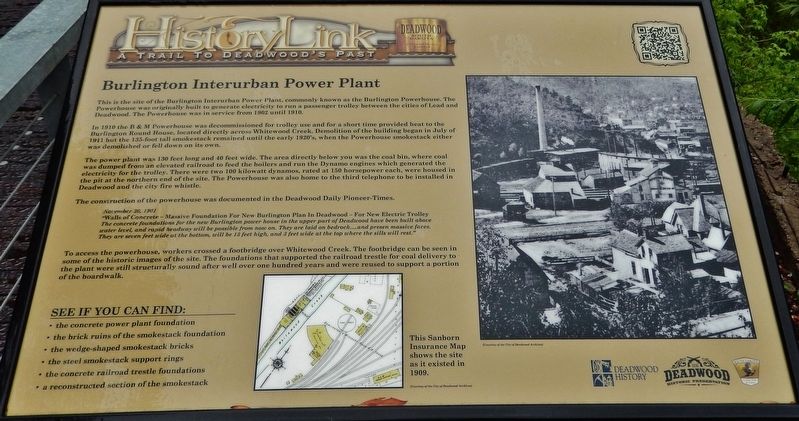
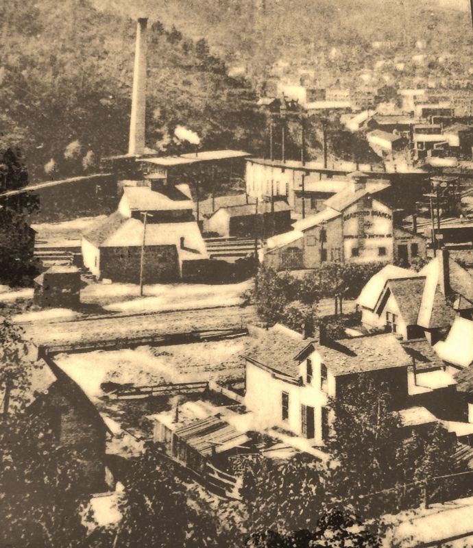
In 1910 the B & M Powerhouse was decommissioned for trolley use and for a short time provided heat to the Burlington Round House, located directly across Whitewood Creek. Demolition of the building began in July of 1911 but the 135-foot tall smokestack remained until the early 1920's, when the Powerhouse smokestack either was demolished or fell down on its own.
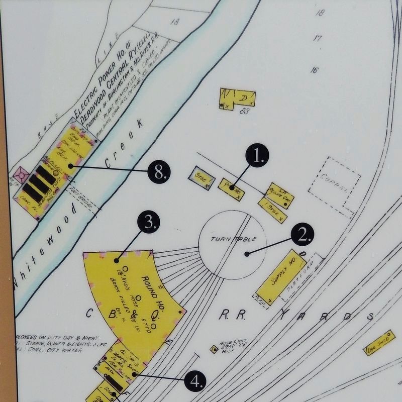
The power plant was 130 feet long and 40 feet wide. The area directly below you was the coal bin, where coal was dumped from an elevated railroad to feed the boilers and run the Dynamo engines which generated the electricity for the trolley. There were two 100 kilowatt dynamos, rated at 150 horsepower each, were housed in the pit at the northern end of the site. The Powerhouse was also home to the third telephone to be installed in Deadwood and the city fire whistle.
The construction of the powerhouse was documented in the Deadwood Daily Pioneer-Times.
November 30, 1901
"Walls of Concrete - Massive Foundation For New Burlington Plan In Deadwood - For New Electric Trolley
The concrete foundations for the new Burlington power house in the upper part of Deadwood have been built above water level, and rapid headway will be possible from now on. They are laid on bedrock… and present massive faces. They are seven feet wide at the bottom, will be 13 feet high, and 3 feet wide at the top where the sills will rest."
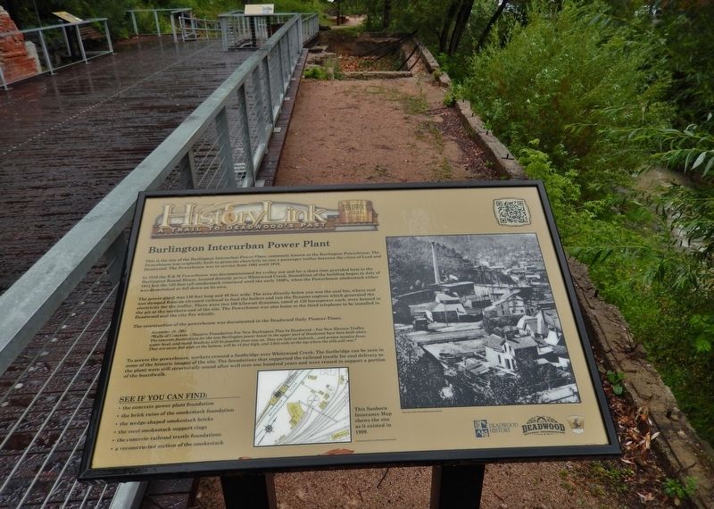
To access the powerhouse, workers crossed a footbridge over Whitewood Creek. The footbridge can be seen in some of the historic images of the site. The foundations that supported the railroad trestle for coal delivery to the plant were still structurally sound after well over one hundred years and were reused to support a portion of the boardwalk.
See if you can find:
• the concrete power plant foundation
• the brick ruins of the smokestack foundation
• the wedge-shaped smokestack bricks
• the steel smokestack support rings
• the concrete railroad trestle foundations
• a reconstructed section of the smokestack
Erected by The Deadwood Historic Preservation Commission; South Dakota Department of Game, Fish and Parks.
Topics. This historical marker is listed in these topic lists: Industry & Commerce • Man-Made Features • Railroads & Streetcars. A significant historical year for this entry is 1902.
Location. 44° 22.271′ N, 103° 43.734′ W. Marker is in Deadwood, South Dakota, in Lawrence County. Marker can be reached from the intersection of Charles Street (CanAm Highway) (U.S. 85) and Cedar Lane, on the right when traveling south. Located in Deadwood's Powerhouse Park, along the Whitewood Creek boardwalk, about 100 yds north of the George S. Mickelson Trailhead and west of the trailhead parking lot. Touch for map. Marker is at or near this postal address: 32 Charles St, Deadwood SD 57732, United States of America. Touch for directions.
Other nearby markers. At least 8 other markers are within walking distance of this marker. Interurban Trolley (a few steps from this marker); Radial Brick Smokestack (a few steps from this marker); The Resilient Whitewood Creek (within shouting distance of this marker); George S. Mickelson Trail (within shouting distance of this marker); Chicago Burlington & Quincy Railroad Yard (within shouting distance of this marker); The Smokestack - Reconstructed (about 300 feet away, measured in a direct line); McGovern Hill (about 300 feet away); The Presidential District (about 500 feet away). Touch for a list and map of all markers in Deadwood.
More about this marker. Marker is a large composite plaque, mounted horizontally on waist-high posts.
Credits. This page was last revised on October 11, 2021. It was originally submitted on August 3, 2018, by Cosmos Mariner of Cape Canaveral, Florida. This page has been viewed 251 times since then and 19 times this year. Last updated on October 10, 2021, by Connor Olson of Kewaskum, Wisconsin. Photos: 1. submitted on August 3, 2018, by Cosmos Mariner of Cape Canaveral, Florida. 2, 3, 4. submitted on August 4, 2018, by Cosmos Mariner of Cape Canaveral, Florida. • Mark Hilton was the editor who published this page.


