Deadwood in Lawrence County, South Dakota — The American Midwest (Upper Plains)
Interurban Trolley
— A Trail to Deadwood's Past —
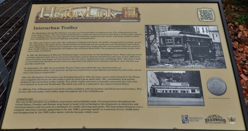
By 1888, only twelve years after the settlement of Deadwood Gulch, two public transportation systems served the community: the horse-drawn Deadwood Street Railroad and the steam powered Deadwood Central Railroad. Beginning in 1893 several companies were organized to undertake the construction of electric railways that would connect communities throughout the northern Black Hills. The proposed interurban trolley lines never came to fruition.
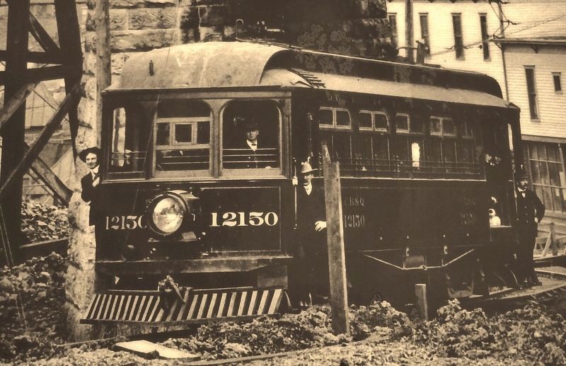
In 1901 the Burlington & Missouri Railroad began construction on the Burlington Power Plant and converted existing railroad track into an electrical interurban railway between Deadwood and Lead. In late 1902 three electric trolley cars began service between the two cities, making fourteen roundtrips daily. The time it took to travel between Deadwood and Lead was expected to be about seven minutes and fares were 15 cents one way and 25 cents round trip.
On September 24, 1902, the Lead Daily Pioneer-Times described the new electric trolley as:
”a finely finished affair, with seaweed, spring back and bottom seats; lighted and heated by electricity; always clean and always comfortable.”
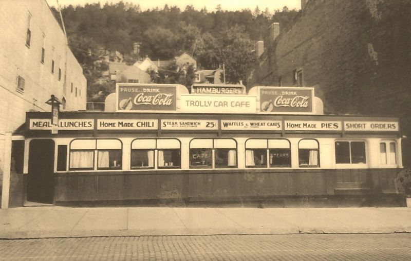
After the Burlington Powerhouse was decommissioned in 1910, the larger power plant located in the Pluma area supplied electricity for the trolleys until its final trip on April 24th, 1924. Automobiles had quickly displaced the interurban trolley system. Two of the trolley cars were eventually converted into cafes that were located in Lead and Deadwood. The third was sold to a railroad in the eastern United States.
In 1992 the City of Deadwood revived the trolley tradition with six gasoline and diesel powered trolleys. This service still runs today with trolley stops throughout the City of Deadwood.
STREETCARS
The rise of the streetcar as a modern, convenient and profitable mode of transportation throughout the United States, Canada, and Europe went hand in hand with technological developments in electricity and electrical motors, and was seen as a hallmark of a stable, thriving metropolis. The Interurban Streetcar was a uniquely American concept, appearing in the late 1800's, growing rapidly to a network of over 18,000 miles and disappearing by the 1930's after motor vehicles became widely used.
Erected by the Deadwood Historic Preservation Commission.
Topics. This historical marker is listed in these topic lists: Industry & Commerce • Railroads & Streetcars • Roads & Vehicles.
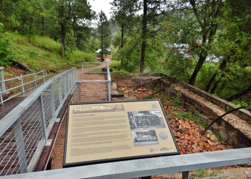
Location. 44° 22.282′ N, 103° 43.733′ W. Marker is in Deadwood, South Dakota, in Lawrence County. Marker can be reached from the intersection of Charles Street (CanAm Highway) (U.S. 85) and Cedar Lane, on the right when traveling south. Located in Deadwood's Powerhouse Park, along the Whitewood Creek boardwalk, about 120 yards north of the George S. Mickelson Trailhead and west of the trailhead parking lot. Touch for map. Marker is at or near this postal address: 32 Charles St, Deadwood SD 57732, United States of America. Touch for directions.
Other nearby markers. At least 8 other markers are within walking distance of this marker. Radial Brick Smokestack (here, next to this marker); Burlington Interurban Power Plant (a few steps from this marker); The Resilient Whitewood Creek (within shouting distance of this marker); The Smokestack - Reconstructed (within shouting distance of this marker); George S. Mickelson Trail (about 300 feet away, measured in a direct line); Chicago Burlington & Quincy Railroad Yard (about 300 feet away); McGovern Hill (about 400 feet away); The Presidential District (about 500 feet away). Touch for a list and map of all markers in Deadwood.
More about this marker. Marker is a large composite plaque, mounted horizontally on waist-high posts.
Also see . . . Deadwood Central Railroad. In 1902, the track between Lead and Deadwood was electrified and passenger service was provided with 3-foot narrow gauge interurban cars. Between Pluma and Deadwood, the tracks were shared with the 4-foot 8 1/2 inch standard gauge CBQ, with a third rail laid to make the track dual gauge. This service was abandoned in 1924 with the permission of the Interstate Commerce Commission, due to operating losses and deterioration of equipment. In total, the railroad had operated nearly 26 miles of track, but over time, much of this was abandoned and taken up. The railroad also operated six engines. Due to the stock market crash of 1929, like other local railroads, the Deadwood Central Railroad was abandoned in 1930. Trucks began to operate in place of the railroad. (Submitted on August 5, 2018, by Cosmos Mariner of Cape Canaveral, Florida.)
Credits. This page was last revised on October 8, 2021. It was originally submitted on August 3, 2018, by Cosmos Mariner of Cape Canaveral, Florida. This page has been viewed 380 times since then and 36 times this year. Last updated on October 6, 2021, by Connor Olson of Kewaskum, Wisconsin. Photos: 1. submitted on August 3, 2018, by Cosmos Mariner of Cape Canaveral, Florida. 2, 3, 4. submitted on August 5, 2018, by Cosmos Mariner of Cape Canaveral, Florida. • Mark Hilton was the editor who published this page.


