Santiago de Querétaro in Querétaro, Mexico — The Central Highlands (North America)
Jardín Guerrero / Municipal Palace
Inscription.
Jardín Guerrero
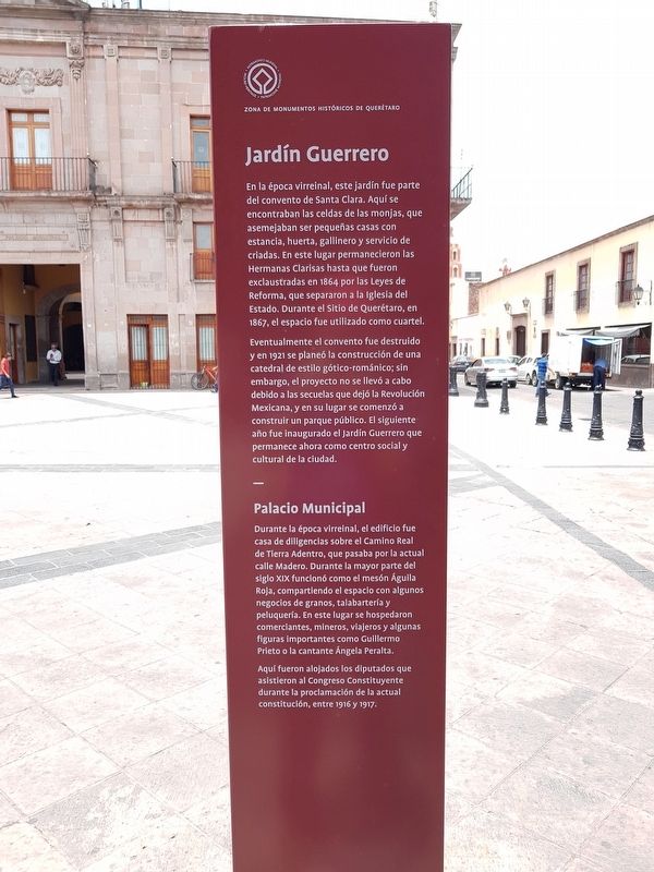
En la época virreinal, este jardín fue parte del convento de Santa Clara. Aquí se encontraban las celdas de las monjas, que asemejaban ser pequeñas casas con estancia, huerta, gallinero y servicio de criadas. En este lugar permanecieron las Hermanas Clarisas hasta que fueron exclaustradas en 1864 por las Leyes de Reforma, que separaron a la Iglesia del Estado. Durante el Sitio de Querétaro, en 1867, el espacio fue utilizado como cuartel.
Eventualmente el convento fue destruido y en 1921 se planeó la construcción de una catedral de estilo gótico-románico; sin embargo, el proyecto no se llevó a cabo debido a las secuelas que dejó la Revolución Mexicana, y en su lugar se comenzó a construir un parque público. El siguiente año fue inaugurado el Jardín Guerrero que permanece ahora como centro social y cultural de la ciudad.
Palacio Municipal
Durante la época virreinal, el edificio fue casa de diligencias sobre el Camino Real de Tierra Adentro, que pasaba por la actual calle Madero. Durante la mayor parte del siglo XIX funcionó como el mesón Águila Roja, compartiendo el espacio con algunos negocios de granos, talabartería y peluquería. En este lugar se hospedaron comerciantes, mineros, viajeros y algunas figuras importantes como Guillermo Prieto o la cantante Ángela Peralta.
Aquí fueron alojados los diputados que asistieron al Congreso Constituyente durante la proclamación de la actual constitución, entre 1916 y 1917.
Jardín Guerrero
Guerrero Park
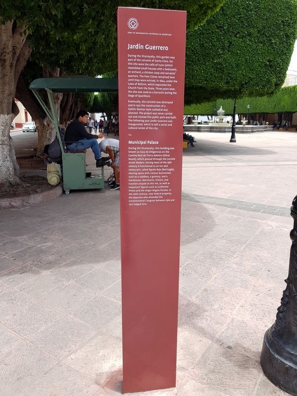
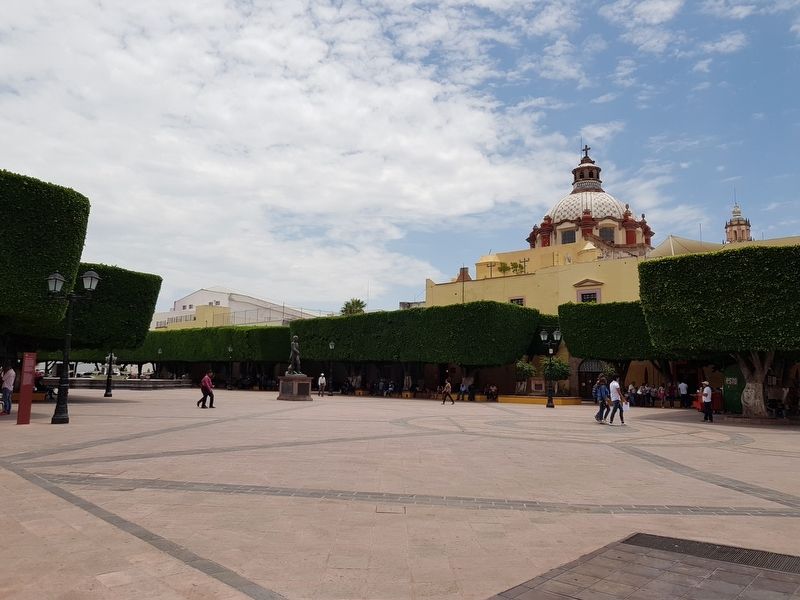
During the Viceroyalty, this garden was part of the convent of Santa Clara. On this site were the cells of nuns (which resembled small houses with a bedroom), an orchard, a chicken coop and servants’ quarters. The Poor Clares remained here until they were evicted, in 1864, under the Laws of Reform, which separated the Church from the State. Three years later, the site was used as a barracks during the Siege of Querétaro.
Eventually, the convent was destroyed and in 1921 the construction of a Gothic-Roman style cathedral was planned. The project was never carried out and instead this public park was inaugurated, which is still a social and cultural center of the city.
Municipal Palace
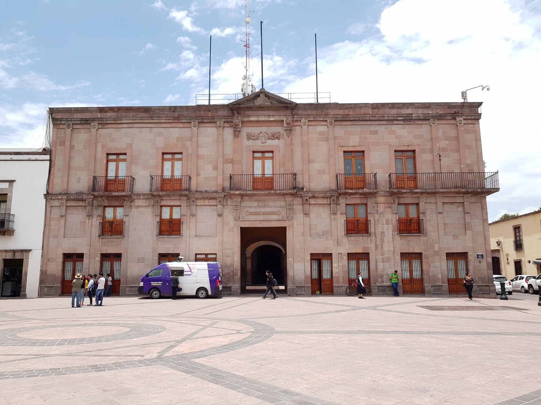
During the Viceroyalty, this building was known as Casa de Diligencias on the Camino Real de Tierra Adentro (Silver Route), which passed through the current street Madero. During most of the 19th century it functioned as an inn and restaurant, called
Águila Roja (Red Eagle), sharing space with various businesses, such as a saddlery, a granary, and a hairdresser. Merchants, miners, and travelers stayed at this inn, as well as important figures such as Guillermo Prieto and the singer Ángela Peralta. In the 20th century, now federal property, the deputies who attended the Constitutional Congress between 1916 and 1917 lodged here.
Erected 2018 by Municipalidad de Querétaro.
Topics. This historical marker is listed in these topic lists: Colonial Era • Industry & Commerce • Man-Made Features • Roads & Vehicles. A significant historical year for this entry is 1864.
Location. 20° 35.501′ N, 100° 23.707′ W. Marker is in Santiago de Querétaro, Querétaro. Marker is on Calle Vicente Guerrero Sur just south of Calle 16 de Septiembre, on the left when traveling south. Touch for map. Marker is in this post office area: Santiago de Querétaro QUE 76000, Mexico. Touch for directions.
Other nearby markers. At least 8 other markers are within walking distance of this marker. Vicente Guerrero (a few steps from this marker); Vicente Guerrero Garden (within shouting distance of this marker); Temple and former Convent of Santa Clara (within shouting distance of this marker); Temple of the Ex-Convent of Santa Clara de Jesus (about 90 meters away, measured in a direct line); Benito Juárez in Querétaro (about
120 meters away); Fountain of Neptune (about 120 meters away); Alley of Matamoros (about 150 meters away); Former hospital of San José de Gracia (about 150 meters away). Touch for a list and map of all markers in Santiago de Querétaro.
Credits. This page was last revised on August 7, 2018. It was originally submitted on August 7, 2018, by J. Makali Bruton of Accra, Ghana. This page has been viewed 163 times since then and 28 times this year. Photos: 1, 2, 3, 4. submitted on August 7, 2018, by J. Makali Bruton of Accra, Ghana.


