The Avenues in Salt Lake City in Salt Lake County, Utah — The American Mountains (Southwest)
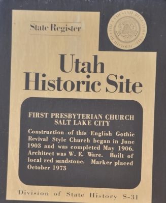
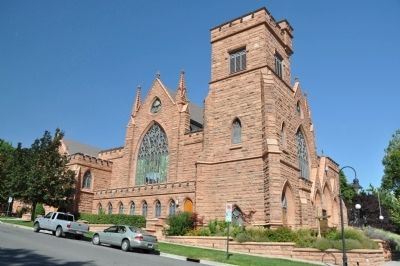
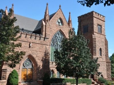
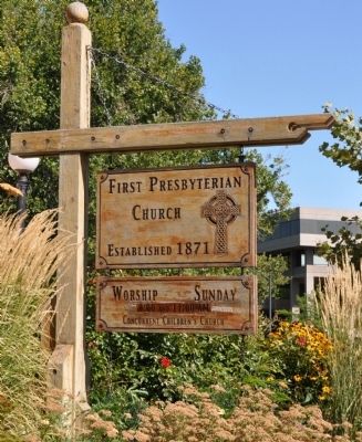
First Presbyterian Church Salt Lake City
American Presbyterian and Reformed Historical Site
Erected 1973 by Utah State Historical Society. (Marker Number S-31, 323.)
Topics and series. This historical marker is listed in this topic list: Churches & Religion. In addition, it is included in the American Presbyterian and Reformed Historic Sites series list. A significant historical year for this entry is 1903.
Location. 40° 46.175′ N, 111° 52.812′ W. Marker is in Salt Lake City, Utah, in Salt Lake County. It is in The Avenues. Marker is at the intersection of South Temple Street (State Highway 186) and C Street, on the right when traveling west on South Temple Street. The marker is located facing east on the left pillar of the central section of the main entry. Touch for map. Marker is at or near this postal address: 12 C Street, Salt Lake City UT 84103, United States of America. Touch for directions.
Other nearby markers. At least 8 other markers are within walking distance of this marker. Cathedral of the Madeleine (about 400 feet away, measured in a direct line); Twentieth Ward School (approx. 0.2 miles away); St. Mark's Episcopal Cathedral (approx. ¼ mile away); Lincoln Arms Apartments (approx. ¼ mile away); Hollywood Apartments (approx. ¼ mile away); Grave of Brigham Young (approx. 0.3 miles away); Eliza R. Snow (approx. 0.3 miles away); William Clayton (approx. 0.3 miles away). Touch for a list and map of all markers in Salt Lake City.
Regarding First Presbyterian Church Salt Lake City. The First Presbyterian Church Salt Lake City was listed as a contributing building as part of the South Temple Historic District in the National Register of Historic Places in 1980. The church is also one of 445 American Presbyterian and Reformed Historical Sites registered between 1973 and 2003 by the Presbyterian Historical Society (PHS), headquartered in Philadelphia. Approved sites received a metal plaque featuring John Calvin’s seal and the site’s registry number (PHS marker location unknown).
The following text is taken from the Presbyterian Historical Society website:
Josiah Welsh, a newly ordained home missionary recruited by Sheldon Jackson, organized the First Presbyterian Church of Salt Lake City in November 1873 with eleven members. Its first building was the first home of Westminster College, and was occupied for thirty years before the congregation moved to its present facility.
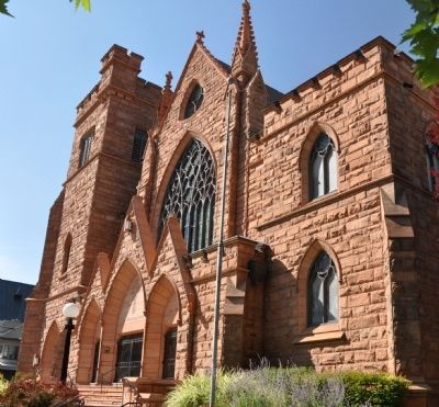
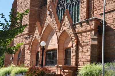
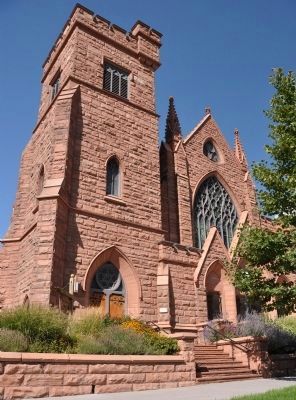
Walter E. Ware designed the Gothic Revival structure, inspired by the cathedral church of Carlisle, England, with its low square tower. The exterior was built of indigenous red sandstone with hard stone trim. First occupied in 1905, the most recent renovations occurred in 2003. It was listed on the National Register of Historic Places in 1980.
Credits. This page was last revised on February 16, 2023. It was originally submitted on September 12, 2010, by Bryan R. Bauer of Kearns, Ut 84118. This page has been viewed 936 times since then and 18 times this year. Last updated on August 14, 2018, by Douglass Halvorsen of Klamath Falls, Oregon. Photos: 1, 2, 3, 4, 5, 6, 7. submitted on September 12, 2010, by Bryan R. Bauer of Kearns, Ut 84118. • Syd Whittle was the editor who published this page.
