Cheboygan in Cheboygan County, Michigan — The American Midwest (Great Lakes)
Cheboygan's Beginnings
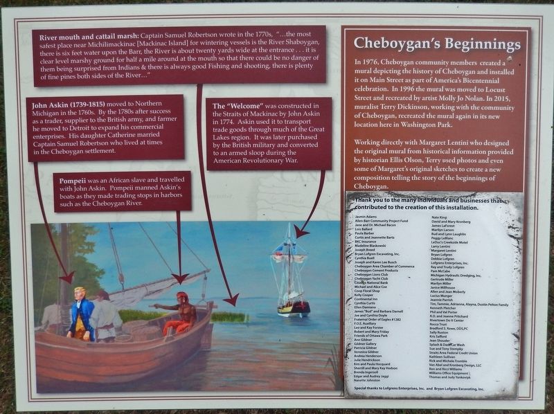
The "Welcome"
River mouth and cattail marsh:
Captain Samuel Robertson wrote in the 1770s, "…the most safest place near Michilimackinac [Mackinac Island] for wintering vessels is the River Shaboygan, there is six feet water upon the Barr, the River is about twenty yards wide at the entrance… it is clear level marshy ground for half a mile around at the mouth so that there could be no danger of them being surprised from Indians & there is always good Fishing and shooting, there is plenty of fine pines both sides of the River…"
John Askin (1739-1815)
moved to Northern Michigan in the 1760s. By the 1780s after success as a trader, supplier to the British army, and farmer he moved to Detroit to expand his commercial enterprises. His daughter Catherine married Captain Samuel Robertson who lived at times in the Cheboygan settlement.
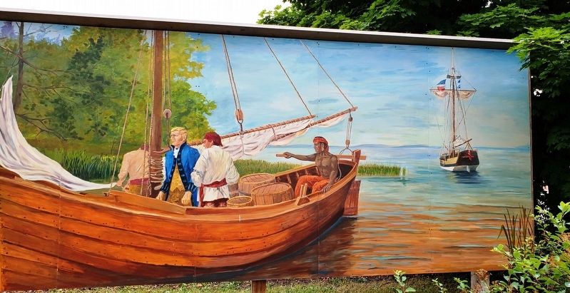
The "Welcome"
was constructed in the Straits of Mackinac by John Askin in 1774. Askin used it to transport trade goods through much of the Great Lakes region. It was later purchased by the British military and converted to an armed sloop during the American Revolutionary War.
Pompeii
was an African slave and travelled with John Askin. Pompeii manned Askin's boats as they made trading stops in harbors such as the Cheboygan River.
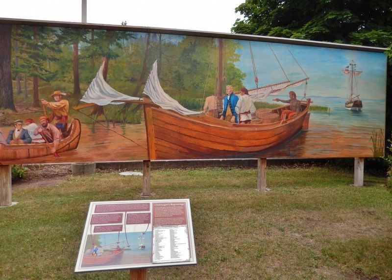
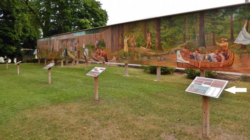
In 1976, Cheboygan community members created a mural depicting the history of Cheboygan and installed it on Main Street as part of America's Bicentennial celebration. In 1996 the mural was moved to Locust Street and recreated by artist Molly Jo Nolan. In 2015, muralist Terry Dickinson, working with the community of Cheboygan, recreated the mural again in its new location here in Washington Park.
Working directly with Margaret Lentini who designed the original mural from historical information provided by historian Ellis Olson, Terry used photos and even some of Margaret's original sketches to create a new composition telling the story of the beginnings of Cheboygan.
Topics. This historical marker is listed in these topic lists: Colonial Era • Native Americans • Settlements & Settlers • Waterways & Vessels.
Location. 45° 38.602′ N, 84° 28.65′ W. Marker is in Cheboygan, Michigan, in Cheboygan County. Marker can be reached from North Main Street (State Highway 27) south of West Elm Street, on the right when traveling north. This marker, related markers, and associated mural are located along the south side of Cheboygan's Washington Park, on the east side of North Main Street. Touch for map. Marker is at or near this postal address: 124 North Main Street, Cheboygan MI 49721, United States of America. Touch for directions.
Other nearby markers. At least 8 other markers are within
walking distance of this marker. A different marker also named Cheboygan's Beginnings (here, next to this marker); a different marker also named Cheboygan's Beginnings (a few steps from this marker); a different marker also named Cheboygan's Beginnings (a few steps from this marker); a different marker also named Cheboygan's Beginnings (a few steps from this marker); Old Cheboygan County Courthouse (approx. 0.4 miles away); Jail and Sheriff's Residence (approx. 0.4 miles away); St. Mary Church (approx. half a mile away); Jacob J. Post House (approx. half a mile away). Touch for a list and map of all markers in Cheboygan.
More about this marker. Marker is a large composite plaque, mounted horizontally on a waist-high post. This is marker #5 of a five marker series which outlines some early colonial history and characters of Cheboygan, Michigan.
Related markers. Click here for a list of markers that are related to this marker. Cheboygan's Beginnings Mural Series
Also see . . . Building Sloop "Welcome" (1974). Chandler Township Charlevoix County Michigan Memories website entry (Submitted on July 30, 2022, by Larry Gertner of New York, New York.)
Credits. This page was last revised on July 30, 2022. It was originally submitted on August 16, 2018, by Cosmos Mariner of Cape Canaveral, Florida. This page has been viewed 194 times since then and 15 times this year. Photos: 1, 2, 3, 4. submitted on August 18, 2018, by Cosmos Mariner of Cape Canaveral, Florida. • Bill Pfingsten was the editor who published this page.


