Ringgold in Catoosa County, Georgia — The American South (South Atlantic)
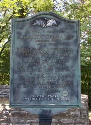
Atlanta Campaign
Ringgold Gap
— May 7, 1864 —
Atlanta Campaign
Ringgold Gap
May 7, 1864
Here, through Ringgold Gap,
a Federal advance position,
Sherman and his army
moved forward
to begin the campaign
against Atlanta
and the heart of the South.
The Confederate defense,
well conceived
and ably executed, delayed
the march to the sea
and the eventual division
of the Confederacy
Erected by National Park Service, U.S. Department of the Interior.
Topics. This historical marker is listed in this topic list: War, US Civil. A significant historical month for this entry is May 1857.
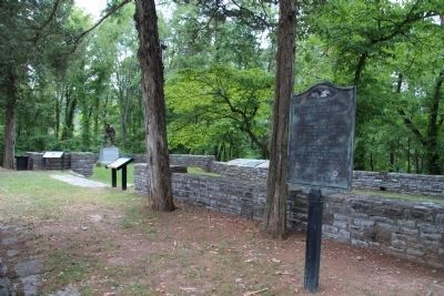
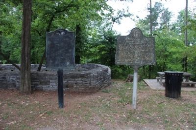
Location. 34° 54.575′ N, 85° 6.172′ W. Marker is in Ringgold, Georgia, in Catoosa County. Marker is on Nashville Street (U.S. 41) 0.3 miles south of Peters Land, on the left when traveling north. This marker is at the pavilion erected by the WPA in the 1930s, containing a picnic area and a bronze relief map of the Ringgold Gap area showing movements during the Civil War. Touch for map. Marker is in this post office area: Ringgold GA 30736, United States of America. Touch for directions.
Other nearby markers. At least 8 other markers are within walking distance of this marker. General Patrick R. Cleburne Memorial (here, next to this marker); The Battle of Ringgold Gap (here, next to this marker); a different marker also named The Atlanta Campaign (here, next to this marker); Confederate General Patrick Cleburne's Emancipation Proposal (here, next to this marker); Ringgold Gap (a few steps from this marker); Ireland's New York Brigade (about 300 feet away, measured in a direct line); Historic Ringgold (about 600 feet away); The Great Locomotive Chase (approx. half a mile away). Touch for a list and map of all markers in Ringgold.
Credits. This page was last revised on June 14, 2020. It was originally submitted on October 7, 2008, by David Seibert of Sandy Springs, Georgia. This page has been viewed 2,225 times since then and 17 times this year. Photos: 1. submitted on October 7, 2008, by David Seibert of Sandy Springs, Georgia. 2, 3, 4. submitted on August 6, 2014, by Dale K. Benington of Toledo, Ohio. • Craig Swain was the editor who published this page.


