St. Simons Island in Glynn County, Georgia — The American South (South Atlantic)
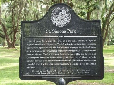
St. Simons Park
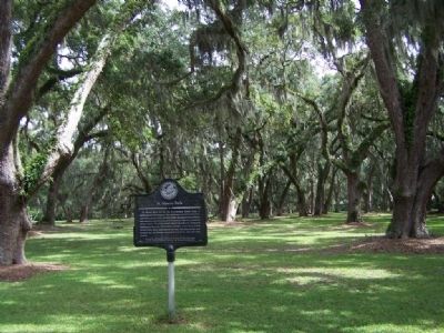
St. Simons park was the site of a Mocama Indian village of approximately 100-200 people. The inhabitants used marine resources, agriculture, square wattle and daub houses, stamped and incised Irene style ceramics, and burial mounds characteristic of this late prehistorical coastal culture. The burial mounds were in use within the chiefdom of Guadalquini from the 1450s-1600s. Artifacts found there include ceramic bowls, pipes, and a rare chevron bead. The refuse midden area revealed that the Indians consumed fish, mollusks, deer, and small animals.
Erected 2002 by Georgia Historical Society, Friends of the Park, Coastal Georgia Historical Society and Neptune Garden Club. (Marker Number 63-4.)
Topics and series. This historical marker is listed in these topic lists: Cemeteries & Burial Sites • Native Americans • Settlements & Settlers. In addition, it is included in the Georgia Historical Society series list.
Location. 31° 8.321′ N, 81° 23.666′ W. Marker is on St. Simons Island, Georgia, in Glynn County. Marker is on Mallery Street near Anne Street, on the right when traveling north. Touch for map. Marker is in this post office area: Saint Simons Island GA 31522, United States of America. Touch for directions.
Other nearby markers. At least 8 other markers are within walking distance of this marker. Historic St. Simons Lighthouse (approx. 0.3 miles away); Fort St. Simons (approx. 0.3 miles away); Couper's Point (approx. 0.3 miles away); North Atlantic Right Whale (approx. 0.3 miles away); Early History of St. Simons Island (approx. 0.3 miles away); The First Lighthouse ~ 1810 (approx. 0.3 miles away); The Historic St. Simons Light Station (approx. 0.3 miles away); a different marker also named Fort St. Simons (approx. 0.3 miles away). Touch for a list and map of all markers in St. Simons Island.
Credits. This page was last revised on November 25, 2020. It was originally submitted on October 9, 2008, by Mike Stroud of Bluffton, South Carolina. This page has been viewed 1,295 times since then and 10 times this year. Photos: 1, 2. submitted on October 9, 2008, by Mike Stroud of Bluffton, South Carolina. • Bill Pfingsten was the editor who published this page.

