Near Fort Oglethorpe in Catoosa County, Georgia — The American South (South Atlantic)
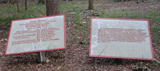
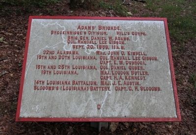
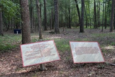
Adams' Brigade
Breckinridge's Division.
— Hill's Corps. —
Breckinridge's Division, Hill's Corps.
Brigadier General Daniel W. Adams.
Colonel Randall Lee Gibson.
September 20, 1863, 11 a.m.
32nd Alabama, - Major John C. Kimbell.
13th and 20th Louisiana, - Colonel Randall Lee Gibson.
13th and 20th Louisiana, - Captain E. M. Dubroca.
16th and 25th Louisiana, - Colonel Daniel Gober.
19th Louisiana, - Major Loudon Butler.
19th Louisiana, - Captain H. A. Kennedy.
14th Louisiana Battalion, - Major J. E. Austin.
Slocomb's (Louisiana) Battery, - Captain C. H. Slocomb.
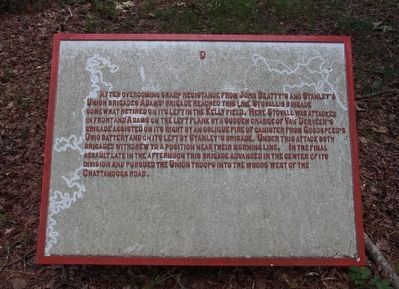
Text on the Second Tablet:
After overcoming sharp resistance from John Beatty's and Stanley's Union brigades Adams' brigade reached this line Stovall's brigade somewhat retired on its left in the Kelly field. Here Stovall was attacked in front and Adams on the left flank by a sudden charge of Van Derveer's brigade assisted on its right by an oblique fire of canister from Goodspeed's Ohio battery and on its left by Stanley's brigade. Under this attack both brigades withdrew to a position near their morning line. In the final assault late in the afternoon this brigade advanced in the center of its division and pursued the Union troops into the woods west of the Chattanooga road.
Erected 1890 by the Chickamauga and Chattanooga National Military Park Commission. (Marker Number MT-1123.)
Topics. This historical marker is listed in this topic list: War, US Civil. A significant historical date for this entry is September 20, 1899.
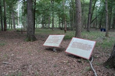
Location. 34° 55.941′ N, 85° 15.654′ W. Marker is near Fort Oglethorpe, Georgia, in Catoosa County. Marker is on Vittetoe-Chickamauga south of Lafayette Road, on the left when traveling north. This maker is located in the national park that preserves the site of the Chickamauga Battlefield, The marker is located along one of the park's secondary roads, a short distance into the woods, south of the national park's visitor's center. Touch for map. Marker is in this post office area: Fort Oglethorpe GA 30742, United States of America. Touch for directions.
Other nearby markers. At least 8 other markers are within walking distance of this marker. Stanley's Brigade (a few steps from this marker); 104th Illinois Infantry (within shouting distance of this marker); 44th Indiana Infantry (within shouting distance of this marker); 11th Michigan Infantry (about 300 feet away, measured in a direct line); 86th Indiana Infantry (about 300 feet away); Breckinridge's Division (about 400 feet away); a different
marker also named Stanley's Brigade (about 500 feet away); 47th Georgia Infantry (about 500 feet away). Touch for a list and map of all markers in Fort Oglethorpe.
More about this marker. I used the "Chickamauga Battlefield" map, that I purchased at the Chickamauga and Chattanooga National Military Park, Visitor Center, to determine both the monument number for this marker and the marker's location in relation to the rest of the park's monuments, markers, and tablets. According to the map it provides the, "numerical listing of all monuments, markers, and tablets on the Chickamauga Battlefield (using the Chick-Chatt NMP Monument Numbering System)."
Approximately 700 metal position and descriptive markers with raised lettering. Union markers are painted blue with white text; Confederate markers are painted white with red text. Most of these tablets and plaques have integrity of location, design, setting, materials, workmanship, feeling, and association to the historically significant period of Commemorative/Park Development (1895-1899).
Credits. This page was last revised on September 2, 2018. It was originally submitted on August 18, 2015, by Dale K. Benington of Toledo, Ohio. This page has been viewed 392 times since then and 7 times this year. Last updated on August 31, 2018, by Byron Hooks of Sandy Springs, Georgia. Photos: 1, 2, 3, 4, 5. submitted on August 18, 2015, by Dale K. Benington of Toledo, Ohio.
