Coloma in El Dorado County, California — The American West (Pacific Coastal)
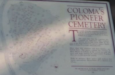
Coloma’s Pioneer Cemetery
Inscription.
Thousands of people emigrated to California with the dream of riches for themselves and have found their final rest in these hallowed grounds.
The exact date that the cemetery was founded is unknown. The earliest known graves date from 1849. In the past it has been known by various names: Sutter Mill, Coloma Protestant, and Vineyard.
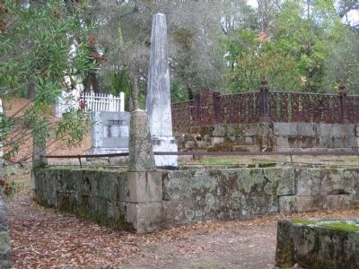
More than 600 pioneers and their families are buried here. The graves contain the remains of those drawn to Coloma in search for gold. All races and many nations are represented. Together they rest in this peaceful setting.
Help us preserve these graves and markers for future generations. Desecration of a cemetery is a felony.
Erected by Marshall Gold Discovery State Historic Park.
Topics. This historical marker is listed in these topic lists: Cemeteries & Burial Sites • Industry & Commerce • Settlements & Settlers. A significant historical year for this entry is 1849.
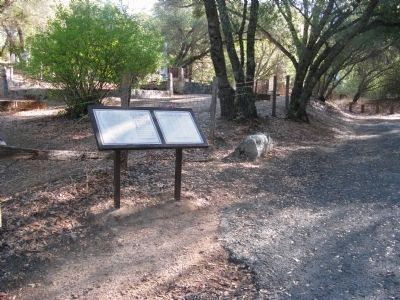
Location. 38° 47.786′ N, 120° 53.364′ W. Marker is in Coloma, California, in El Dorado County. Marker is on Cold Springs Road, on the right when traveling north. Marker is located within the bounderies of The Marshall Gold Discovery State Park. Touch for map. Marker is in this post office area: Coloma CA 95613, United States of America. Touch for directions.
Other nearby markers. At least 8 other markers are within walking distance of this marker. Sutter Mill Cemetery – 1848 (here, next to this marker); Pioneer Cemetery (here, next to this marker); Emmanuel Church (about 500 feet away, measured in a direct line); The Miller House (approx. 0.2 miles away); Noteware-Thomas House (approx. 0.2 miles away); Site of Joe Seeley Home Watchmaker (approx. 0.2 miles away); Saint John's Church (approx. 0.2 miles away); Mining Ditches (approx. 0.2 miles away). Touch for a list and map of all markers in Coloma.
Regarding Coloma’s Pioneer Cemetery. Also see: Pioneer Cemetery, Sutter’s Mill Cemetery and all nearby Coloma markers for additional information.
Also see . . . New York Times Article by Robert Lindsay June 19, 1983: Regarding California’s Mother Lode Country. (Submitted on October 9, 2008.)
Additional keywords. Gold Rush
Credits. This page was last revised on November 3, 2019. It was originally submitted on October 9, 2008, by Syd Whittle of Mesa, Arizona. This page has been viewed 3,974 times since then and 52 times this year. Photos: 1, 2, 3, 4. submitted on October 9, 2008, by Syd Whittle of Mesa, Arizona.


