Columbia Way in Vancouver in Clark County, Washington — The American West (Northwest)
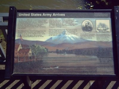
United States Army Arrives
The Army quickly rented buildings from the Hudson's Bay Company and constructed quarters on top of the hillside to the north. As the Army's role grew, the available facilities proved inadequate for its needs.
Over the objections of the Company, the Army constructed a new wharf in 1857 and a large warehouse in 1859 here on the riverfront. Between the mid-1850s and 1866, the Army tore down and burned the old Company buildings.
Erected by Vancouver National Historic Reserve.
Topics. This historical marker is listed in these topic lists: Industry & Commerce • Military • Notable Events • Settlements & Settlers. A significant historical date for this entry is May 13, 1849.
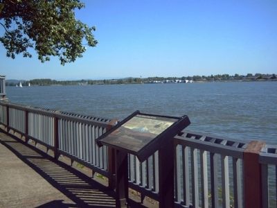
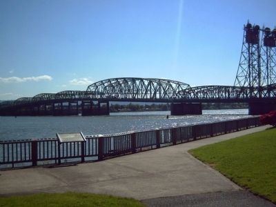
Location. 45° 37.232′ N, 122° 40.216′ W. Marker is in Vancouver, Washington, in Clark County. It is in Columbia Way. Marker is on SE Columbia Way. Marker is in Old Apple Tree Park. Touch for map. Marker is at or near this postal address: 112 Columbia Way, Vancouver WA 98661, United States of America. Touch for directions.
Other nearby markers. At least 8 other markers are within walking distance of this marker. A Busy Place Is This (within shouting distance of this marker); Heart of a Trading Empire (about 300 feet away, measured in a direct line); A River of Settlers (about 600 feet away); Captain George Vancouver Monument Plaza (approx. 0.2 miles away); Captain George Vancouver Monument (approx. 0.2 miles away); Esther Short (approx. 0.4 miles away); St. James Mission (approx. 0.4 miles away); The Red Cross Convalescent House (approx. 0.4 miles away). Touch for a list and map of all markers in Vancouver.
More about this marker. The background picture is an "1874 painting of the US Army wharf by Brevet Major General Alfred Sully," provided for the marker courtesy of the Oregon Historical Society.
In the upper right is a portrait of Rufus Ingalls. "The early Army post owed much of its original design to quartermaster Rufus Ingalls. His responsibility was to oversee construction of the facilities at what would later become Vancouver Barracks."
Also in the upper right of the marker is a picture of the "U.S.S. Massachusetts, a steam assisted, 750-ton bark." It "carried the first US Army troops to Fort Vancouver. The ship remained on the Pacific Coast and later transported US soldiers to San Juan Island during the Pig War, the 1859 border dispute between the United States and Great Britain." The picture is provide for the marker courtesy of the Naval Historical Foundation.
The Vancouver National Historic Reserve is a partnership of the National Park service, the City of Vancouver, the U. S. Army, and the State of Washington and is dedicated to the preservation, education and public use of these historic properties. This exhibit is funded by the National Park Service's Fee Demonstration Program.
Credits. This page was last revised on February 7, 2023. It was originally submitted on October 9, 2008, by Kevin W. of Stafford, Virginia. This page has been viewed 1,246 times since then and 14 times this year. Photos: 1, 2, 3. submitted on October 9, 2008, by Kevin W. of Stafford, Virginia.


