Columbia Way in Vancouver in Clark County, Washington — The American West (Northwest)
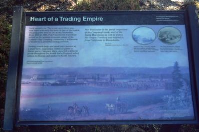
Heart of a Trading Empire
Trading vessels large and small once moored at a wharf here, supplying a variet of goods to distant ports. Company ships exported northwest goods throughout the world: fur to England, salted salmon to Hawaii, and lumber to South America.
Fort Vancouver is the grand emporium of the Company's trade west of the Rocky Mountains as well as within the Oregon Territory and beyond it, from California to Kamschatka.
John Dunn,
Postmaster at Fort Vancouver 1836-1838
Erected by Vancouver National Historic Reserve.
Topics. This historical marker is listed in these topic lists: Industry & Commerce • Settlements & Settlers • Waterways & Vessels. A significant historical year for this entry is 1825.
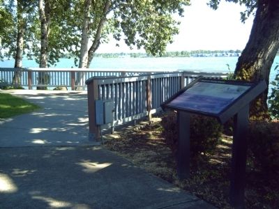
Location. 45° 37.21′ N, 122° 40.161′ W. Marker is in Vancouver, Washington, in Clark County. It is in Columbia Way. Marker can be reached from SE Columbia Way. Marker is in Old Apple Tree Park. Touch for map. Marker is at or near this postal address: 112 Columbia Way, Vancouver WA 98661, United States of America. Touch for directions.
Other nearby markers. At least 8 other markers are within walking distance of this marker. A Busy Place Is This (within shouting distance of this marker); United States Army Arrives (about 300 feet away, measured in a direct line); A River of Settlers (about 300 feet away); Captain George Vancouver Monument Plaza (approx. ¼ mile away); Captain George Vancouver Monument (approx. ¼ mile away); St. James Mission (approx. 0.4 miles away); The Vancouver Farm (approx. 0.4 miles away); An English Garden in the Wilderness (approx. 0.4 miles away). Touch for a list and map of all markers in Vancouver.
More about this marker. The background painting "shows Fort Vancouver's busy riverfront in 1845."
In the upper right corner of the marker are two pictures. One states, "Hudson's Bay Company vessels like the Cadboro navigated the treacherous mouth of the Columbia River to reach Fort Vancouver." The other reads, "The Port of Honolulu offered an excellent market for Fort Vancouver's lumber, salted beef, flour, butter, and salmon."
The Vancouver National Historic Reserve is a partnership of the National Park service, the City of Vancouver, the U. S. Army, and the State of Washington and is dedicated to the preservation, education and public use of these historic properties. This exhibit is funded by the National Park Service's Fee Demonstration Program.
Credits. This page was last revised on February 7, 2023. It was originally submitted on October 9, 2008, by Kevin W. of Stafford, Virginia. This page has been viewed 1,238 times since then and 13 times this year. Photos: 1, 2. submitted on October 9, 2008, by Kevin W. of Stafford, Virginia.

