Missoula in Missoula County, Montana — The American West (Mountains)
Brave New World

Photographed By Barry Swackhamer, May 9, 2018
1. Brave New World Marker
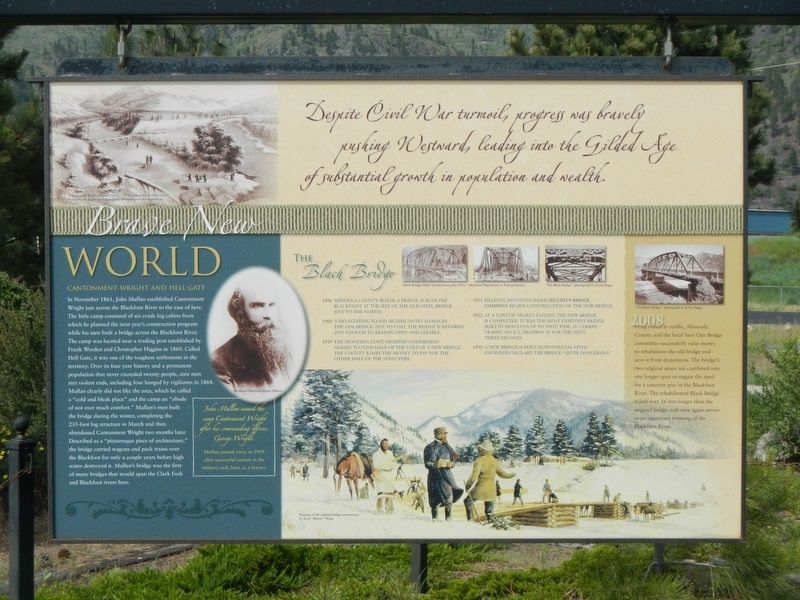
Captions: (top left) "Cantonment Wright, Captain Mullan's Winter Quarters i 1861-1862" Illustration by Gustavus Sohon, guide and interpreter for expedition.; (lower left) John Mullan named the camp Cantonment Wright after his commanding officer, George Wright. Mullan passed away in 1909 after successful careers in the military and, later, as a lawyer.; (bottom) Painting of the original bridge construction; (middle right) Black Bridge Under Construction, July 1921 & Black Bridge.
In November 1861, John Mullan established Cantonment Wright just across the Blackfoot River to the east of here. The little camp consisted of six crude log cabins from which he planned the next year's construction program while his men built a bridge across the Blackfoot River. The camp was located near a trading post established by Frank Worden and Christopher Higgins in 1860. Called Hell Gate, it was one of the toughest settlements in the territory. Over its four year history and a permanent population that never exceeded twenty people, nine men met violent ends, including four hanged by vigilantes in 1864. Mullan clearly did not like the area, which he called a "cold and bleak place" and the camp an "abode of not over much comfort." Mullan's men built the bridge during the winter, completing the 235-foot structure in March and then abandoned Cantonment Wright two months later. Described as a "picturesque piece of architecture," the bridge carries wagons and pack trains over the Blackfoot for only a couple of years before high water destroyed it. Mullan's bridge was the first of may bridges that would span the Clark Fork and Blackfoot rivers here.
1896 -- Missoula County builds a bridge across the Blackfoot at the site of the old steel bridge just to the north.
1908 -- A devastating flood significantly damages the 1896 bridge. Due to cost, the bridge is repaired just enough to remain open and useable.
1919 -- The Montana State Highway Commission agrees to fund half of the cost of a new bridge. The County raises the money to pay for the other half of the structure.
1921 -- Billings, Montana-based Security Bridge Company begins construction of the new bridge.
1922 -- At a cost of nearly $110,000, the new bridge is completed. It was the most expensive bridge built in Montana up to that time. It carries traffic on U.S. Highway 10 for the next three decades.
1950 -- A new bridge is built downstream after engineers declare the bridge "quite dangerous."
2008 -- Long closed to traffic, Missoula County and the local Save Our Bridge committee successfully raise money to rehabilitate the old bridge and save it from demolition. The bridge's two original spans are combined into one longer span to negate the need for a concrete pier in the Blackfoot River. The rehabilitated Black Bridge is just over 56 feet longer than the original bridge and once again
serves as an important crossing of the Blackfoot River.
Topics. This historical marker is listed in these topic lists: Bridges & Viaducts • Roads & Vehicles • Settlements & Settlers. A significant historical month for this entry is November 1861.
Location. 46° 52.497′ N, 113° 53.123′ W. Marker is in Missoula, Montana, in Missoula County. Marker is on Montana Highway East (State Highway 200) near 1st Street, on the right when traveling west. Touch for map. Marker is at or near this postal address: 7985 Montana Highway 200, Missoula MT 59802, United States of America. Touch for directions.
Other nearby markers. At least 8 other markers are within 5 miles of this marker, measured as the crow flies. Twilight of an Era (here, next to this marker); Journey Through the Blackfoot (a few steps from this marker); Prescott House (approx. 4.6 miles away); a different marker also named Prescott House (approx. 4.6 miles away); Central Heating Plant (approx. 4.7 miles away); Glacial Lake Missoula (approx. 4.7 miles away); All gave some, some gave all (approx. 4.7 miles away); Men's Gymnasium (approx. 4.7 miles away). Touch for a list and map of all markers in Missoula.
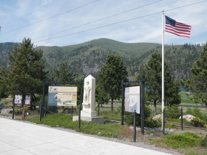
More about this marker. This marker is located at a roadside turnout on the north side of Montana Highway 200.
Also see . . . Hell Gate, Montana - Wikipedia. Hell Gate was the scene of notorious lynchings in 1864.... Cyrus Skinner, a member of Henry Plummer's "road agent" gang, and other members of the Plummer gang took up residence in Hell Gate... and began a reign of terror against the townspeople....On the night of January 27, 1864, a group of 21 vigilantes... from Alder Gulch rode into Hell Gate and rounded up Skinner and the other outlaws. A brief trial was held in Worden and Higgins' store, and four members of the Plummer gang were sentenced to death. (Submitted on September 9, 2018, by Barry Swackhamer of Brentwood, California.)
Credits. This page was last revised on September 9, 2018. It was originally submitted on September 9, 2018, by Barry Swackhamer of Brentwood, California. This page has been viewed 196 times since then and 8 times this year. Photos: 1, 2. submitted on September 9, 2018, by Barry Swackhamer of Brentwood, California.
