Cumberland Township near Gettysburg in Adams County, Pennsylvania — The American Northeast (Mid-Atlantic)
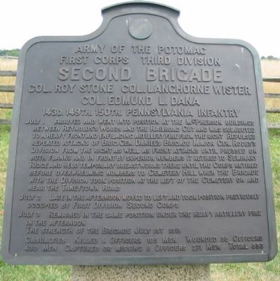
Second Brigade
Third Division - First Corps
— Army of the Potomac —
First Corps Third Division
Second Brigade
Col. Roy Stone, Col. Langhorne Wister
Col. Edmund L. Dana
143d. 149th. 150th. Pennsylvania Infantry
July 1 Arrived and went into position at the McPherson building between Reynolds's Woods and the Railroad Cut and was subjected to a heavy front and enfilading artillery fire from the right. Repulsed repeated attacks of Brig. Gen. Daniel's Brigade Major Gen. Rodes's Division from the right as well as front attacks until pressed on both flanks and in front by superior numbers it retired to Seminary Ridge and held temporary breast works there until the Corps retired before overwhelming numbers to Cemetery Hill when the Brigade with the Division took position at the left of the Cemetery on and near the Taneytown Road.
July 2 Late in the afternoon moved to left and took position previously occupied by First Division Second Corps.
July 3 Remained in the same position under the heavy artillery fire in the afternoon.
The strength of the Brigade July 1st 1315.
Casualties. Killed 4 officers 105 men. Wounded 35 officers 430 men. Captured or missing 8 officers 271 men. Total 853.
Erected 1912 by Gettysburg National Military Park Commission.
Topics. This historical marker is listed in this topic list: War, US Civil. A significant historical month for this entry is July 1895.
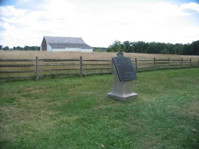
Location. 39° 50.251′ N, 77° 15.119′ W. Marker is near Gettysburg, Pennsylvania, in Adams County. It is in Cumberland Township. Marker is at the intersection of Stone Avenue and Chambersburg Pike (U.S. 30), on the left when traveling south on Stone Avenue. Located near McPherson Barn in Gettysburg National Military Park. Touch for map. Marker is in this post office area: Gettysburg PA 17325, United States of America. Touch for directions.
Other nearby markers. At least 8 other markers are within walking distance of this marker. Edward McPherson Farm (a few steps from this marker); Gettysburg Campaign (within shouting distance of this marker); Battery A, Second U.S. Artillery (within shouting distance of this marker); Touring the Battlefield (within shouting distance of this marker); 149th Pennsylvania Infantry (within shouting distance of this marker); Hall's 2nd Maine Battery (within shouting distance of this marker); Buford (within shouting distance of this marker); Major General John Fulton Reynolds (within shouting distance of this marker). Touch for a list and map of all markers in Gettysburg.
Also see . . . Report of Col. Roy Stone. Col. Stone was wounded during the action and passed the command to Col. Langhorne Wister, 150th Pennsylvania. Later when Col. Wister
was wounded, he passed the command to Col. Edmund Dana, 143rd Pennsylvania. All three officers described a very determined fight along McPherson Ridge in their official reports. (Submitted on October 12, 2008, by Craig Swain of Leesburg, Virginia.)
Photographed By Craig Swain, August 16, 2008
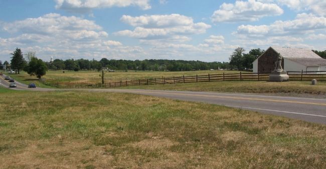
3. Right Flank Stone's Brigade
Looking from the base of the Buford Monument to the southeast across the Chambersburg Pike. The McPherson Barn is in on the left. Around mid-morning Stone's Brigade arrived on the field and deployed north of Meredith's Brigade (the famed Iron Brigade). With the arrival of Confederates of Rodes' Division, Stone re-oriented the 143rd and 149th Pennsylvania to face north with their frontage along the Chambersburg Pike. The 149th Pennsylvania Regiment's monument is on the left beside the Pike. The 143rd Pennsylvania's is in the distance close to the modern traffic lights.
Photographed By Craig Swain
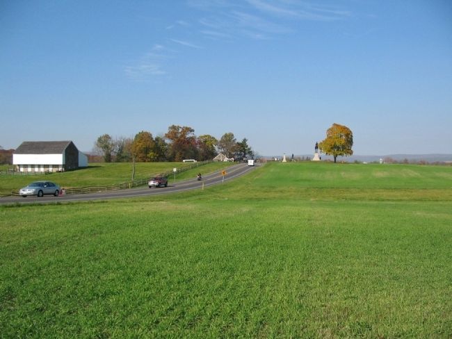
4. Stone's Brigade Struck by Daniel's Brigade
Looking west at Chambersburg Pike from a point just north of the 143rd Pennsylvania Monument. Stone's Brigade was arrayed with the 143rd Pennsylvania between what is today Reynold's Avenue and the low ground near where the red truck is seen on the Pike. The 149th Pennsylvania were in line to their left. Initially the 150th Pennsylvania was on a line facing west along what is today Stone Avenue, but wheeled out along the Pike to face north. Note the McPherson Barn in the left background. In the afternoon phase of the fighting at Gettysburg, element's of Daniel's Confederate Brigade, Rodes' Division, advanced from the right of this view, catching Stone's Brigade in a "vice." Elements of Heth's Confederate Division attacked from the west (distant left beyond the McPherson Barn). Caught on two sides, Stone's Brigade fell back to Seminiary Ridge.
Photographed By Craig Swain
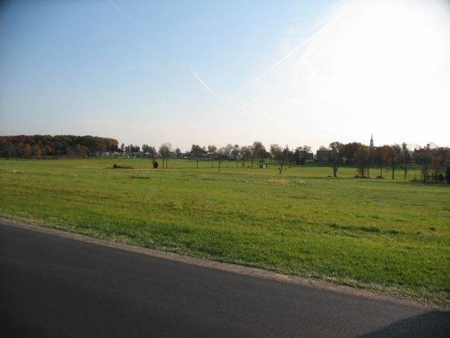
5. Stone's Brigade on Seminary Ridge
Looking from Reynolds' Drive, near the McPherson Woods, toward the Lutheran Theological Seminary. In the later phases of the afternoon fighting of July 1, Stone's brigade was reformed on Seminary Ridge with the 143rd Pennsylvania north of the Chambersburg Pike (entering from the left of this view next to the tree line and white hotel buildings). The 149th Pennsylvania was posted to the south of the Pike, around the Seminary buildings in the center of this view. The 150th Pennsylvania was to their left rear. This position, supporting several batteries of Federal guns, was flanked when the Eleventh Corps collapsed.
Credits. This page was last revised on February 7, 2023. It was originally submitted on October 12, 2008, by Craig Swain of Leesburg, Virginia. This page has been viewed 1,145 times since then and 19 times this year. Photos: 1, 2, 3. submitted on October 12, 2008, by Craig Swain of Leesburg, Virginia. 4, 5. submitted on January 11, 2009, by Craig Swain of Leesburg, Virginia.
