Almo in Cassia County, Idaho — The American West (Mountains)
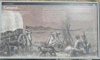
Camped...
Mentally remove the buildings, roads, and vehicles, and picture this landscape around July 1850.
In the morning or afternoon California-bound wagon trains would be passing from left to right. At midday a train might be stopped to "noon." pausing for relief from the sun, In the evening you would see the activity of trains stopping for the night - preparing meals, herding livestock to pasture, discussing plans for tomorrow. Darkness would bring flickering campfires.
Good water provided by springs and streams flowing from the mountains behind you induced many emigrant trains to camp here before heading into the City of Rocks.
In the distance to the right you might also have seen dust rising from other wagon trains plodding westward on the Salt Lake Alternate. This route via Salt Lake City joined the main trail a few miles southwest of here.
Erected by National Park Service, Idaho Department of Parks and Recreation.
Topics and series. This historical marker is listed in these topic lists: Roads & Vehicles • Settlements & Settlers. In addition, it is included in the California Trail series list. A significant historical month for this entry is July 1850.
Location. 42° 5.501′ N, 113° 37.938′ W. Marker is in Almo, Idaho, in Cassia County. Marker is on Elba-Almo Road near 3000 South, on the left when traveling south. Touch for map. Marker is at or near this postal address: 3943 Elba-Almo Road, Almo ID 83312, United States of America. Touch for directions.
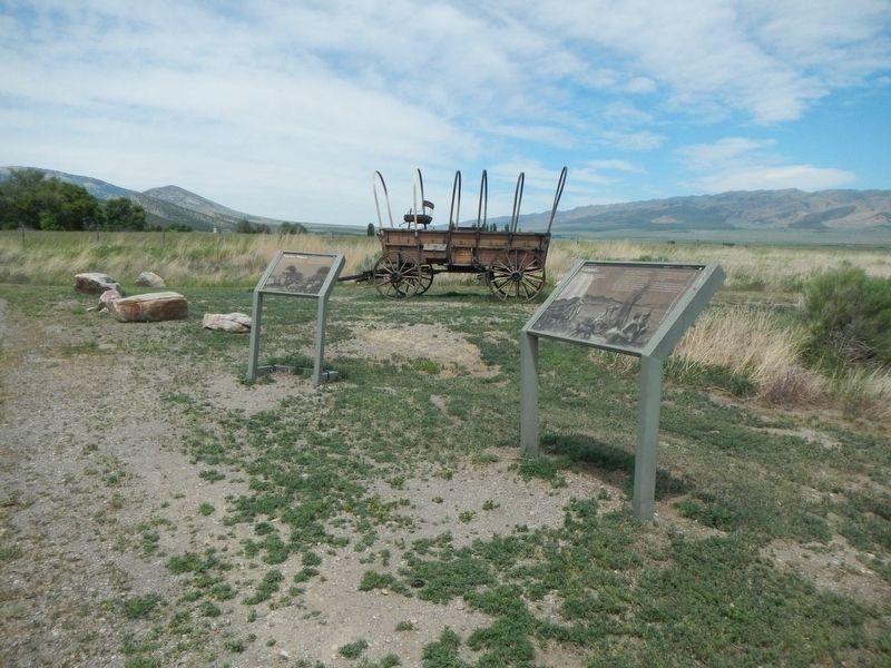
Other nearby markers. At least 8 other markers are within 5 miles of this marker, measured as the crow flies. Replica Wagon (here, next to this marker); Horrible Indian Massacre (approx. 0.3 miles away); California Trail - Nearing City of Rocks (approx. 0.4 miles away); Distant Views (approx. 3.2 miles away); Fading Away (approx. 3.2 miles away); California Trail -- Silent City of Rocks (approx. 3˝ miles away); A Pleasant Place (approx. 3˝ miles away); Pinnacle Pass (approx. 4.1 miles away). Touch for a list and map of all markers in Almo.
More about this marker. This marker is located at the City of Rocks National Reserve Visitor Center.
Credits. This page was last revised on September 28, 2018. It was originally submitted on September 28, 2018, by Barry Swackhamer of Brentwood, California. This page has been viewed 259 times since then and 26 times this year. Photos: 1, 2. submitted on September 28, 2018, by Barry Swackhamer of Brentwood, California.

