Calhoun in McLean County, Kentucky — The American South (East South Central)
Camp Calhoun
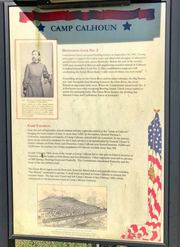
Defending Lock No. 2
Confederate forces occupied Bowling Green on September 18, 1861. Young men, eager to support the Union cause and filled with thoughts of adventure, joined Home Guard units across Kentucky. Before the end of the month 2,000 men recruited in McLean and neighboring counties arrived in Calhoun to defend Green River Lock No. 2. They established a camp on a hill overlooking the Green River about ¼ mile west of where you now stand.
Controlling access to the Green River and its major tributary, the Big Barren, was vital. Navigable from Bowling Green to the Ohio River, the rivers formed an important trade route. When the Confederates seized Lock No. 3 at Rochester soon after occupying Bowling Green, Union forces rushed to secure the remaining locks. The Green River became the dividing line between Union and Confederate forces in Kentucky.
Camp Calhoun
Near the end of September several Indiana infantry regiments arrived at the "camp at Calhoun" bringing the total number of men to more than 5,000. In November, General Thomas L. Crittenden, appointed commander of Camp Calhoun, arrived with his command. In late January more troops arrived in readiness for the Union advance to be spearheaded by General Ulysses S. Grant's assaults on Forts Henry and Donelson. Camp Calhoun now housed between 10,000 and 15,000 men. In contrast, the civilian population of Calhoun was little more than 500.
In early February 1862, most of the troops at Camp Calhoun left to take part in Grant's invasion of Tennessee and the battles at Fort Henry and Fort Donelson. Other regiments soon left to advance on Mill Springs, Bowling Green and Nashville. The Confederates abandoned Kentucky and the focus of the war shifted south.
The Green River region was far from safe, however. Rebel raiders and guerilla forces including "Sue Mundy" continued to operate. A small force remained at Camp Calhoun to counter this constant threat. The last state Guard unit left Camp Calhoun in late February 1865, which corresponds to the last known burial at Camp Calhoun Cemetery.
{Photo inset}
Gen. Thomas Leonidas Crittenden
Commander of Camp Calhoun
Thomas Crittenden was the son of Kentucky statesman John Crittenden, author of the Crittenden Compromise, an attempt to find a peaceful solution to the differences that even then seemed destined to end in civil war. The Crittenden family exemplified the divisiveness of the War. Thomas' brother George joined the Confederate army, in which be also became a general.
Erected 2008 by Commonwealth of Kentucky, City of Calhoun, McLean County Cemetery Board & Fiscal Court, Forrest's Orphans Camp 1744 SCV.
Topics and series. This historical marker is listed in these topic lists: War, US Civil • Waterways & Vessels. In addition, it is included in the Sons of Confederate Veterans/United Confederate Veterans series list. A significant historical month for this entry is February 1862.
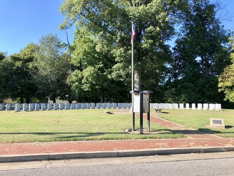
Location. 37° 32.255′ N, 87° 15.696′ W. Marker is in Calhoun, Kentucky, in McLean County. Marker is on West 3rd Street west of Poplar Street, on the right when traveling west. Located at Camp Calhoun Cemetery. Touch for map. Marker is at or near this postal address: West 3rd Street, Calhoun KY 42327, United States of America. Touch for directions.
Other nearby markers. At least 8 other markers are within 9 miles of this marker, measured as the crow flies. Camp Calhoun Cemetery (here, next to this marker); Forrest Reconnoitered (about 400 feet away, measured in a direct line); County Named / Calhoun (approx. 0.2 miles away); McLean County War Memorial (approx. 0.8 miles away); Charles Hansford / Charles Hansford (1759-1850) (approx. 0.8 miles away); Union Camp Site / McLean County Recruits, Co. D 35 Regt. KY. Vol. Mounted Inf. (approx. 6.1 miles away); Livermore Bridge (approx. 7.9 miles away); William Worthington (1761-1848) (approx. 9.1 miles away). Touch for a list and map of all markers in Calhoun.
Credits. This page was last revised on October 10, 2018. It was originally submitted on September 28, 2018, by Mark Hilton of Montgomery, Alabama. This page has been viewed 539 times since then and 65 times this year. Photos: 1, 2. submitted on September 28, 2018, by Mark Hilton of Montgomery, Alabama.
Editor’s want-list for this marker. Photo of Green River Lock #2 located about 3000 feet southwest of marker. • Can you help?

