Tintagel in Cornwall, England, United Kingdom — Northwestern Europe (the British Isles)
A complicated ruin
Magor gomplek
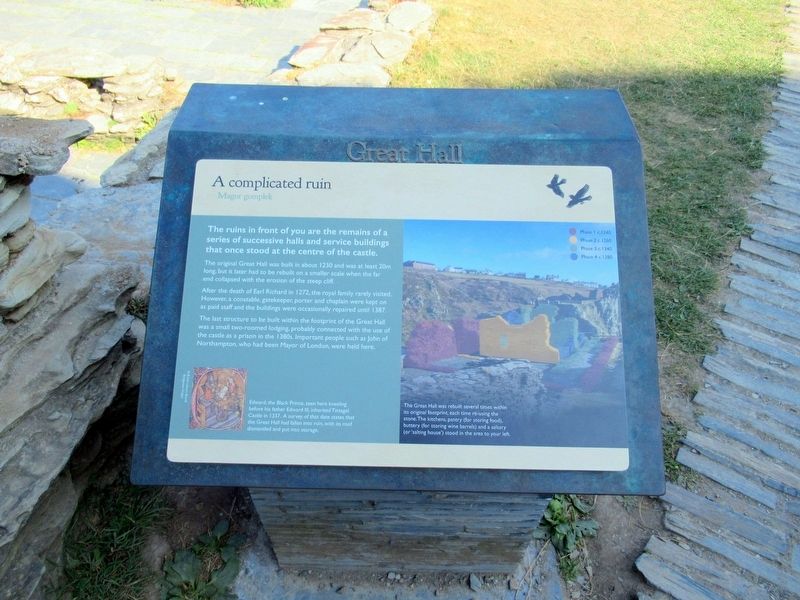
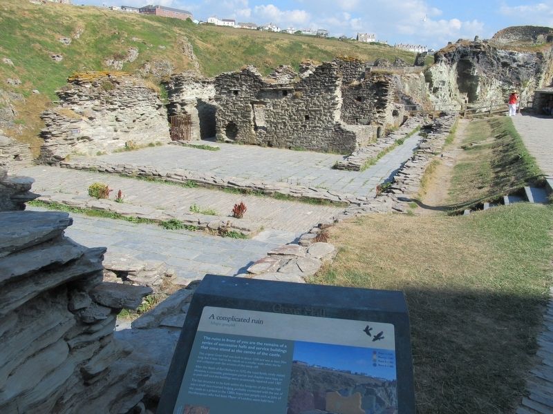
The ruins in front of you are the remains of a series of successive halls and service buildings that once stood at the centre of the castle.
The original Great Hall was built in about 1230 and was at least 20m long, but it later had to be rebuilt on a smaller scale when the far end collapsed with the erosion of the steep cliff.
After the death of Earl Richard in 1272, the royal family rarely visited. However, a constable. gatekeeper, porter and chaplain were kept on as paid staff and the buildings were occasionally repaired until 1387.
The last structure to be built within the footprint of the Great Hall was a small two-roomed lodging, probably connected with the use of the castle as a prison in the 1380s. Important people such as John of Northampton, who had been Mayor of London, were held here.
Edward, the Black Prince, seen here kneeling before his father Edward II, inherited Tintagel Castle in 1337. A survey of that date states that the Great Hall had fallen into ruin, with its roof dismantled and put into storage.
Topics. This historical marker is listed in this topic list: Forts and Castles.
Location. 50° 40.094′ N, 4° 45.591′ W. Marker is in Tintagel, England, in Cornwall. Marker can be reached from Castle Road, 0.6 kilometers west of Atlantic Road, on the right when traveling west. Located at Tintagel Castle. Touch for map. Marker is in this post office area: Tintagel, England PL34 0HE, United Kingdom. Touch for directions.
Other nearby markers. At least 8 other markers are within walking distance of this marker. Prince Dafydd’s tale (a few steps from this marker); Excavations and discoveries (a few steps from this marker); Florence’s shelter (within shouting distance of this marker); The Trader’s tale (within shouting distance of this marker); The Priest’s tale (within shouting distance of this marker); Where history meets legend (about 90 meters away, measured in a direct line); Tintagel village (about 120 meters away); A changing coastline (about 120 meters away). Touch for a list and map of all markers in Tintagel.
Also see . . .
1. English Heritage - Tintagel Castle. (Submitted on October 1, 2018, by Michael Herrick of Southbury, Connecticut.)
2. Tintagel Castle on Wikipedia. (Submitted on October 1, 2018, by Michael Herrick of Southbury, Connecticut.)
Credits. This page was last revised on January 27, 2022. It was originally submitted on October 1, 2018, by Michael Herrick of Southbury, Connecticut. This page has been viewed 150 times since then and 27 times this year. Photos: 1, 2. submitted on October 1, 2018, by Michael Herrick of Southbury, Connecticut.

