Fort Pierre in Stanley County, South Dakota — The American Midwest (Upper Plains)
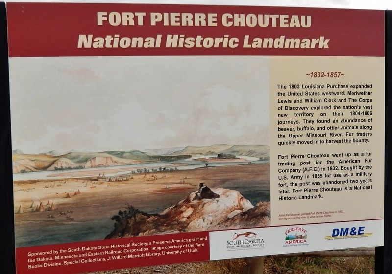
Fort Pierre Chouteau
National Historic Landmark
— 1832-1857 —
Fort Pierre Chouteau went up as a fur trading post for the American Fur Company (A.F.C.) in 1832. Bought by the U.S. Army in 1855 for use as a military fort, the post was abandoned two years later. Fort Pierre Chouteau is a National Historic Landmark.
Images courtesy of the South Dakota Historical Society and the National Archives.
Erected by The South Dakota State Historical Society, a Preserve America grant and the Dakota, Minnesota and Eastern Railroad Corporation.
Topics. This historical marker is listed in these topic lists: Exploration • Forts and Castles • Industry & Commerce • Settlements & Settlers. A significant historical year for this entry is 1832.
Location. 44° 23.375′ N, 100° 23.354′ W. Marker is in Fort Pierre, South Dakota, in Stanley County. Marker is on Fort Chouteau Road, 0.3 miles east of State Highway 1806, on the left when traveling east. Marker is located on the north side of Fort Pierre Chouteau Road, at the entrance to Fort Pierre Chouteau National Historic Site. Touch for map. Marker is at or near this postal address: 350 Fort Chouteau Road, Fort Pierre SD 57532, United States of America. Touch for directions.
Other nearby markers. At least 8 other markers are within walking distance of this marker. Fort Pierre Chouteau and the "Yellow Stone" (within shouting distance of this marker); Scotty Philip and his Buffalo Ranch (within shouting distance of this marker); Rivers and Trails (within shouting distance of this marker); Fur Trade on the Upper Missouri River (within shouting distance of this marker); Fort Pierre Chouteau: Fur Trade (1832-1855) (about 300 feet away, measured in a direct line); Cultures Come Together (about 500 feet away); Fort Pierre Chouteau Site (about 600 feet away); Fort Pierre Chouteau: Military Occupancy (1855-1857) (about 600 feet away). Touch for a list and map of all markers in Fort Pierre.
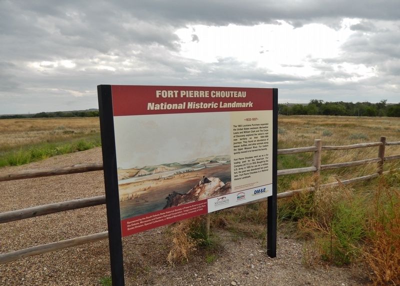
More about this marker. Marker is a large composite plaque, mounted vertically, at eye-level, on a "billboard-style" metal frame.
Related markers. Click here for a list of markers that are related to this marker. Fort Pierre Chouteau National Historic Landmark
Also see . . .
Fort Pierre Chouteau Site. No visible remains exist at the site today. The fort undoubtedly underwent numerous additions and changes. Travelers up the Missouri during the first half of the 19th century described the fort. The most reliable of those descriptions is Prince Maximillian’s, made in 1833. He estimated each side of the fort to be about 300 feet long. George Catlin visited Fort Pierre the previous year and naturalist John J. Audubon a decade later. Their journals and the memoirs of members of their parties provide a picture of the fort’s construction.
The outline of the old stockade was still visible at the turn of the 20th century, when historian Charles E. DeLand studied the site. (Submitted on October 9, 2018, by Cosmos Mariner of Cape Canaveral, Florida.)
Credits. This page was last revised on October 10, 2018. It was originally submitted on October 6, 2018, by Cosmos Mariner of Cape Canaveral, Florida. This page has been viewed 146 times since then and 14 times this year. Photos: 1, 2, 3. submitted on October 9, 2018, by Cosmos Mariner of Cape Canaveral, Florida. • Andrew Ruppenstein was the editor who published this page.


