Near Affton in St. Louis County, Missouri — The American Midwest (Upper Plains)
Grant's Departure / ~150 Years Ago
(left panel)
Grant’s Departure
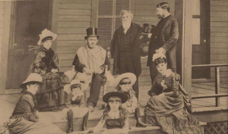
After the Presidency and a world tour, Ulysses and Julia Grant settled in New York to be closer to their children and grandchildren. While the romance of one day returning to White Haven remained, it was not practical. In 1884 Grant lost his fortune when swindled by his son's business partner, Ferdinand Ward. He had used the estate as collateral on a loan from William Vanderbilt and turned the property over to him to settle the debt. Luther Conn, a former Confederate Officer during the Civil War, acquired the property in 1888.
Conn, although a former foe, became so enamored with Grant while owning the property, that he renamed the place "Grantwood" which became the name of the village in which the park now exists.
(right panel)
~150 Years Ago—
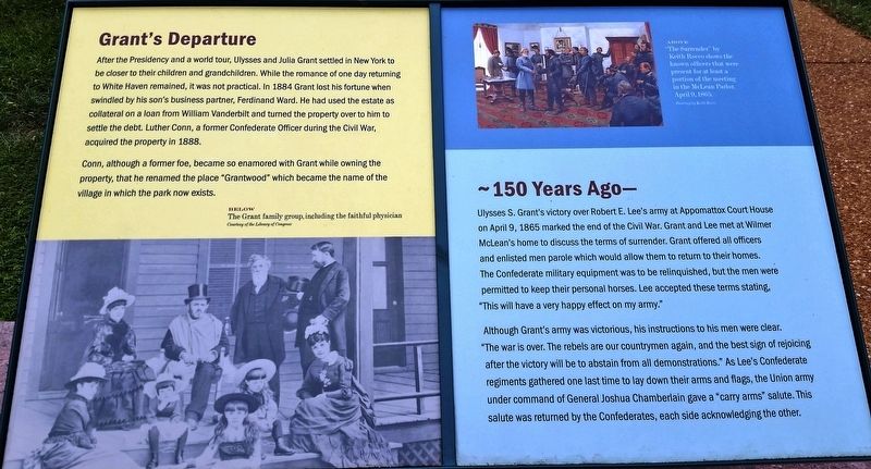
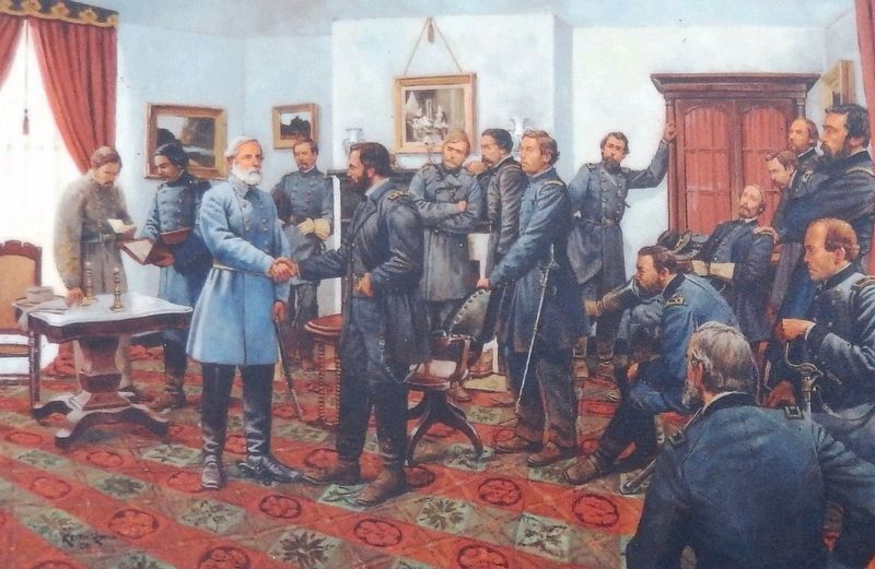
Ulysses S. Grant's victory over Robert E. Lee's army at Appomattox Court House on April 9, 1865 marked the end of the Civil War. Grant and Lee met Wilmer McLean's home to discuss the terms of surrender. Grant offered all officers and enlisted men parole which would allow them to return to their homes. The Confederate military equipment was to be relinquished, but the men were permitted to keep their personal horses. Lee accepted these terms stating, "This will have a very happy effect on my army.”
Although Grant's army was victorious, his instructions to his men were clear. “The war is over. The rebels are our countrymen again, and the best sign of rejoicing after the victory will be to abstain from all demonstrations.” As Lee's Confederate regiments gathered one last time to lay down their arms and flags, the Union army under command of General Joshua Chamberlain gave a "carry arms" salute. This salute was returned by the Confederates, each side acknowledging the other.
Erected by Ulysses S. Grant National Historic Site.
Topics and series. This historical marker is listed in this topic list: War, US Civil. In addition, it is included in the Former U.S. Presidents: #18 Ulysses S. Grant series list. A significant historical date for this entry is April 9, 1865.
Location. 38° 33.083′ N, 90° 21.137′ W. Marker is near Affton, Missouri, in St. Louis County. Marker can be reached from Grant Road, 0.4 miles north of Gravois Road (State Highway 30), on the right when traveling north. Marker is located on the grounds of the Ulysses S. Grant National Historic Site, along the walking path at the west side of the visitor center, overlooking Grant Road to the south. Touch for map. Marker is at or near this postal address: 7400 Grant Road, Saint Louis MO 63123, United States of America. Touch for directions.
Other nearby markers. At least 8 other markers are within walking distance of this marker.
Changes at White Haven / ~150 Years Ago - Grants Horses (here, next to this marker); Working Plantation / ~150 Years Ago - Emancipation (within shouting distance of this marker); A Slave Plantation (within shouting distance of this marker); White Haven (within shouting distance of this marker); A Place Called Home / ~150 Years Ago—Petersburg (about 300 feet away, measured in a direct line); Ulysses S. Grant and the Farm at White Haven (about 300 feet away); Green Haven? (about 300 feet away); White Haven's Outbuildings (about 300 feet away). Touch for a list and map of all markers in Affton.
Also see . . .
1. Ferdinand Ward: A Swindle of the Century & The Sins of the Father. Ferdinand Ward ran what came to be called, 40 years later, a ‘Ponzi scheme’, a swindle as old certainly as financial instruments and probably as greed itself. He promised investors improbable returns from unlikely investments, in Ward’s case government procurement contracts. Ward reached Grant through Grant’s son. Some hard convincing led Buck Grant to become Ward’s partner. And so came into existence in 1880 the infamous firm of Grant & Ward - with Ulysses S. Grant Jr.’s $100,000 and most importantly his last name first on the letterhead. Grant Sr. had no pension. Presidents didn’t receive one, and vengeful Democrats and southerners in Congress refused to reinstate Grant to his military
rank, so he could get an Army stipend. He lived on private benefactions and speaking fees. A notoriously poor businessman and judge of honesty, the allure of money from not-very-heavy lifting in an already successful enterprise appears to have been overwhelming. He soon invested in Grant & Ward.
On May 6, 1883 came the reckoning. When Grant left home that morning he had believed himself a millionaire. When he got home in the evening he had $80 in his pocket. His wife had another $130. There was nothing else. (Submitted on August 26, 2018, by Cosmos Mariner of Cape Canaveral, Florida.)
2. Ulysses S Grant Mational Historic Site. National Park Service (Submitted on August 27, 2018.)
Credits. This page was last revised on July 12, 2021. It was originally submitted on August 24, 2018, by Cosmos Mariner of Cape Canaveral, Florida. This page has been viewed 165 times since then and 15 times this year. Last updated on October 15, 2018, by Devry Becker Jones of Washington, District of Columbia. Photos: 1, 2, 3, 4. submitted on August 26, 2018, by Cosmos Mariner of Cape Canaveral, Florida. • Andrew Ruppenstein was the editor who published this page.


