Bradenton in Manatee County, Florida — The American South (South Atlantic)
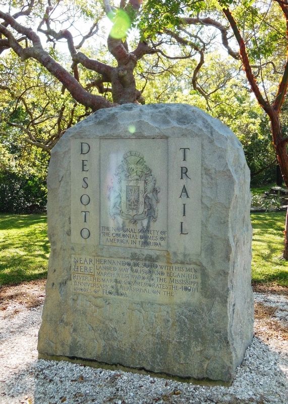
De Soto Trail Monument
De Soto National Memorial
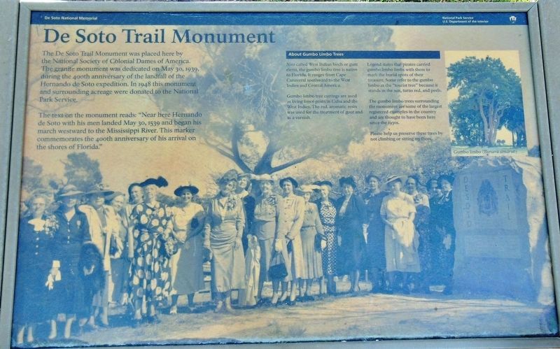
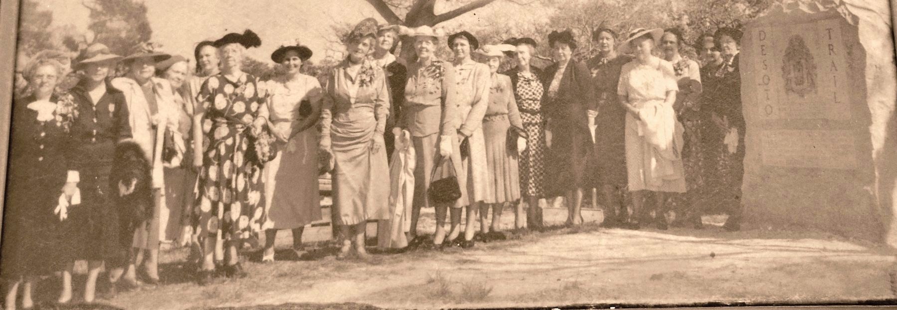
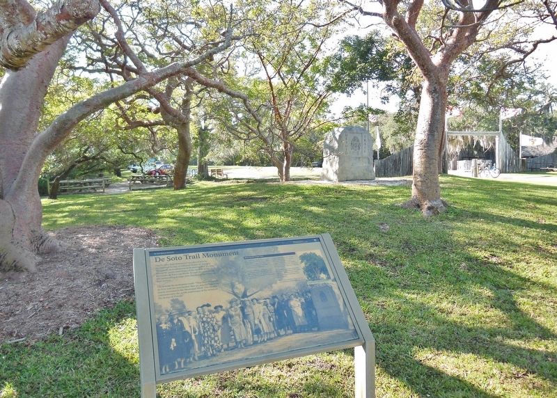
The text on the monument reads: “Near here Hernando de Soto with his men landed May 30, 1539 and began his march westward to the Mississippi River. This marker commemorates the 400th anniversary of his arrival on the shores of Florida.”
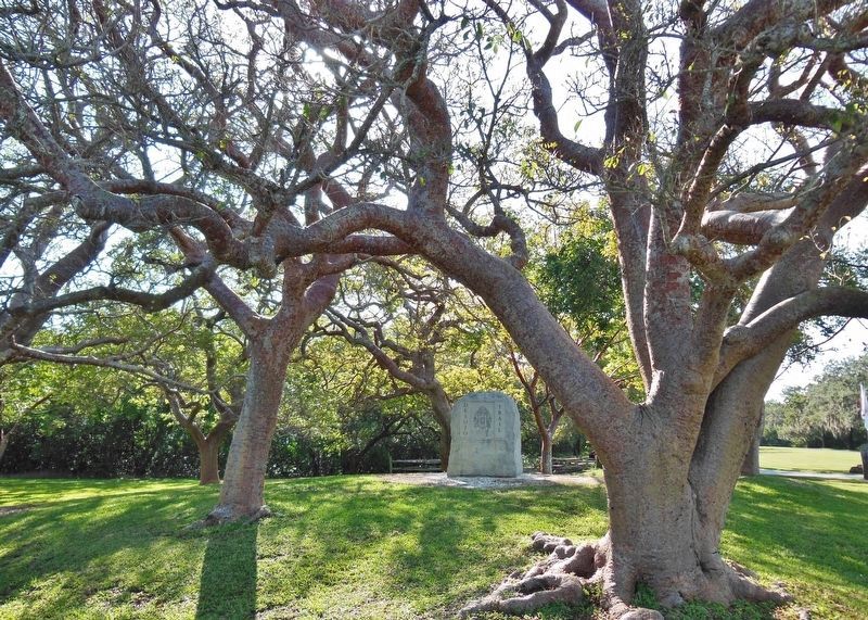
About Gumbo Limbo Trees
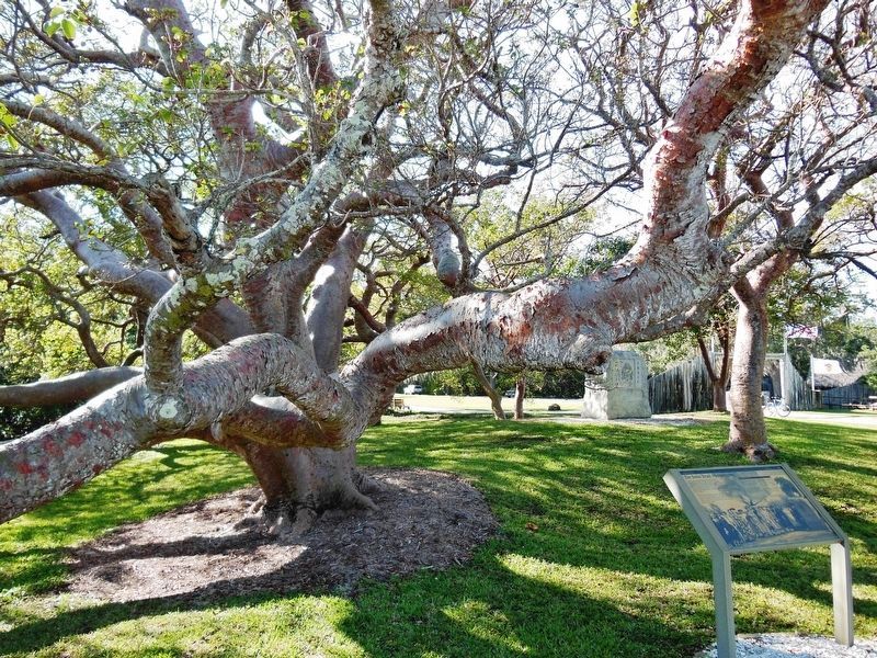
Also called West Indian birch or gum elemi, the gumbo limbo tree is native to Florida. It ranges from Cape Canaveral southward to the West Indies and Central America.
Gumbo limbo tree cuttings are used as living fence posts in Cuba and the West Indies. The red, aromatic resin was used for the treatment of gout and as a varnish.
Legend states that pirates carried gumbo limbo limbs with them to mark the burial spots of their treasure. Some refer to the gumbo limbo as the “tourist tree” because it stands in the sun, turns red, and peels.
The gumbo limbo trees surrounding the monument are some of the largest registered examples in the country and are thought to have been here since the 1930s.
Please help us preserve these trees by not climbing or sitting on them.
Erected by National Park Service, U.S. Department of the Interior.
Topics. This historical marker and monument is listed in these topic lists: Exploration • Parks & Recreational Areas. A significant historical date for this entry is May 30, 1939.
Location. 27° 31.428′ N, 82° 38.661′ W. Marker is in Bradenton, Florida, in Manatee County. Marker can be reached from Desoto Memorial Highway (75th Street NW), 0.2 miles north of 24th Avenue NW when traveling north. Marker is located within the DeSoto National Memorial Park, beside the sidewalk, between the main front entrance and the park Visitor Center. Touch for map. Marker is at or near this postal address: 8300 Desoto Memorial Highway, Bradenton FL 34209, United States of America. Touch for directions.
Other nearby markers. At least 8 other markers are within walking distance of this marker. La Florida's Early Peoples (a few steps from this marker); The Spanish Crown (a few steps from this marker); Hernando de Soto (a few steps from this marker); The Landing (a few steps from this marker); Knight of Santiago (within shouting distance of this marker); DeSoto Trail (within shouting distance of this marker); Camp Uzita (within shouting distance of this marker); Tabby House Ruins (approx. 0.2 miles away). Touch for a list and map of all markers in Bradenton.
Regarding De Soto Trail Monument. National Register of Historic Places (1966); National Historic Landmark (2001)
Related markers. Click here for a list of markers that are related to this marker. De Soto National Memorial
Also see . . .
1. Hernando de Soto. In 1537 Hernando de Soto would meet with Emperor Charles V of Spain and impress him with his tales from the Indies. Charles would later approve De Soto's request to govern and conquer a portion of the New world, a place named La Florida. In May 1539, Hernando de Soto’s army of soldiers, hired mercenaries, craftsmen and clergy made landfall in Tampa Bay. They were met with fierce resistance of indigenous people protecting their homelands. De Soto’s quest for glory and gold would be a four year, four thousand mile odyssey of intrigue, warfare, disease, and discovery that would form the history of the United States. (Submitted on October 24, 2018, by Cosmos Mariner of Cape Canaveral, Florida.)
2. De Soto National Memorial. De Soto National Memorial commemorates the 1539 landing of Hernando de Soto and the first extensive organized exploration by Europeans of what is now the southern United States. The expedition did not yield the gold and treasure these men sought. Instead, they marched from one village to the next, taking food and enslaving the native peoples to use as guides and porters. Hundreds of lives were lost on this calamitous four year, 4,000 miles journey. The de Soto
expedition would change the face of the American Southeast forever, and cause Spain to reevaluate her role in the New World. (Submitted on October 24, 2018, by Cosmos Mariner of Cape Canaveral, Florida.)
Credits. This page was last revised on June 9, 2021. It was originally submitted on October 23, 2018, by Cosmos Mariner of Cape Canaveral, Florida. This page has been viewed 431 times since then and 27 times this year. Photos: 1, 2, 3, 4, 5, 6. submitted on October 23, 2018, by Cosmos Mariner of Cape Canaveral, Florida. • Bernard Fisher was the editor who published this page.
