Centro Histórico in Ciudad de México, Mexico — The Valley of Mexico (The Central Highlands)
Archaeological Remains at Republica de Argentina Street
Recinto Sagrado Gran Basamento - Sacred Area Great Foundation
— Centro Histórico - Historic Center —

Photographed By J. Makali Bruton, October 12, 2018
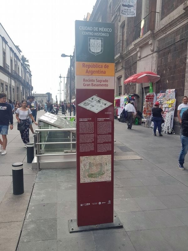
1. Archaeological Remains at Republica de Argentina Street Marker
This view of the northernmost marker is towards the south. A copy of the marker is a few meters to the south, on the opposite side of the windows which allow views down into the remains of the great Aztec pyramids.
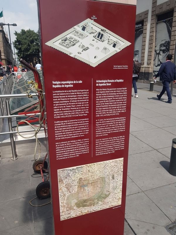
Vestigios arqueológicos de la calle República de Argentina
La rehabilitación de la calle República de Argentina por parte del Gobierno de la Ciudad de México permitió al Instituto Nacional de Antropologia e Historia (INAH), a través del Programa de Arqueología Urbana, descubrir vestigios arqueológicos. El hallazgo más destacado fue un gran basamento de 40 metros de largo que se ubicaba al norte del Templo Mayor y dentro del recinto sagrado de Tenochtitlan. Presenta por lo menos cinco ampliaciones constructivas, que coinciden con las etapas IVa (1440-1469), IVb (1469-1481), V (1481-1486), VI (1486-1502) y Vll (1502-1521) del Templo Mayor.
El edificio que mejor se conservó fue el correspondiente a la etapa IVb, de 33 metros de largo, formado por muros de rocas volcánicas y lajas incrustadas horizontalmente. Por el lado oeste presenta una gran escalinata con alfardas de 3.40 metros de ancho. Se puede identificar un basamento más temprano, correspondiente a la etapa IVa, mientras que las etapas siguientes apenas se aprecian por restos de pisos y desplantes de muros.
Ante la relevancia del hallazgo, el INAH, el Gobierno de la Ciudad de México y la empresa Mucar unieron esfuerzos con el fin de preserva, habilitar y mostrar al público este Gran Basamento que ha contribuido al conocimiento del recinto sagrado de los tenochcas. De esta manera, se enaltecen nuestras raíces y la magnificencia del Centro Histórico, declarado Patrimonio Cultural de la Humanidad por la Unesco en 1987.
Pie de dibujos: Recinto Sagrado de Tenochtitlán (Luis Rosey, actualizado del plano de Marquina)
Mapa de Uppsala (1555)
Archaeological Remains at Republica de Argentina Street
When the Mexico City government revamped República de Argentina Street in the city's Historic Centre, the National Institute for Archaeology and History (INAH) was able to find archaeological remains as part of its Urban Archaeology Program. The most notable finding was a grand 40-meter foundation located at the north section of the Templo Mayor inside the larger sacred shrine of Tenochtitlan. This basement underwent at least five major expansions that coincide with the temple’s principal construction stages over an 80-year period: IVa (1440-1469); IVb (1469-1481); V (1481-1486); VI (1486-1502), and finally, VII (1502-1521).
At 33 meters, the best-preserved building belongs to stage IVb, which is made of volcanic rock and embedded flagstones placed horizontally.
The west side features a long staircase with 3.40-meter-wide ridges. Earlier foundations belonging to stage IVa have also been identified, while later expansion stages are only barely
noticeable, mostly through the remainders of floors as well as wall removals.
Given the importance of this finding, the INAH, the Mexico City government, and the firm Mucar, all joined their efforts to continue to preserve, restore, and display this Great Basement to the general public, which has broadened our knowledge of Tenochtitlan's holiest shrine. As such, Mexico's heritage is celebrated through the greatness of its Historic Centre, which was named Unesco World Heritage Site in 1987.
English translation of captions: The Sacred Area of Tenochtitlán (Luis Rosey, updated from the plan by Marquina)
The Uppsala Map (1555)
Erected by Ciudad de México.
Topics. This historical marker is listed in these topic lists: Anthropology & Archaeology • Architecture • Native Americans. A significant historical year for this entry is 1987.
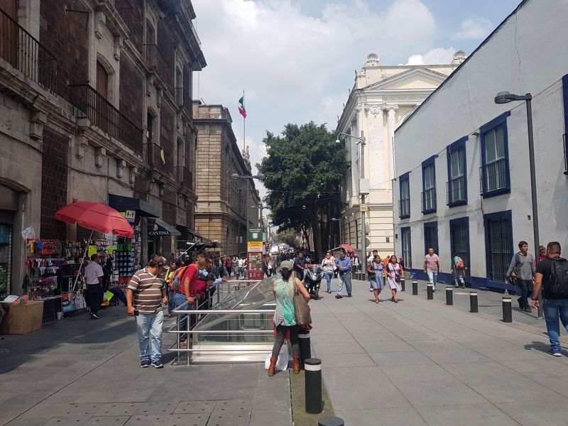
Location. 19° 26.185′ N, 99° 7.898′ W. Marker is in Ciudad de México. It is in Centro Histórico. Marker is on República de Argentina just north of Justo Sierra, in the median. República de Argentina is pedestrian-only on this block north of Justo Sierra.
Touch for map. Marker is in this post office area: Ciudad de México 06000, Mexico. Touch for directions.
Other nearby markers. At least 8 other markers are within walking distance of this marker. The Former School of Jurisprudence (within shouting distance of this marker); Temple of Santa Catalina de Siena (within shouting distance of this marker); House of Luis de Castilla (within shouting distance of this marker); a different marker also named Temple of Santa Catalina de Siena (within shouting distance of this marker); The Seminary of San Ildefonso (about 90 meters away, measured in a direct line); Temple of Our Lady of the Pillar (about 90 meters away); Former College of San Ildefonso (about 120 meters away); Juan de Dios Peza (about 120 meters away). Touch for a list and map of all markers in Ciudad de México.

Photographed By J. Makali Bruton, October 12, 2018
4. Archaeological Remains at Republica de Argentina Street
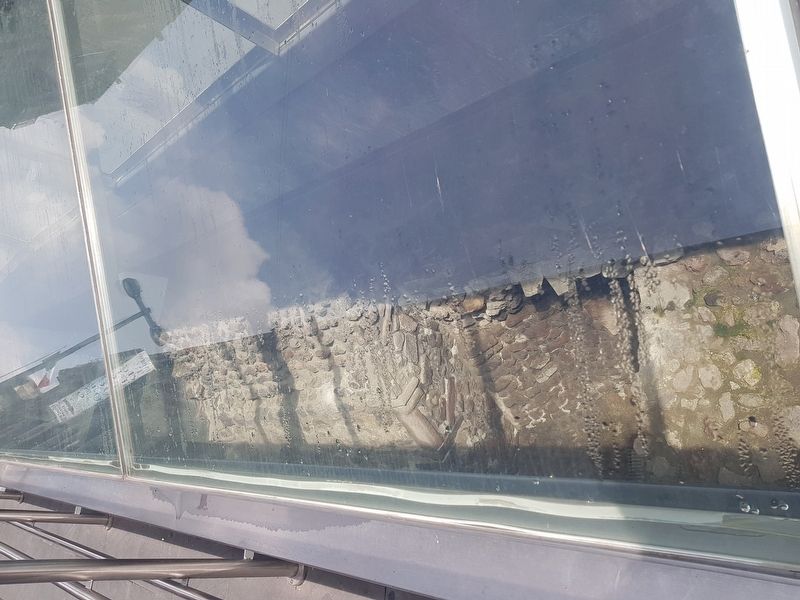
The remains are somewhat difficult to photograph as they are some meters below the street surface and under reflective glass. Regardless, it is amazing to realize and actually see that modern Mexico City is built on top of the remains of the Aztec capital of Tenochtitlán.
Credits. This page was last revised on October 4, 2022. It was originally submitted on October 31, 2018, by J. Makali Bruton of Accra, Ghana. This page has been viewed 174 times since then and 14 times this year. Photos: 1, 2, 3, 4. submitted on October 31, 2018, by J. Makali Bruton of Accra, Ghana.

