Edgefield in Edgefield County, South Carolina — The American South (South Atlantic)
Edgefield County
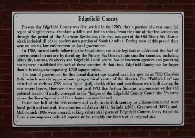
Present-day Edgefield County was first settled in the 1750's, then a portion of a vast unsettled region of virgin forests, abundant wildlife and Indian tribes. From the time of the first settlements through the period of the American Revolution, this area was part of the Old Ninety Six District which included all of the northwestern portion of South Carolina. During most of this period there were no courts, law enforcement or local government.
In 1785, immediately following the Revolution, the state legislature addressed the lack of governmental structure by dividing the Ninety Six District into smaller counties, including Abbeville, Laurens, Newberry and Edgefield. At that time, Edgefield County was far larger than it is today, encompassing 1,720 square miles.
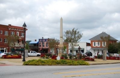
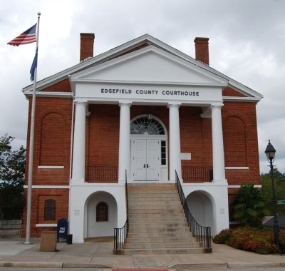
The seat of government for this broad district was located near this spot on an "Old Cherokee Path" which was the approximate geographic center of the district. The "Publik Lot" was identified as early as 1785, and a "gaol" (jail), clerk's office and courthouse were built during the next several years. However, it was not until 1792 that Arthur Simkins, a prominent settler and political leader, officially conveyed to the "Judges of Edgefield County Court" the 2 1/4 acres where the Town Square and Courthouse are now located.
In the last half of the 19th century and early in the 20th century, as citizens demanded more local political control, the counties of Aiken (1871), Saluda (1895), Greenwood (1897), and McCormick (1916) were created, taking substantial parts of Edgefield County. Today, Edgefield County encompasses only 481 square miles, roughly one-forth of its original size.
Topics. This historical marker is listed in these topic lists: Colonial Era • Settlements & Settlers. A significant historical year for this entry is 1785.
Location. 33° 47.383′ N, 81° 55.8′ W. Marker is in Edgefield, South Carolina, in Edgefield County. Marker is on Jeter Street, on the right when traveling west. Marker is located in the greenspace in the northwest corner of the intersection of Jeter and Bumcombe Streets. Touch for map. Marker is in this post office area: Edgefield SC 29824, United States of America. Touch for directions.
Other nearby markers. At least 10 other markers are within walking distance of this marker. A History of Violence (within shouting distance of this marker); Political Heritage (within shouting distance of this marker); The Name "Edgefield" (within shouting distance of this marker); Agricultural History (within shouting distance of this marker); First Term of Court (within shouting distance of this marker); Edgefield County World War I Memorial (within shouting distance of this marker); Industrial History
(within shouting distance of this marker); Religion & Education (within shouting distance of this marker); Welcome to Historic Edgefield (within shouting distance of this marker); Governors and Lieutenant Governors from Edgefield (within shouting distance of this marker). Touch for a list and map of all markers in Edgefield.
Also see . . .
1. Edgefield County Government. Official website of the Edgefield County Government. (Submitted on October 16, 2008, by Brian Scott of Anderson, South Carolina.)
2. Edgefield County, South Carolina. Edgefield County is a county located in the U.S. state of South Carolina. (Submitted on October 16, 2008, by Brian Scott of Anderson, South Carolina.)
Credits. This page was last revised on November 15, 2020. It was originally submitted on October 16, 2008, by Brian Scott of Anderson, South Carolina. This page has been viewed 1,301 times since then and 13 times this year. Photos: 1, 2. submitted on October 16, 2008, by Brian Scott of Anderson, South Carolina. 3. submitted on November 29, 2009, by Brian Scott of Anderson, South Carolina. 4, 5, 6. submitted on October 16, 2008, by Brian Scott of Anderson, South Carolina.


