Shoreacres near La Porte in Harris County, Texas — The American South (West South Central)
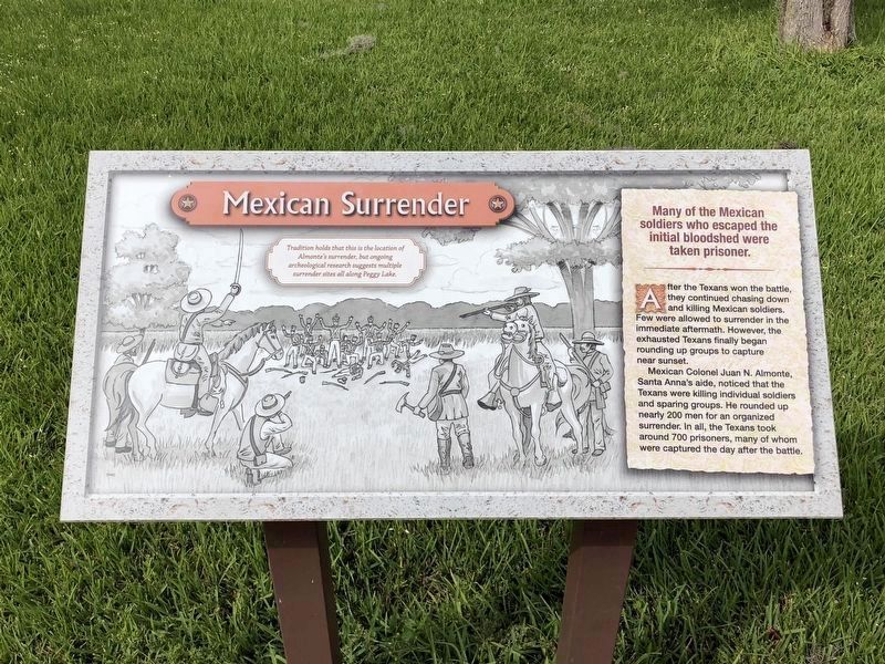
Mexican Surrender
After the Texans won the battle, they continued chasing down and killing Mexican soldiers. Few were allowed to surrender in the immediate aftermath. However, the exhausted Texans finally began rounding up groups to capture near sunset.
Mexican Colonel Juan N. Almonte, Santa Anna's aide, noticed that the Texans were killing individual soldiers and sparing groups. He rounded up nearly 200 men for an organized surrender. In all, the Texans took around 700 prisoners, many of whom were captured the day after the battle.
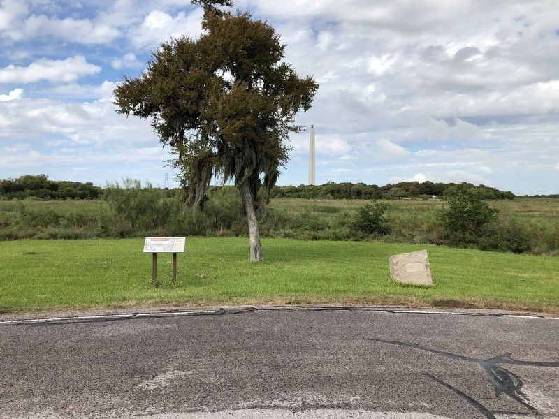
Tradition holds that this is the location of Almonte's surrender, but ongoing archaeological research suggests multiple surrender sites all along Peggy Lake.
Topics. This historical marker is listed in this topic list: War, Texas Independence. A significant historical date for this entry is April 21, 1836.
Location. 29° 44.558′ N, 95° 4.391′ W. Marker is near La Porte, Texas, in Harris County. It is in Shoreacres. Marker is on Park Road 1836 North, 0.9 miles east of Vista Road, on the left when traveling north. Marker is located within the San Jacinto Battleground State Historic Site. Touch for map. Marker is at or near this postal address: 3523 Independence Parkway, La Porte TX 77571, United States of America. Touch for directions.
Other nearby markers. At least 8 other markers are within walking distance of this marker. Almonte Captured (here, next to this marker); Mexican Breastworks (approx. 0.4 miles away); Santa Anna's Camp (approx. 0.4 miles away); Mexican Cannon (approx. 0.4 miles away); a different marker also named Mexican Breastworks (approx. 0.4 miles away); Houston Wounded (approx. half a mile away); Mexican Position (approx. 0.7 miles away); San Jacinto Monument (approx. 0.7 miles away). Touch for a list and map of all markers in La Porte.
Also see . . .
1. San Jacinto, Battle of - The Handbook of Texas Online. Texas State Historical Association (TSHA) (Submitted on November 6, 2018, by Brian Anderson of Humble, Texas.)
2. Almonte, Juan Nepomuceno - The Handbook of Texas Online. Texas State Historical Association (TSHA) (Submitted on November 6, 2018, by Brian Anderson of Humble, Texas.)
Credits. This page was last revised on February 1, 2023. It was originally submitted on November 6, 2018, by Brian Anderson of Humble, Texas. This page has been viewed 272 times since then and 19 times this year. Photos: 1, 2, 3. submitted on November 6, 2018, by Brian Anderson of Humble, Texas. • Bernard Fisher was the editor who published this page.


