Hexham in Northumberland, England, United Kingdom — Northwestern Europe (the British Isles)
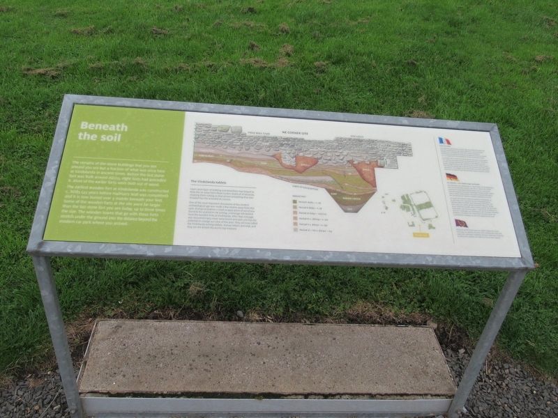
Beneath the soil
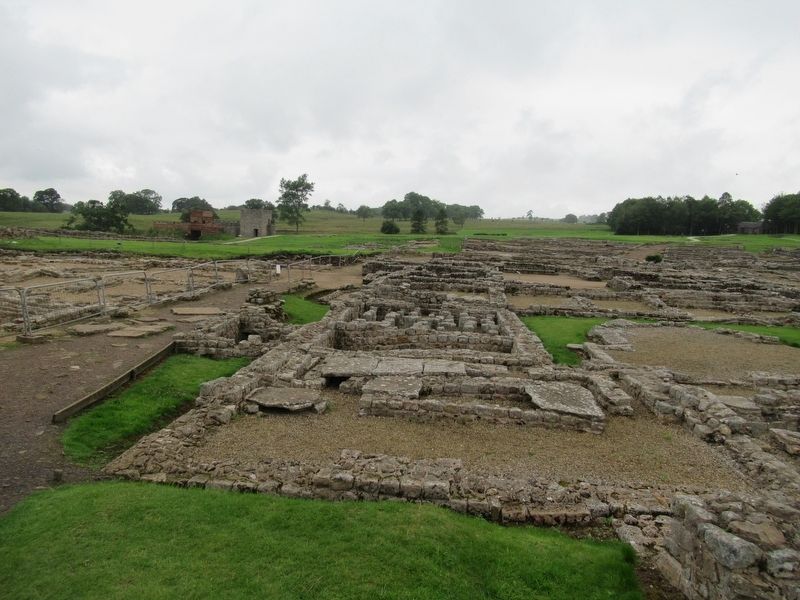
The remains of the stone buildings that you see around you are but a fraction of what was once here at Vindolanda in ancient times. Before the last stone fort was built around AD213, eight forts had preceded it. Most of the earlier forts were built out of wood. The earliest wooden fort at Vindolanda was constructed C. AD85 (43 years before Hadrian's Wall was completed) and it is now buried over 5 metres beneath your feet Some of the wooden forts at the site were far larger than the last stone fort you see today, up to three times the size. The wooden towns that go with these forts stretch under the ground into the distance beyond the modern car park where you arrived.
The Vindolanda tablets
Layer upon layer of building and demolition has helped to keep the air away from those sunken levels of Vindolanda, stopping them rotting so that almost everything that was dropped has the potential to survive.
One of the most important discoveries of the modern archaeological age was made a few metres away from this spot. During excavation a small scrappy piece of wood was found to be covered in ink writing, a message left behind from the wooden forts at Vindolanda. After that message was recovered many more were found and each one has the potential to change our view of the past. They are now called the Vindolanda writing tablets, Roman letters and mail, and they are the British Museum's top treasure.
Topics. This historical marker is listed in these topic lists: Forts and Castles • Settlements & Settlers.
Location. 54° 59.471′ N, 2° 21.69′ W. Marker is in Hexham, England, in Northumberland. Marker can be reached from road 68, 4 kilometers north of England Route A69, on the left when traveling north. Located at Vindolanda Roman fort and village archaeological site. Touch for map. Marker is in this post office area: Hexham, England NE47 7JN, United Kingdom. Touch for directions.
Other nearby markers. At least 8 other markers are within walking distance of this marker. North West Quadrant Barracks (here, next to this marker); The Severan fort (a few steps from this marker); A military community (within shouting distance of this marker); Severan Circular Huts (within shouting distance of this marker); The heart of the fort (within shouting distance of this marker); The village and fort (within shouting distance of this marker); Workshops (about 90 meters away, measured in a direct line); Dolichenum (about 120 meters away). Touch for a list and map of all markers in Hexham.
Also see . . . Vindolanda on Wikipedia. (Submitted on November 15, 2018, by Michael Herrick of Southbury, Connecticut.)
Credits. This page was last revised on January 27, 2022. It was originally submitted on November 15, 2018, by Michael Herrick of Southbury, Connecticut. This page has been viewed 55 times since then and 4 times this year. Photos: 1, 2. submitted on November 15, 2018, by Michael Herrick of Southbury, Connecticut.

