Hexham in Northumberland, England, United Kingdom — Northwestern Europe (the British Isles)
A Changing Fort
A Changing Fort
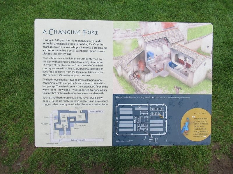
During its 280-year life, many changes were made in the fort, no more so than to building XV. Over the years, it served as a workshop, a barracks, a stable, and a storehouse before a small bathhouse (balneae) was placed at its eastern end.
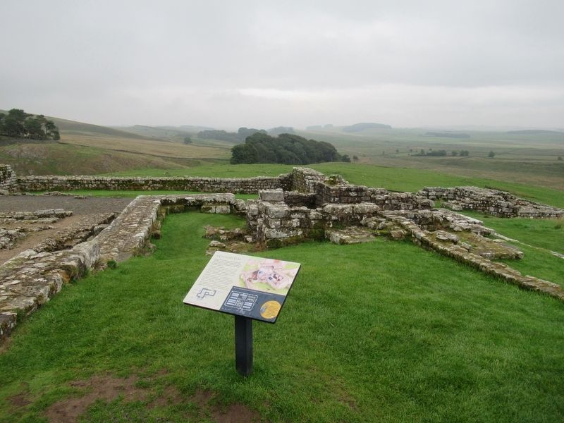
The bathhouse was built in the fourth century AD over the demolished end of a long, two-storey storehouse. The walls of the storehouse, from the end of the third century AD, are still visible. Its purpose was possibly to keep food collected from the local population as a tax (the annona militaris) to support the army.
The bathhouse had just two rooms; a changing room containing a cold plunge bath, and a warm room with a hot plunge. The raised cement (opus signinum) floor of the warm room - now gone- was supported on stone pillars to allow hot air from a furnace to circulate underneath.
Such a small bathhouse could only have served a few people. Baths are rarely found inside forts and its presence suggests that security outside had become a serious issue.
Felix says …
The walls in front of you are part of a small bathhouse. We like a nice scrub, but most of us go outside to a bigger bathhouse in the vicus.
( photo caption )
Above: The bathhouse, as it may have looked about AD 370. Reconstruction by Peter Urmston
Topics. This historical marker is listed in these topic lists: Forts and Castles • Settlements & Settlers.
Location. 55° 0.814′ N, 2° 19.754′ W. Marker is in Hexham, England, in Northumberland. Marker can be reached from England Route B6319, 4.7 kilometers west of North Road, on the right when traveling west. Located at Housesteads Roman Fort. Touch for map. Marker is in this post office area: Hexham, England NE47 6NW, United Kingdom. Touch for directions.
Other nearby markers. At least 8 other markers are within walking distance of this marker. Barracks: the Last Hundred Years at Housesteads (within shouting distance of this marker); Where the Soldiers Lived (within shouting distance of this marker); The Fort Food Supply (within shouting distance of this marker); The Comanding Officer and his House (within shouting distance of this marker); The North Gate (within shouting distance of this marker); The Heart of the Fort (within shouting distance of this marker); 16th Century Bastle House (within shouting distance of this marker); The Fort and its Design (within shouting distance of this marker). Touch for a list and map of all markers in Hexham.
Also see . . .
1. English Heritage - Housesteads Roman Fort. (Submitted on November 17, 2018, by Michael Herrick of Southbury, Connecticut.)
2. Housesteads Roman Fort on Wikipedia. (Submitted on November 17, 2018, by Michael Herrick of Southbury, Connecticut.)
Credits. This page was last revised on January 27, 2022. It was originally submitted on November 17, 2018, by Michael Herrick of Southbury, Connecticut. This page has been viewed 81 times since then and 7 times this year. Photos: 1, 2. submitted on November 17, 2018, by Michael Herrick of Southbury, Connecticut.

