Ely in White Pine County, Nevada — The American Mountains (Southwest)
The Liberty Pit
Robinson Mining District
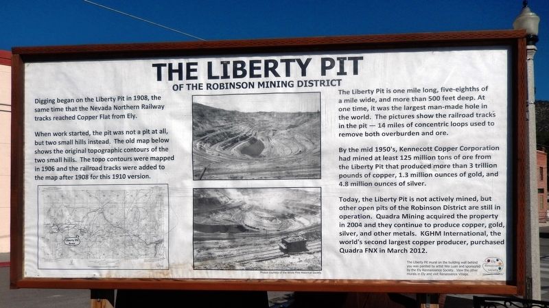
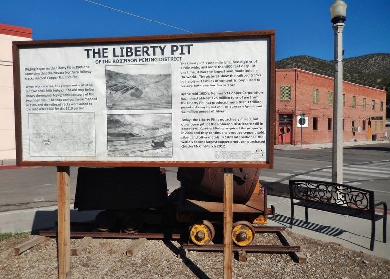
Digging began on the Liberty Pit in 1908, the same time that the Nevada Northern Railway tracks reached Copper Flat from Ely.
When work started, the pit was not a pit at all, but two small hills instead. The old map below shows the original topographic contours of the two small hills. The topo contours were mapped in 1906 and the railroad tracks were added to the map after 1908 for this 1910 version.
The Liberty Pit is one mile long, five-eighths of a mile wide, and more than 500 feet deep. At one time, it was the largest man-made hole in the world. The pictures show the railroad tracks in the pit — 14 miles of concentric loops used to remove both overburden and ore.
By the mid 1950's, Kennecott Copper Corporation had mined at least 125 million tons of ore from the Liberty Pit that produced more than 3 trillion pounds of copper, 1.3 million ounces of gold, and 4.8 million ounces of silver.
Today, the Liberty Pit is not actively mined, but other open pits of the Robinson District are still in operation. Quadra Mining acquired the property in 2004 and they continue to produce copper, gold, silver, and other metals. KGHM International, the world's second largest copper producer, purchased Quadra FNX in March 2012.
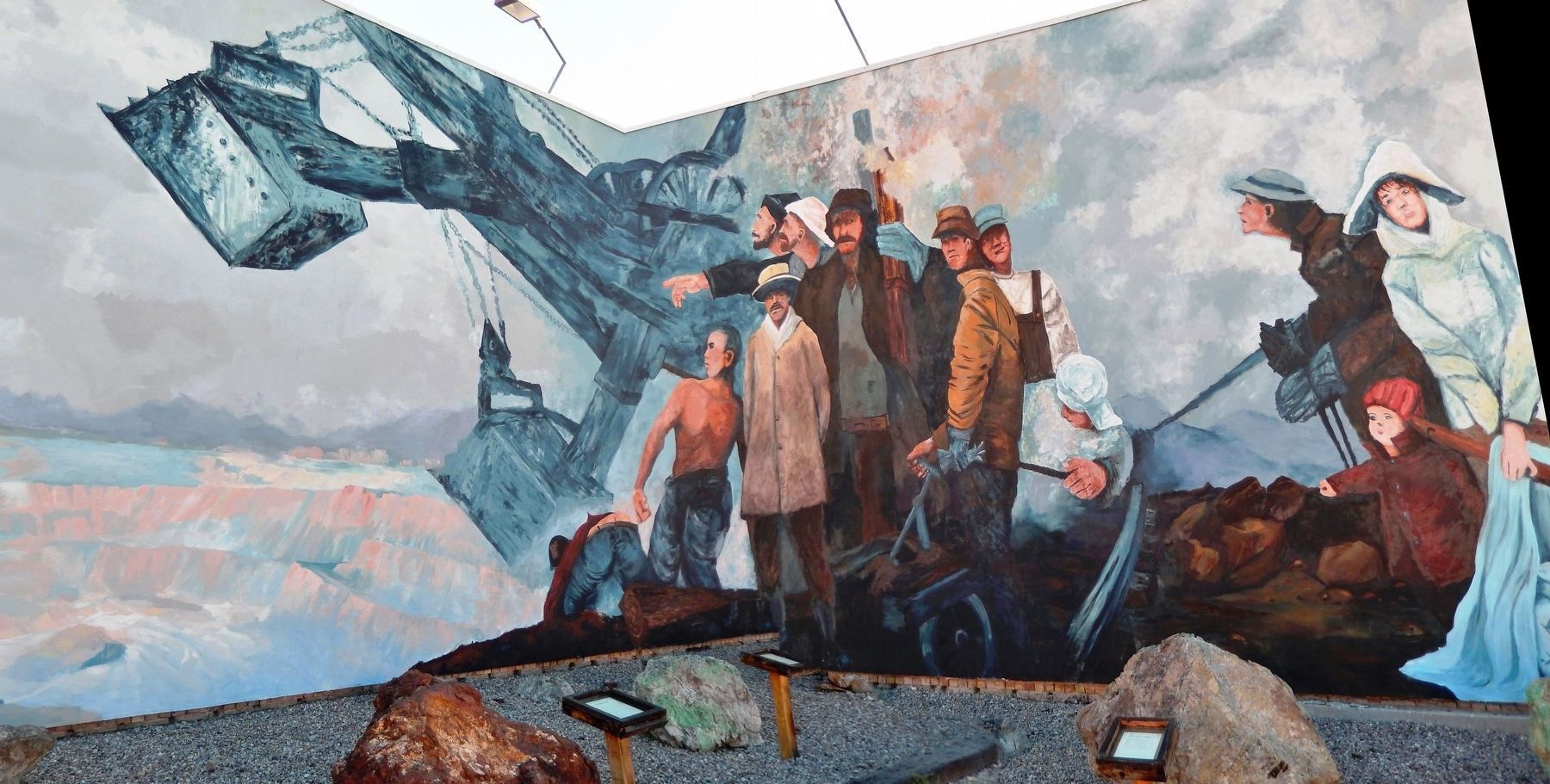
The Liberty Pit mural on the building wall behind you was painted by artist Wei Luan and sponsored by the Ely Renaissance Society. View the other murals in Ely and visit Renaissance Village.
Erected by Ely Renaissance Society.
Topics. This historical marker is listed in these topic lists: Industry & Commerce • Natural Resources • Notable Places • Railroads & Streetcars. A significant historical year for this entry is 1908.
Location. 39° 14.866′ N, 114° 53.631′ W. Marker is in Ely, Nevada, in White Pine County. Marker is at the intersection of East Aultman Street (Lincoln Highway) (U.S. 50) and 4th Street, on the right when traveling east on East Aultman Street (Lincoln Highway). Marker is located at the southeast corner of the intersection. Touch for map. Marker is in this post office area: Ely NV 89301, United States of America. Touch for directions.
Other nearby markers. At least 8 other markers are within 14 miles of this marker, measured as the crow flies. U.S. Post Office Ely, Nevada - 1937 (about 300 feet away, measured in a direct line); Ely - Forging the Link (about 800 feet away); Nevada Northern Railway (approx. 0.9 miles away); Jedediah Strong Smith (approx. 4.3 miles away); Copper Country (approx. 4˝ miles away); The Ward Cemetery (approx. 12.1 miles away); Ward Mining District (approx. 13.3 miles away); Taylor (approx. 13.3 miles away). Touch for a list and map of all markers in Ely.
More about this marker. This is a large "billboard-style" historical marker, consisting of a large glass-covered poster mounted inside a heavy wooden frame.
Also see . . . "Ruth: Old mining town now swallowed up by pit mine". Lahotan Valley News article, Tuesday, December 21, 2004:
While Ruth’s mines were originally conventional underground tunnels, they were expanded to more cost-effective open-pit operations after 1907, when steam shovels were introduced to strip away more of the ground. By 1912, when the town’s most famous native daughter was born, Thelma Catherine Patricia Ryan (Former First Lady “Pat” Nixon), Ruth already boasted one of the state’s largest open pit mines. In the late 1950s, Kennecott gained control of virtually all the area’s mines. The company immediately began an aggressive expansion of the largest mine in the region, the Liberty Pit. As a result, old Ruth was swallowed up and is now part of an open-pit mine. At the time, a handful of the old structures were moved to the new town site but most of Ruth was bulldozed (including, it is believed, the actual site of the cabin or house where Pat Nixon was born). (Submitted on November 20, 2018, by Cosmos Mariner of Cape Canaveral, Florida.)
Photographed By Cosmos Mariner, July 30, 2014
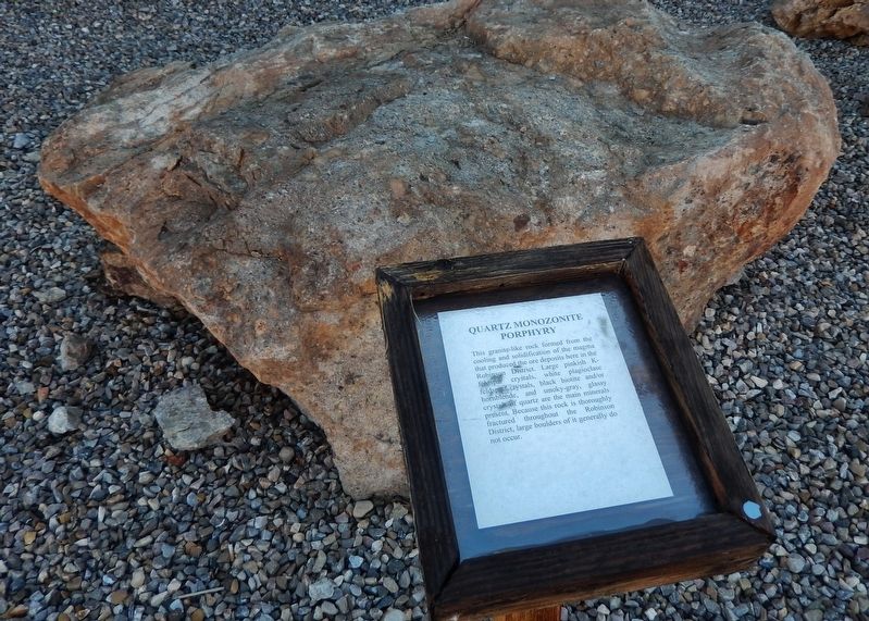
4. The Liberty Pit Exhibit (across parking lot from marker): Quartz
This granite-like rock formed from the cooling and solidification of the magma that produced he ore deposits here in the Robinson District. Large pinkish K-feldspar crystals, white plagioclase feldspar crystals, black biotite and/or hornblende, and smoky-gray, glassy crystals of quartz are the main minerals present. Because this rock is thoroughly fractured throughout the Robinson District, large boulders of it generally do not occur.
Photographed By Cosmos Mariner, July 30, 2014
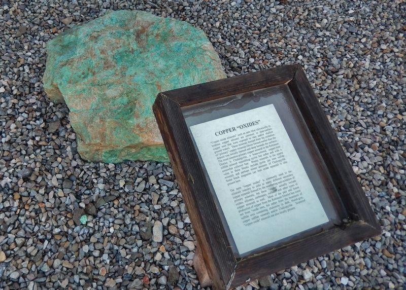
5. The Liberty Pit Exhibit (across parking lot from marker): Copper
“Copper oxide minerals” such as pale blue chrysocolla (a hydrous copper silicate) are common in near surface copper ores that were exposed to rain and/or shallow ground waters. These minerals formed from the oxidation of “primary” copper minerals (those formed earlier than the deposit was initially formed and deep beneath the surface). The most common primary copper mineral in the Robinson District is Chalcopyrite, a brass-colored, copper-iron sulfide mineral resembling pyrite but softer and with a somewhat yellower hue. Brassy minerals in the quartz veins in these blocks include pyrite (an iron sulfide mineral) and perhaps minor amounts of Chalcopyrite. Some black magnetite (an iron oxide mineral) is also present here.
The term “copper oxides” is commonly used in the minerals industry to refer to many different secondary copper minerals formed by the weathering and oxidation of primary minerals, but these “oxides” actually include oxides, silicates, carbonates, sulfates and other types of copper minerals as well. Most of the past and future production of copper from the Robinson District has come not from “oxide” ores, but rather from the treatment of sulfide ores containing chalcocite (a dark, bluish-gray, copper sulfide mineral) and/or Chalcopyrite. Scattered “copper oxide” minerals are also locally present.
The term “copper oxides” is commonly used in the minerals industry to refer to many different secondary copper minerals formed by the weathering and oxidation of primary minerals, but these “oxides” actually include oxides, silicates, carbonates, sulfates and other types of copper minerals as well. Most of the past and future production of copper from the Robinson District has come not from “oxide” ores, but rather from the treatment of sulfide ores containing chalcocite (a dark, bluish-gray, copper sulfide mineral) and/or Chalcopyrite. Scattered “copper oxide” minerals are also locally present.
Photographed By Cosmos Mariner, July 30, 2014
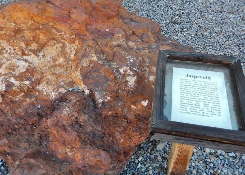
6. The Liberty Pit Exhibit (across parking lot from marker): Jasperoid
Jasperoid is the name given to hard, rusty-brown, red, or orange-yellow colored rock composed mostly of very fine-grained quartz stained by iron-oxide minerals such as hermatite or limonite. Jasperoid is one of the many types of rock formed in the Robinson District by hydrothermal alteration of original rocks such as limestone. This alteration process is a large scale chemical reaction between these original rocks and the later hot, silica and metal bearing hydrothermal fluids. Other types of “altered” limestone in the Robinson District include skarn, marble, and silicified limestone, all of which are represented in the boulders here.
Photographed By Cosmos Mariner, July 30, 2014
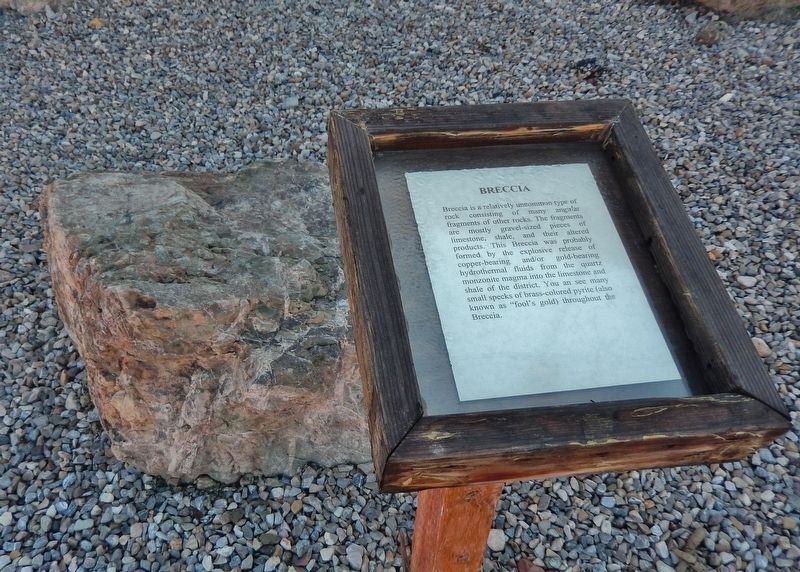
7. The Liberty Pit Exhibit (across parking lot from marker): Breccia
Breccia is a relatively uncommon type of rock consisting of many angular fragments of other rocks. The fragments are mostly gravel-sized pieces of limestone, shale, and their altered products. This Breccia was probably formed by the explosive release of copper-bearing and/or gold-bearing hydrothermal fluids from the quartz monzonite magma into the limestone and shale of the district. You can see many small specks of brass-colored pyrite (also known as “fool's gold”) throughout the Breccia.
Photographed By Cosmos Mariner, July 30, 2014
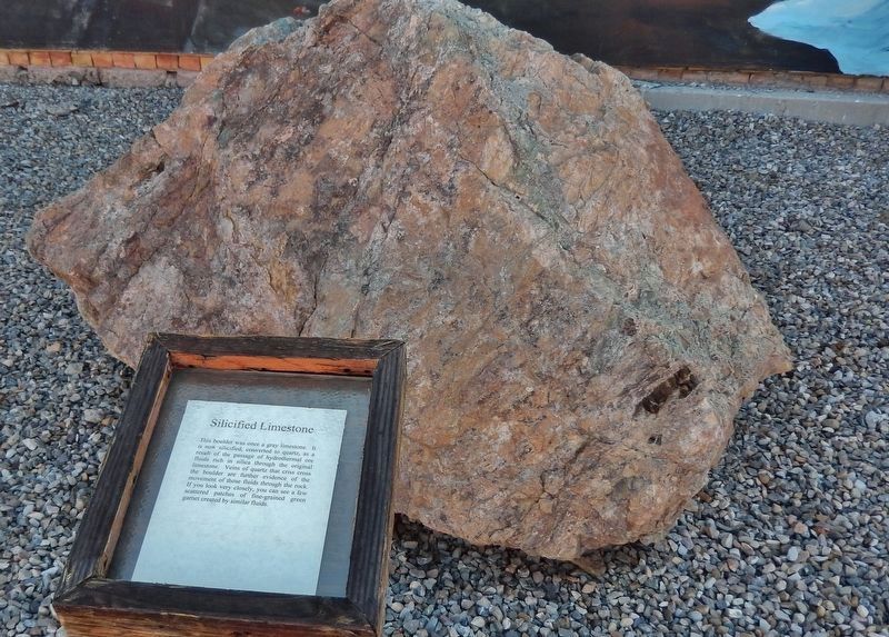
8. The Liberty Pit Exhibit (across parking lot from marker): Silicified Limestone
This boulder was once a gray limestone. It is now silicified, converted to quartz, as a result of the passage of hydrothermal ore fluids rich in silica through the original limestone. Veins of quartz that criss-cross the boulder are further evidence of the movement of those fluids through the rock. If you look very closely, you can see a few scattered patches of fine-grained green garnet created by similar fluids.
Photographed By Cosmos Mariner, July 30, 2014
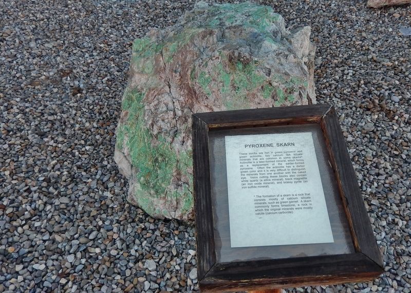
9. The Liberty Pit Exhibit (across parking lot from marker): Pyroxene Skarn
These blocks are rich in green pyroxene and green actinolite, two calcium rich silicate minerals that are common in some skarns. Actinolite is a later-formed mineral, which forms as a replacement of the earlier-formed pyroxene. Often the actinolite has a darker green color and it is very difficult to distinguish the minerals from one another with the naked eye. Veins cutting these blocks also contain white quartz (a silica mineral), black magnetite (an iron oxide mineral), and brassy pyrite (an iron sulfide mineral).
Credits. This page was last revised on February 13, 2021. It was originally submitted on November 18, 2018, by Cosmos Mariner of Cape Canaveral, Florida. This page has been viewed 341 times since then and 47 times this year. Photos: 1, 2, 3, 4, 5, 6. submitted on November 20, 2018, by Cosmos Mariner of Cape Canaveral, Florida. 7, 8, 9. submitted on December 27, 2018, by Cosmos Mariner of Cape Canaveral, Florida. • Syd Whittle was the editor who published this page.
