Newcastle upon Tyne in Tyne and Wear, England, United Kingdom — Northwestern Europe (the British Isles)
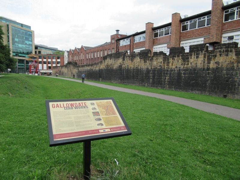
Gallowgate Lead Works
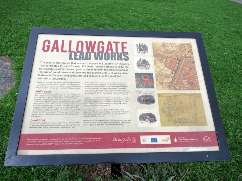
Established in the late 18th century, the lead works was one of various commercial premises in the area. The 1863 ordnance survey shows timber yards and tanneries close by, together with a large slaughter house complex at the end of Dispensary Lane.
White Lead
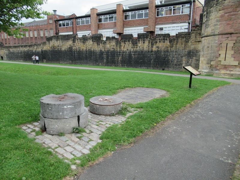
The white lead trade made pigments for the paint industry, and their production involved a process that changed very little since its introduction in the late 1780s. This was the Dutch Stack method of corroding sheets of lead by placing them upon a bed of earthenware pots containing concentrated acetic acid, one stack of pots and lead upon another. Insulated by leather or wood bark, the acid evaporated and turned the lead into a blue paste. This lead paste was then dried in large ovens to create a dry white carbonate that could be ground into a fine powder for mixing with oil to form the finished pigment. The heavy granite mill-stones found on the site when it was landscaped in 2006, were used in this process.
Lead Shot
Another product of the lead works was lead shot. This was made by pouring molten lead through colanders and allowing the sieved lead to fall down a 200 ft shaft where it cooled in water and formed the spherical lead shot used by artillery and shot-guns. A description of the Gallowgate site, published in the Penny Magazine in August 1844 tells us that "when two tons weight of shot have thus fallen into the pit, operations are temporarily suspended; the aperture of the pit is opened, a man is lowered to the bottom, and he sends up all the shot from the water into which they had fallen". The site of this shaft is marked on the ground.
Lead shot was made from a mixture of lead and arsenic, and the Penny Magazine published a drawing of a man ladling the molten mixture from a furnace pot into the top of the colander or sieve. Other drawings illustrate the white lead process and a female worker separating finished lead shot.
The lead trade was an important industry in 19th century Newcastle. This site was owned by the Locke Blackett Company. Other sites of former white lead works are in the Ouseburn, Elswick, and Walker Riverside.
The plan of the site dates from July 1930, not long before the lead works was closed. it shows the location of the
Shot House at the south east corner of the site, near to the Mordon Tower.
This panel was produced by Newcastle City Council with financial assistance from the Heritage Lottery Fund. We are grateful to Tyne & Wear Archives for permission to reproduce the Penny Magazine drawings (TWAS 1512/11923) and the plan (TWAS 1512/9569).
Topics. This historical marker is listed in this topic list: Industry & Commerce. A significant historical month for this entry is July 1930.
Location. 54° 58.357′ N, 1° 37.234′ W. Marker is in Newcastle upon Tyne, England, in Tyne and Wear. Marker can be reached from the intersection of Bath Lane and Stowell Street, on the left when traveling south. Touch for map. Marker is in this post office area: Newcastle upon Tyne, England NE1 4XQ, United Kingdom. Touch for directions.
Other nearby markers. At least 8 other markers are within walking distance of this marker. Ever Tower (about 90 meters away, measured in a direct line); The Town Wall (about 90 meters away); West Walls (about 90 meters away); Bath Lane (about 120 meters away); 28 Clayton Street West (approx. 0.4 kilometers away); Thomas Bewick (approx. 0.4 kilometers away); 36 Clayton Street West (approx. 0.4 kilometers away); Basil Hume Memorial Garden (approx. 0.4 kilometers away). Touch for a list and map of all markers in Newcastle upon Tyne.
Credits. This page was last revised on January 27, 2022. It was originally submitted on November 20, 2018, by Michael Herrick of Southbury, Connecticut. This page has been viewed 299 times since then and 40 times this year. Photos: 1, 2, 3. submitted on November 20, 2018, by Michael Herrick of Southbury, Connecticut.


