Terra Ceia in Manatee County, Florida — The American South (South Atlantic)
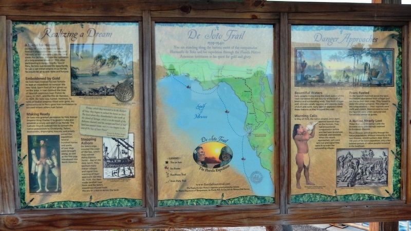
Realizing a Dream
Florida De Soto Trail
— May 29, 1539 —
A Name for Himself
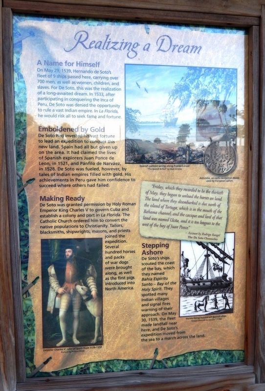
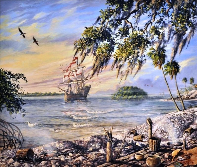
On May 29, 1539, Hernando de Soto’s fleet of 9 ships passed here, carrying over 700 men, as well as women, children, and slaves. For De Soto, this was the realization of a long-awaited dream. In 1533, after participating in conquering the Inca of Peru, De Soto was denied the opportunity to rule a vast Indian empire. In La Florida, he would risk all to seek fame and fortune.
Emboldened by Gold
De Soto had invested his vast fortune to lead an expedition to conquer this new land. Spain had all but given up on the area. It had claimed the lives of Spanish explorers Juan Ponce de Leon, in 1521, and Pánfilo de Narváez, in 1528. De Soto was fueled, however, by tales of Indian empires filled with gold. His achievements in Peru gave him confidence to succeed where others had failed.
Making Ready
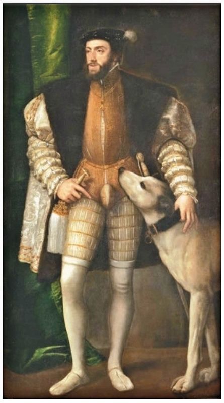
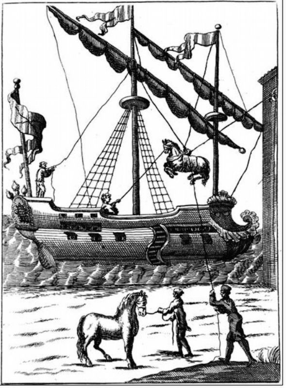
De Soto was granted permission by Holy Roman Emperor King Charles V to govern Cuba and establish a colony and port in La Florida. The Catholic Church ordered him to convert the native populations to Christianity. Tailors, blacksmiths, shipwrights, masons, and priests joined the expedition. Several hundred horses and packs of war dogs were brought along, as well as the first pigs introduced into North America.
Stepping Ashore
De Soto’s ships scouted the coast of the bay, which they named Bahia Espiritu Santo – Bay of the Holy Spirit. They spotted many Indian villages and signal fires warning of their approach. On May 30, 1539, the fleet made landfall near here, and De Soto’s expedition moved from the sea to march across the land.
”Friday, which they recorded to be the thirtieth of May, they began to unload the horses on land. The land where they disembarked is due north of the island of Tortuga, which is in the mouth of the Bahama channel; and the cacique and lord of that land was named Ucita, and it is ten leagues to the west of the bay of Juan Ponce.”
- Account by Rodrigo Rangel
The De Soto Chronicles
Erected by Florida De Soto Trail, Florida Department of Transportation, the Florida Park Service, and the National Park Service. (Marker Number 2a.)
Topics. This historical marker is listed in these topic lists: Colonial Era • Exploration • Native Americans. A significant historical date for this entry is May 29, 1539.
Location. 27° 35.107′ N, 82° 36.903′ W. Marker is in Terra Ceia, Florida, in Manatee County. Marker can be reached from Interstate 275, 2½ miles north of Terra Ceia Road, on the right when traveling north. Marker is located at the Tampa Bay Sunshine
Skyway Bridge South Fishing Pier. This fishing pier & rest stop is accessible from both the northbound and southbound lanes of I-275. The marker is at the northeast corner of the Manatee County Rest Area parking lot, on the east side of I-275. Touch for map. Marker is in this post office area: Terra Ceia FL 34250, United States of America. Touch for directions.
Other nearby markers. At least 8 other markers are within 4 miles of this marker, measured as the crow flies. Danger Approaches (here, next to this marker); Florida Honors and Remembers our POW’s and MIA’s (within shouting distance of this marker); Guerrero Home Site (approx. 1.8 miles away); Madira Bickel Mound State Archaeological Site (approx. 1.9 miles away); Terra Ceia School/Village Improvement Association Hall (approx. 2.2 miles away); Atzeroth Home Site (approx. 2.3 miles away); Franklin C. Armstrong (approx. 2.6 miles away); Veterans of Rubonia (approx. 3.9 miles away). Touch for a list and map of all markers in Terra Ceia.
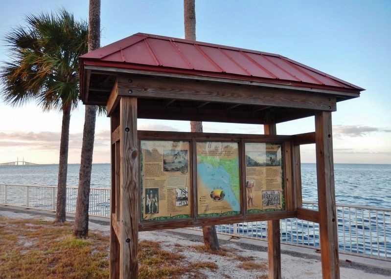
More about this marker. Marker is a large, composite plaque mounted vertically within a heavy-duty wooden kiosk. This marker is the leftmost panel of a three-panel kiosk.
Regarding Realizing a Dream. Hernando de Soto landed at Tampa Bay in 1539 and made his way north in search of gold and riches. A controversial figure in American history, Spanish Conquistador Hernando de Soto is regarded as a hero and brave explorer by
some — and an overzealous madman by others. The De Soto Trail shows him as a product of Medieval Europe, a brutal society forged over 780 years of warfare. It also tells the story of the Native American peoples of 16th-century Florida, a highly advanced collection of chiefdoms struggling against each other to gain dominance over their regions.
Related markers. Click here for a list of markers that are related to this marker. Florida De Soto Trail
Also see . . . De Soto’s Expedition to North America. In 1536, de Soto obtained a royal commission to conquer and settle the region known as La Florida (now the southeastern United States), which had been the site of earlier explorations by Juan Ponce de León and others. De Soto set out from Spain in April 1538, set with 10 ships and 700 men. After a stop in Cuba, the expedition landed at Tampa Bay in May 1539. They moved inland and eventually set up camp for the winter at a small Indian village near present-day Tallahassee. (Submitted on November 4, 2018, by Cosmos Mariner of Cape Canaveral, Florida.)
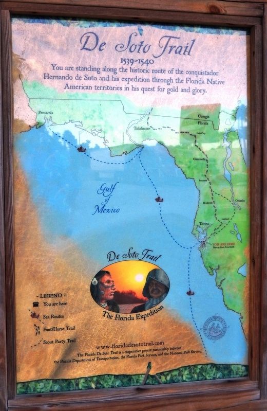
Photographed By Cosmos Mariner, October 31, 2018
5. De Soto Trail Map (panel to the right of marker in kiosk)
1539-1540
Credits. This page was last revised on December 20, 2020. It was originally submitted on October 30, 2018, by Cosmos Mariner of Cape Canaveral, Florida. This page has been viewed 219 times since then and 20 times this year. Last updated on November 21, 2018, by Cosmos Mariner of Cape Canaveral, Florida. Photos: 1. submitted on November 3, 2018, by Cosmos Mariner of Cape Canaveral, Florida. 2, 3. submitted on November 4, 2018, by Cosmos Mariner of Cape Canaveral, Florida. 4. submitted on November 5, 2018, by Cosmos Mariner of Cape Canaveral, Florida. 5, 6, 7. submitted on November 4, 2018, by Cosmos Mariner of Cape Canaveral, Florida. • Bernard Fisher was the editor who published this page.
