Live Oak in Suwannee County, Florida — The American South (South Atlantic)
Plot Exposed
Florida De Soto Trail
— September 15, 1539 —
Hernando de Soto and his army have arrived at the nearby village of Napituca. His interpreter, Juan Ortiz, later recounts –
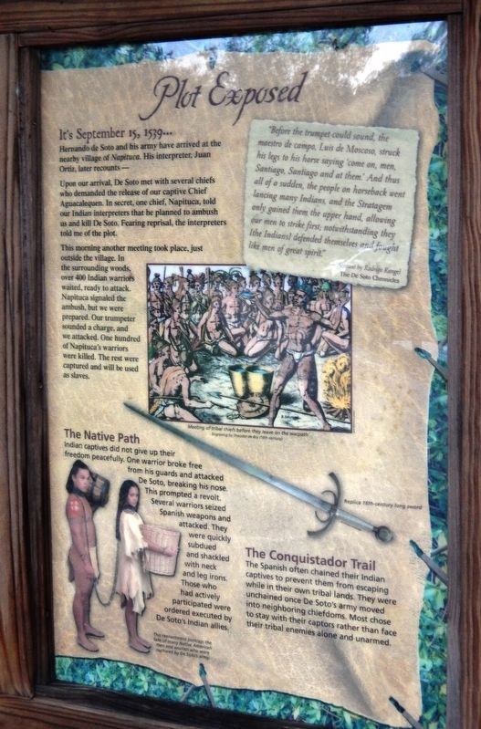
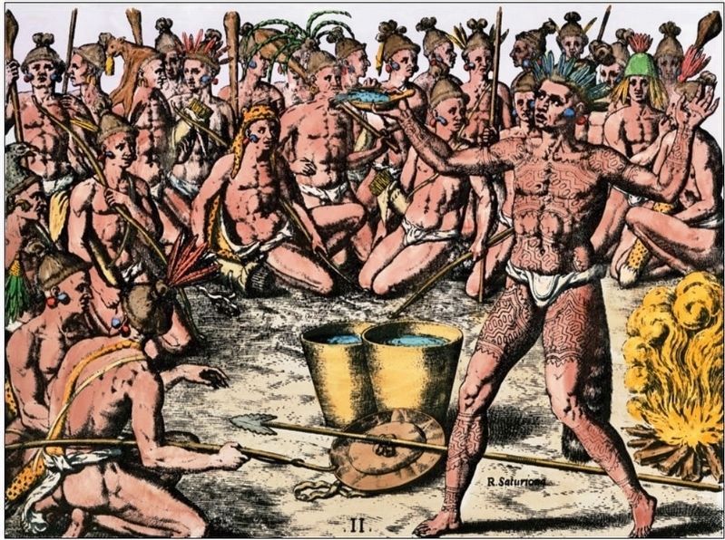
Upon our arrival, De Soto met with several chiefs who demanded the release of our captive Chief Aguacalequen. In secret, one chief, Napituca, told our Indian interpreters that he planned to ambush us and kill De Soto. Fearing reprisal, the interpreters told me of the plot.
This morning another meeting took place, just outside the village. In the surrounding woods, over 400 Indian warriors waited, ready to attack. Napituca signaled the ambush, but we were prepared. Our trumpeter sounded a charge, and we attacked. One hundred of Napituca’s warriors were killed. The rest were captured and will be used as slaves.
”Before the trumpet could sound, the maestro de campo, Luis de Moscoso, struck his legs to his horse saying ‘come on, men, Santiago, Santiago and at them.’ And thus all of a sudden, the people on horseback went lancing many Indians, and the Strategem only gained them the upper hand, allowing our men to strike first; notwithstanding they [the Indians] defended themselves and fought like men of great spirit.”
- Account by Rodrigo Rangel
The De Soto Chronicles
The Native Path
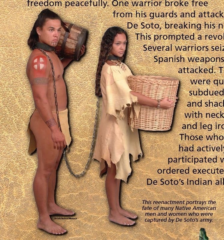
Indian captives did not give up their freedom peacefully. One warrior broke free from his guards and attacked De Soto, breaking his nose. This prompted a revolt. Several warriors seized Spanish weapons and attacked. They were quickly subdued and shackled with neck and leg irons. Those who had actively participated were ordered executed by De Soto’s Indian allies.
The Conquistador Trail
The Spanish often chained their Indian captives to prevent them from escaping while in their own tribal lands. They were unchained once De Soto’s army moved into neighboring chiefdoms. Most chose to stay with their captors rather than face their tribal enemies alone and unarmed.
Erected by Florida De Soto Trail, Florida Department of Transportation, the Florida Park Service, and the National Park Service. (Marker Number 25.)
Topics. This historical marker is listed in these topic lists: Colonial Era • Exploration • Native Americans • Notable Events. A significant historical date for this entry is September 15, 1539.
Location. 30° 16.625′ N, 83° 0.075′ W. Marker is in Live Oak, Florida, in Suwannee County. Marker can be reached from Silas Drive SW, 0.3 miles east of Irvin Avenue NW (State Road 51), on the right when traveling east. Marker is located within the Suwannee County Recreation & Sports
Complex, about 1/10 mile south of Silas Drive, near playground and restrooms on the east side of the complex. Touch for map. Marker is at or near this postal address: 1201 Silas Drive SW, Live Oak FL 32064, United States of America. Touch for directions.
Other nearby markers. At least 8 other markers are within 2 miles of this marker, measured as the crow flies. The Douglass Center (approx. 1.3 miles away); Florida Memorial College ~ Original Site (approx. 1½ miles away); Suwannee County (approx. 1.6 miles away); Suwannee County Veterans Memorial (approx. 1.6 miles away); To Honor Stephen Collins Foster (approx. 1.6 miles away); Lynnette Ricketson Millennium Park (approx. 1.7 miles away); Harry Tyson Moore ~ A Native Son of Suwannee County (approx. 1.8 miles away); Edward Waters College Original Site (approx. 2 miles away). Touch for a list and map of all markers in Live Oak.
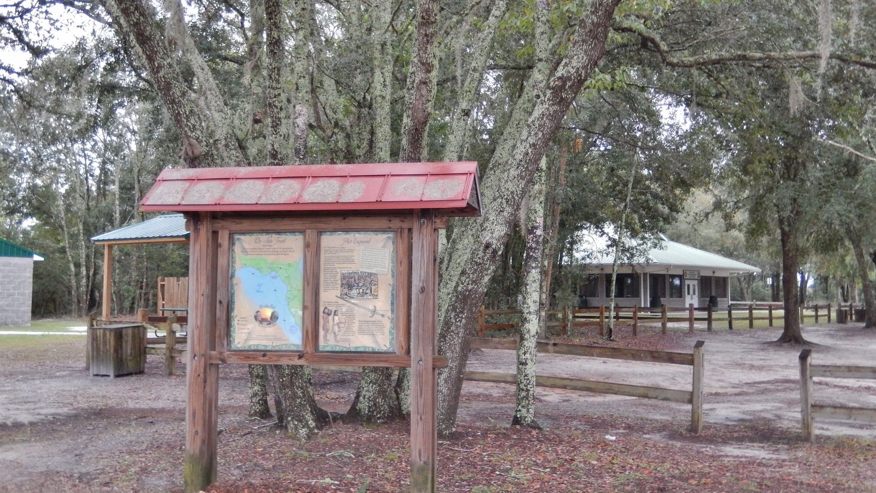
More about this marker. Marker is a large, composite plaque mounted vertically within a heavy-duty wooden kiosk.
Regarding Plot Exposed. Hernando de Soto landed at Tampa Bay in 1539 and made his way north in search of gold and riches. A controversial figure in American history, Spanish Conquistador Hernando de Soto is regarded as a hero and brave explorer by some — and an overzealous madman by others. The De Soto Trail shows him as a product of Medieval Europe, a brutal society forged over 780 years of warfare. It also tells
the story of the Native American peoples of 16th-century Florida, a highly advanced collection of chiefdoms struggling against each other to gain dominance over their regions.
Related markers. Click here for a list of markers that are related to this marker. Florida De Soto Trail
Also see . . . De Soto’s Expedition to North America. In 1536, de Soto obtained a royal commission to conquer and settle the region known as La Florida (now the southeastern United States), which had been the site of earlier explorations by Juan Ponce de León and others. De Soto set out from Spain in April 1538, set with 10 ships and 700 men. After a stop in Cuba, the expedition landed at Tampa Bay in May 1539. They moved inland and eventually set up camp for the winter at a small Indian village near present-day Tallahassee. (Submitted on November 6, 2018, by Cosmos Mariner of Cape Canaveral, Florida.)
Photographed By Cosmos Mariner, November 2, 2018
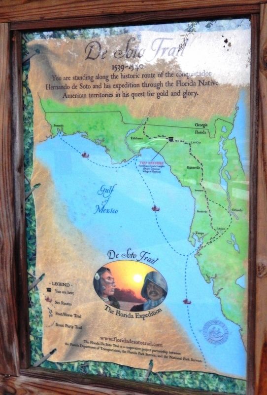
4. Florida De Soto Trail Map (panel to the left of marker in kiosk)
1539-1540
Credits. This page was last revised on January 6, 2021. It was originally submitted on November 6, 2018, by Cosmos Mariner of Cape Canaveral, Florida. This page has been viewed 605 times since then and 89 times this year. Last updated on November 21, 2018, by Cosmos Mariner of Cape Canaveral, Florida. Photos: 1, 2, 3, 4, 5. submitted on November 6, 2018, by Cosmos Mariner of Cape Canaveral, Florida. • Bernard Fisher was the editor who published this page.
