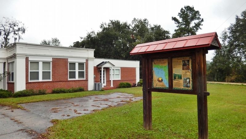
Monticello in Jefferson County, Florida — The American South (South Atlantic)
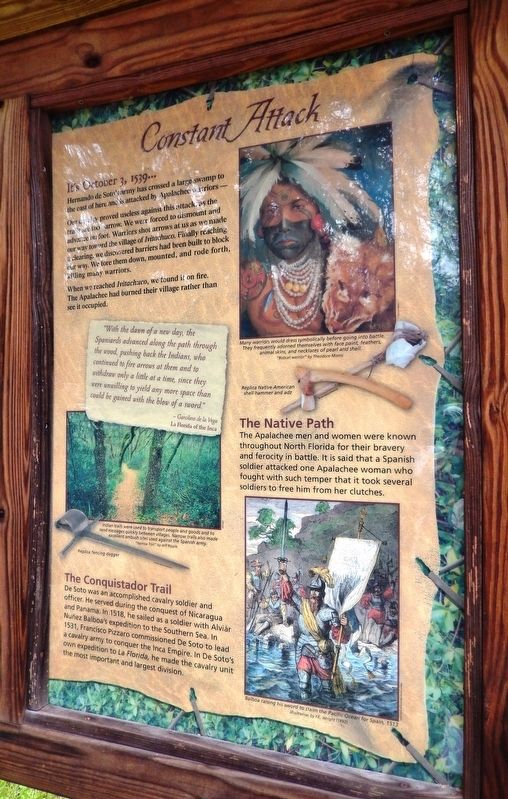
Constant Attack
Florida De Soto Trail
— October 3, 1539 —
Hernando de Soto’s army has crossed a large swamp to the east of here and is attacked by Apalachee warriors –
Our cavalry proved useless against this attack, as the trails are too narrow. We were forced to dismount and advance on foot. Warriors shot arrows at us as we made our way toward the village of Ivitachuco. Finally reaching a clearing, we discovered barriers had been built to block our way. We tore them down, mounted, and rode forth, killing many warriors.
When we reached Ivitachuco, we found it on fire. The Apalachee had burned their village rather than see it occupied.
”With the dawn of a new day, the Spaniards advanced along the path through the wood, pushing back the Indians, who continued to fire arrows at them and to withdraw only a little at a time, since they were unwilling to yield any more space than could be gained with the blow of a sword.”
- Garcilaso de la Vega
La Florida of the Inca
The Conquistador Trail
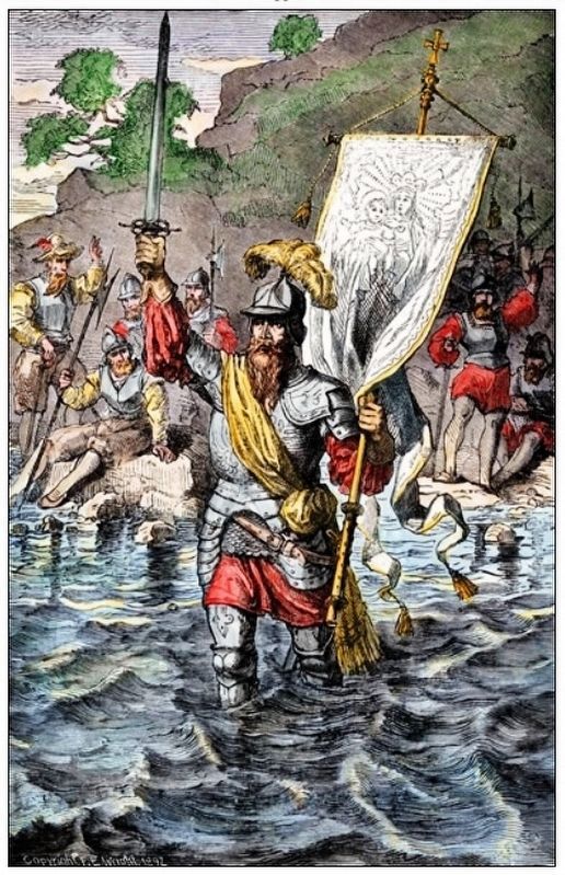
De Soto was an accomplished cavalry soldier and officer. He served during the conquest of Nicaragua and Panama. In 1518, he sailed as a soldier with Aviar Nuñez Balboa’s expedition to the Southern Sea. In 1531, Francisco Pizzaro commissioned De Soto to lead a cavalry army to conquer the Inca Empire. In De Soto’s own expedition to La Florida, he made the cavalry unit the most important and largest division.
The Native Path
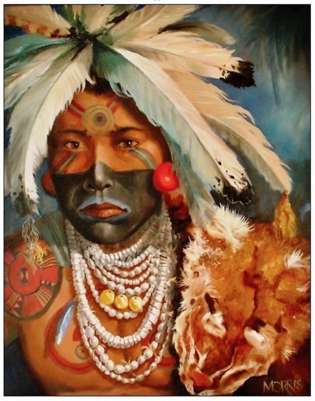
The Apalachee men and women were known throughout North Florida for their bravery and ferocity in battle. It is said that a Spanish soldier attacked one Apalachee woman who fought with such temper that it took several soldiers to free him from her clutches.
Erected by Florida De Soto Trail, Florida Department of Transportation, the Florida Park Service, and the National Park Service. (Marker Number 27.)
Topics. This historical marker is listed in these topic lists: Colonial Era • Exploration • Native Americans • Notable Events. A significant historical date for this entry is October 3, 1539.
Location. 30° 32.72′ N, 83° 52.823′ W. Marker is in Monticello, Florida, in Jefferson County. Marker is on West Washington Street west of Mahan Drive, on the right when traveling west. Marker is located beside the Wilderness Coast Public Library parking lot. Touch for map. Marker is at or near this postal address: 1180 West Washington Street, Monticello FL 32344, United States of America. Touch for directions.
Other nearby markers. At least 8 other markers are within walking distance of this marker. Confederate Memorial (about 400 feet away, measured in a direct line); Ernest I. Thomas Memorial (about 400 feet away); Jefferson County High School
(approx. 0.4 miles away); Monticello Methodist Church (approx. half a mile away); Perkins Opera House (approx. 0.6 miles away); "Meeting Oak" (approx. 0.6 miles away); The Town of Monticello (approx. 0.6 miles away); Jefferson County Florida Confederate Memorial (approx. 0.6 miles away). Touch for a list and map of all markers in Monticello.
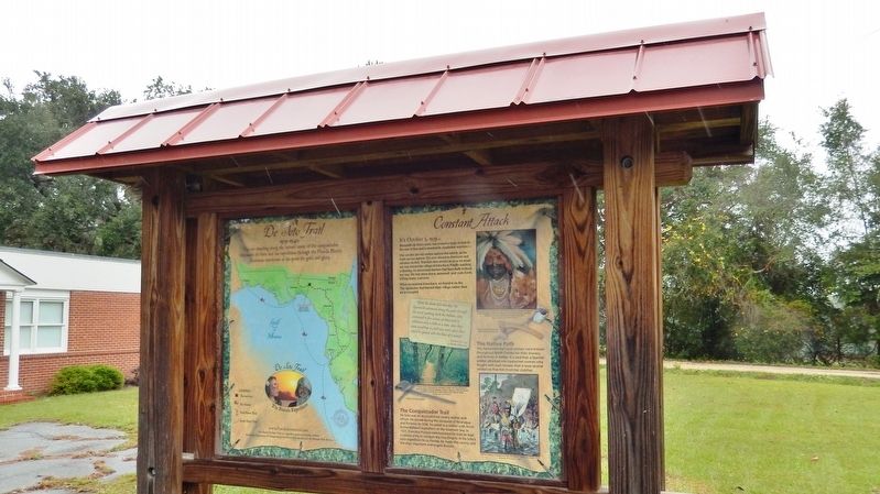
More about this marker. Marker is a large, composite plaque mounted vertically within a heavy-duty wooden kiosk.
Regarding Constant Attack. Hernando de Soto landed at Tampa Bay in 1539 and made his way north in search of gold and riches. A controversial figure in American history, Spanish Conquistador Hernando de Soto is regarded as a hero and brave explorer by some — and an overzealous madman by others. The De Soto Trail shows him as a product of Medieval Europe, a brutal society forged over 780 years of warfare. It also tells the story of the Native American peoples of 16th-century Florida, a highly advanced collection of chiefdoms struggling against each other to gain dominance over their regions.
Related markers.
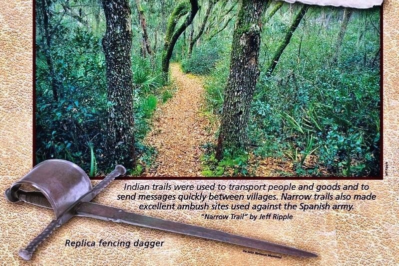
Courtesy of Jeff Ripple
3. Marker detail: “Narrow Trail” by Jeff Ripple
Indian trails were used to transport people and goods and to send messages quickly between villages. Narrow trails also made excellent ambush sites used against the Spanish army.
Replica fencing dagger, Courtesy of De Soto National Memorial
Replica fencing dagger, Courtesy of De Soto National Memorial
Also see . . .
1. Florida Frontiers: The story of the Apalachee. The Apalachee tribe lived in Florida’s Panhandle, and by the 1500s they had developed a sophisticated culture with farming villages and ceremonial centers. Anhaica, the Apalachee capital, was located near present day Tallahassee. In 1539, Hernando de Soto and his men landed on the Gulf Coast of Florida and traveled through the center of the state, looking for gold and killing any natives they encountered along the way. (Submitted on November 17, 2018, by Cosmos Mariner of Cape Canaveral, Florida.)
2. Vasco Núñez de Balboa. Vasco Núñez de Balboa was a Spanish explorer, governor, and conquistador. He is best known for having crossed the Isthmus of Panama to the Pacific Ocean in 1513, becoming the first European to lead an expedition to have seen or reached the Pacific from the New World. (Submitted on November 17, 2018, by Cosmos Mariner of Cape Canaveral, Florida.)
3. De Soto’s Expedition to North America. In 1536, de Soto obtained a royal commission to conquer and settle the region known as La Florida (now the southeastern United States), which had been the site of earlier explorations by Juan Ponce de León and others. De Soto set out from Spain in April 1538, set with 10 ships and 700 men. After a stop in Cuba, the expedition landed at
Tampa Bay in May 1539. They moved inland and eventually set up camp for the winter at a small Indian village near present-day Tallahassee. (Submitted on November 17, 2018, by Cosmos Mariner of Cape Canaveral, Florida.)
Photographed By Cosmos Mariner, November 14, 2018
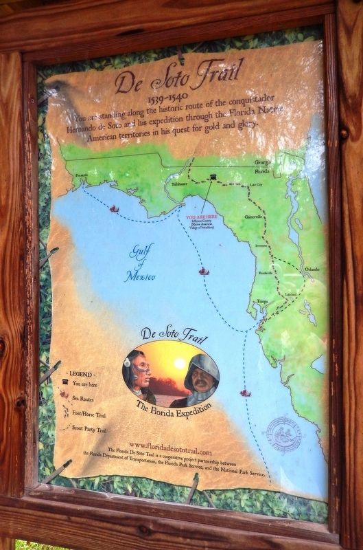
5. Florida De Soto Trail Map (panel to the left of marker in kiosk)
1539-1540
Credits. This page was last revised on January 9, 2021. It was originally submitted on November 16, 2018, by Cosmos Mariner of Cape Canaveral, Florida. This page has been viewed 344 times since then and 29 times this year. Last updated on November 21, 2018, by Cosmos Mariner of Cape Canaveral, Florida. Photos: 1, 2. submitted on November 17, 2018, by Cosmos Mariner of Cape Canaveral, Florida. 3. submitted on December 27, 2018, by Cosmos Mariner of Cape Canaveral, Florida. 4, 5, 6, 7. submitted on November 17, 2018, by Cosmos Mariner of Cape Canaveral, Florida. • Bernard Fisher was the editor who published this page.
