Arrowbrook Centre Park near Herndon in Fairfax County, Virginia — The American South (Mid-Atlantic)
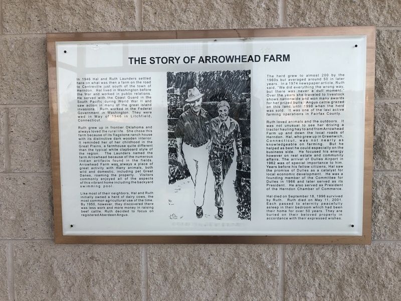
The Story of Arrowhead Farm
Ruth grew up in frontier Oklahoma and always loved the rural life. She chose this farm because of its flagstone ranch house with its distinctive dark wooden interior. It reminded her of her childhood in the Great Plains, a farmhouse quite different than the typical white clapboard style of the region. The Launders named the farm Arrowhead because of the numerous Indian artifacts found in the fields. Arrowhead Farm was always a place of great activity with many animals, both wild and domestic, including pet Great Danes, roaming the property. Visitors commonly enjoyed all of the aspects of this vibrant home including the backyard swimming pool.
Like most of their neighbors, Hal and Ruth initially owned a herd of dairy cows, the most common agricultural use of the time. By 1950, however, they discovered there was less work and more money in raising beef cattle. Ruth decided to focus on registered Aberdeen Angus.
The herd grew to almost 200 by the 1960s but averaged around 50 in later years. In a 1974 newspaper article, Ruth said, "We did everything the wrong way but there was never a dull moment." Over the years, she traveled to livestock shows nationwide and won many awards for her prized bulls. Angus cattle grazed on this land until 1998 when the herd was sold. It was one of the last active farming operations in Fairfax County.
Ruth loved animals and the outdoors. It was not unusual to see her driving a tractor hauling hay to and from Arrowhead Farm up and down the local roads of Herndon. Hal, who grew up in Greenwich, Connecticut, was not nearly as knowledgeable on farming. But he helped as best he could especially on the business side. He focused his energy however on real estate and community affairs. The arrival of Dulles Airport in 1962 was of special importance to him. Years before his fellow citizens, Hal saw the promise of Dulles as a catalyst for local economic development. He was a founding member of the Committee for Dulles in 1966 and later served as its President. He also served as President of the Herndon Chamber of Commerce.
Hal died on September 18, 1996 survived by Ruth. Ruth died on May 11, 2001. Each passed to eternity peacefully asleep in their bedroom which had been their home for over 50 years. They are buried on
Topics. This historical marker is listed in these topic lists: Cemeteries & Burial Sites • Settlements & Settlers • War, World II • Women. A significant historical month for this entry is May 1946.
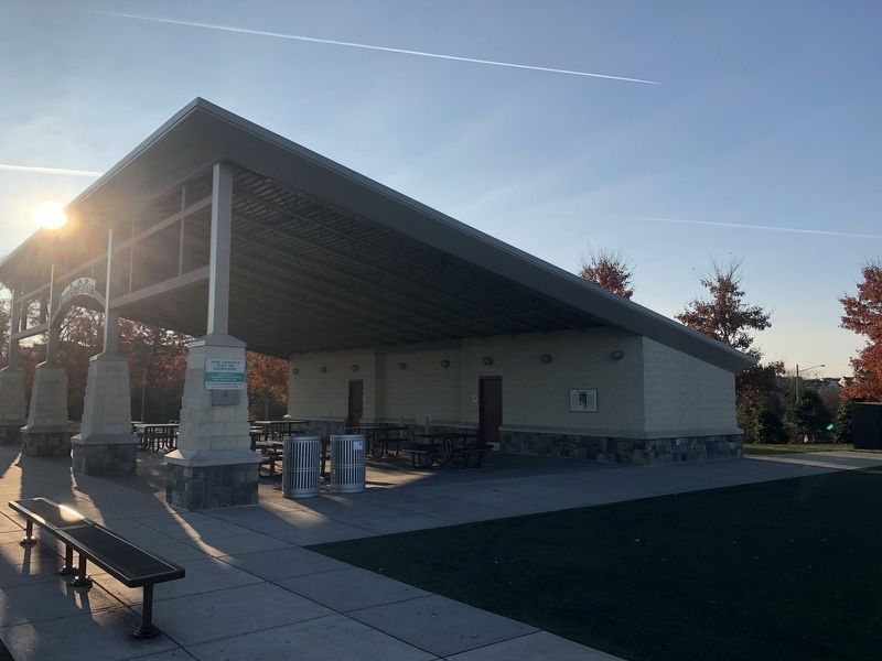
Location. 38° 57.23′ N, 77° 24.582′ W. Marker is near Herndon, Virginia, in Fairfax County. It is in Arrowbrook Centre Park. Marker can be reached from Arrowbrook Centre Drive west of Centreville Road (Virginia Route 657), on the right when traveling west. Touch for map. Marker is in this post office area: Herndon VA 20171, United States of America. Touch for directions.
Other nearby markers. At least 8 other markers are within walking distance of this marker. Laura Ratcliffe (about 500 feet away, measured in a direct line); a different marker also named Laura Ratcliffe (approx. half a mile away); Historical Site of Mount Pleasant Baptist Church (approx. 0.6 miles away); Mosby’s Rock (approx. 0.6 miles away); Pin Oak (approx. one mile away); Frying Pan Meeting House (approx. one mile away); a different marker also named Frying Pan Meeting House (approx. one mile away); Civil War at Frying Pan Spring Meeting House (approx. one mile away). Touch for a list and map of all markers in Herndon.
Credits. This page was last revised on September 21, 2023. It was originally submitted on November 22, 2018, by Devry Becker Jones of Washington, District of Columbia. This page has been viewed 835 times since then and 116 times this year. Last updated on September 9, 2022, by James Dean of Chesterfield, Virginia. Photos: 1, 2. submitted on November 22, 2018, by Devry Becker Jones of Washington, District of Columbia. • Bernard Fisher was the editor who published this page.

