Newcastle upon Tyne in Tyne and Wear, England, United Kingdom — Northwestern Europe (the British Isles)
West Walls
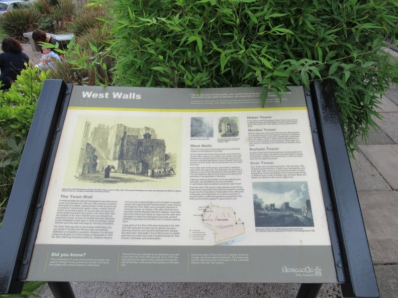
West Walls
"The walles here of Newcastle, are a great deal stronger than these of Yorke and not unlike to the walls of Avineon, but especially those of Jerusalem."
(A Just and Exact Discourse upon the Siege and Storming of Newcastle, The Siege of Newcastle, William Lithgow. Robert Bryson, Edinburgh, 1645). William Lithgow was an eyewitness to the Siege of Newcastle in 1644.
The Town Wall
A medieval defensive wall and Scheduled Ancient Monument it was built between the 13th and 15th centuries to defend Newcastle from attack. Approximately 2 miles long the wall consisted of several entry gates, towers, smaller interval turrets and postern gates. An access lane ran along the whole length and just to the inside of the Town Wall. After the building of the Town Wall the town was divided into twenty-four wards. In times of hostility they were defended by the inhabitants of that ward. In 1402, for example, nightly watches upon the walls were kept by 100 town inhabitants.
The Town Wall was kept in good repair whilst there was any threat of hostility and the town was successfully defended on at least two occasions. However, it is said that during the English Civil War's Siege of Newcastle in 1644 the Town Wall was breached where St. Andrews Street is now, by Lord Lieutenant Bailie and his Scottish Covenanter troops who supported the Parliamentarian cause. During the siege the Town Walls were eventually breached in numerous places on October 19th after which the town was taken and the Royalist defenders defeated. Newcastle had never before been taken by siege and the walls were damaged so badly that Parliament,eventually granted £2564.00, equivalent to £250,000 in 2013, towards repairing them.
Large parts of the Town Wall were destroyed in the 18th and 19th centuries to make way for grand, new town-planning schemes and industrial development. Despite this destruction, Newcastle's Town Wall survives in a better state than any other town wall in England except for York, Chester, Chichester and Southampton.
West Walls
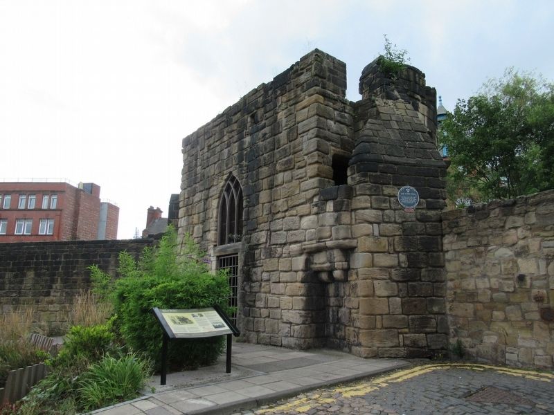
This is the best preserved section and most substantial remains of the Medieval Town Wall.
Of the original wall towers three can be seen from here. All have their original, ground-floor, flat, paved roofs and battlemented parapets apart from Morden Tower which has been changed significantly. East of Morden Tower the remains of Ever Tower still survive though it is not visible from here.
From either side of the towers' ground floor chambers, stairs led to the wall-walk. The wall-walk was just that, a walkway on top of the wall that provided excellent views over the defensive ditch and far beyond and allowed for patrolling of the perimeter of the town.
Additional defence and shelter, for those patrolling the wall-walk, was provided by the interval turrets of which there were normally two between each tower.
From the early 17th century until relatively recent times, all the towers around the Town Wall were leased as meeting houses by the Corporation of Newcastle to the craft guilds. Craft guilds were fraternities of workers involved in a specific trade or craft that regulated standards for their craft and promoted equality in opportunity to sell.
Heber Tower
In the early to mid-17th century Heber Tower was used as a meeting house by the Felt Makers, Curriers and Armourers and by the end of the 19th century it was a blacksmith's shop.
Morden Tower
Morden Tower was used in the 17th and early 18th centuries as a meeting house for the Glaziers, Plumbers, Pewterers and Painters. Inside used to be a gilded ball, suspended from the ceiling, which is said to have been fired from a cannon of the Scottish army during the 1644 siege. It is now used for readings by the world famous Morden Tower Poets.
Durham Tower
Durham Tower is the best preserved and least altered of these towers. It does not seem to have belonged to a guild, but became a military lock-up and later a coal and wood store for the adjoining school.
Ever Tower
Ever Tower was occupied during the 17th and early 18th centuries by the Paviours, Colliers and Carriagemen and in the later 18th century, by an eccentric known as Hairy Nanny. Ever Tower was built by some of the ancient family of Eure or Ever, Lords of Kirkley near the River Blyth and Barons of Whitton in the county of Durham.
Did you know?
The construction of some of the towers and gates was paid for through money granted by wealthy merchants and nobles who owned property in Newcastle.
The land that was cultivated by the Blackfriars was split in two when the Town Wall was built, but in 1280 they were granted the right to build a gateway through the wall so that they could access their gardens on the other side.
During the reign of King Henry III, a wall tax, known as murage, was levied against townsmen. This money was used to help finance the construction of the wall which started in the late 13th century.
( photo captions )
Taken from T.M. Richardson etching. The New Gate as seen in May 1823. This picture illuistrates the scale and strength that William Lithgow refers to above. Courtesy, Newcastle University Library
Morden Tower, pre-1920.
An interval turret on the wall between Morden and Ever Towers, 1783.
West part of the Town Wall looking south-west from St. Andrew’s Church towards Ever Tower in the background, 1786.
Erected by Newcastle City Council.
Topics. This historical marker is listed in this topic list: Forts and Castles. A significant historical month for this entry is May 1823.
Location. 54° 58.306′ N, 1° 37.263′ W. Marker is in Newcastle upon Tyne, England, in Tyne and Wear. Marker is at the intersection of Stowell Street and Friars Street, on the right when traveling south on Stowell Street. Located at Herber Tower. Touch for map. Marker is in this post office area: Newcastle upon Tyne, England NE4 5SP, United Kingdom. Touch for directions.
Other nearby markers. At least 8 other markers are within walking distance of this marker. The Town Wall (here, next to this marker); Bath Lane (within shouting distance of this marker); Gallowgate Lead Works (about 90 meters away, measured in a direct line); Ever Tower (about 180 meters away); 28 Clayton Street West (approx. 0.3 kilometers away); 36 Clayton Street West (approx. 0.3 kilometers away); Thomas Bewick (approx. 0.3 kilometers away); Basil Hume Memorial Garden (approx. 0.3 kilometers away). Touch for a list and map of all markers in Newcastle upon Tyne.
Also see . . . Newcastle town wall on Wikipedia. (Submitted on November 22, 2018, by Michael Herrick of Southbury, Connecticut.)
Credits. This page was last revised on January 27, 2022. It was originally submitted on November 22, 2018, by Michael Herrick of Southbury, Connecticut. This page has been viewed 199 times since then and 18 times this year. Photos: 1, 2. submitted on November 22, 2018, by Michael Herrick of Southbury, Connecticut.

