Newcastle upon Tyne in Tyne and Wear, England, United Kingdom — Northwestern Europe (the British Isles)
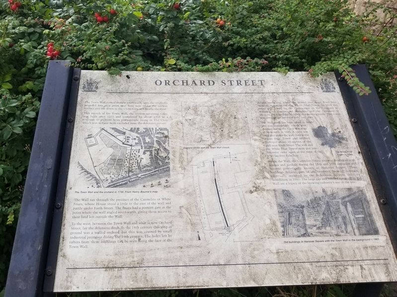
Orchard Street
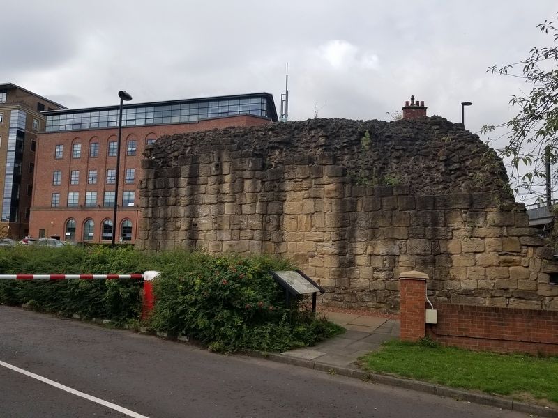
This stretch of the Town Wall, the section surviving today, was built after 1311 and completed by about 1333 as a response to protests from townspeople living in The Close which was to have been excluded from the defensive circuit.
The Wall ran through the precinct of the Carmelite or White Friars, whose House stood a little to the east of the wall and partly under Forth Street. The Friars had a postern gate at the point where the wall angled southwards, giving them access to their land left outside the Wall.
To the west, between the Town Wall and what is now Orchard Street, lay the defensive ditch. Ih the 18th century this strip of ground was a walled orchard, but this was covered by small industrial premises during the 19th century. The holes left by rafters from these buildings can be seen along the face of the Town Wall.
At the south end, where the ground now drops down into Hanover Street, stood the White Friar Tower. In 1614 the tower was leased by the Corporation to the Company of Wallers, Bricklayers and Plasterers and the Company of Mettors, who used the building as a meeting house. The tower was demolished between 1840 and 1844.
The Wall itself has been raised in height and was considerably rebuilt after damage during the Civil War siege of Newcastle in 1644. A mine was exploded under the wall close to the White Friar Tower and artillery destroyed about 52-metres of the wall near Forth Street. The wall and the White Friar Tower were put into defensive order again at the time of the 1745 Jacobite Rebellion.
Inside the Wall, the Carmelite Friary site was developed with houses and gardens during the 18th and 19th centuries and became patriotically known as Hanover Square. These buildings became part of an extensive brewery complex eventually occupied by the Federation Brewery, until its demolition in 1985. The large gap and unfilled openings in the Wall are a legacy of the brewing industry's use of the site. ( photo captions )
The Town Wall and the orchard in 1736. From Henry Bourne’s map. Orchard Street and the Town Wall circuit.
The White Friar Tower in 1840.
Old buildings in Hanover Square with the Town Wall in the background c.1882.
Topics. This historical marker is listed in this topic list: Forts and Castles. A significant historical year for this entry is 1311.
Location. 54° 58.093′ N, 1° 36.818′ W. Marker is in Newcastle upon Tyne, England, in Tyne and Wear. Marker is at the intersection of Forth Street and Orchard Street, on the right when traveling east on Forth Street. Touch for map. Marker is in this post office area: Newcastle upon Tyne, England NE1 3NY, United Kingdom. Touch for directions.
Other nearby markers. At least 8 other markers are within walking distance of this marker. Town Wall Repairs (a few steps from this marker); Literary & Philosophical Society (about 120 meters away, measured in a direct line); Sir Joseph Wilson Swan (about 120 meters away); Hadrian’s Wall (about 150 meters away); Danish Seamen’s Club (about 150 meters away); Castle Keep & Castle Garth (about 210 meters away); The Black Gate (about 210 meters away); Turning Bridge (about 210 meters away). Touch for a list and map of all markers in Newcastle upon Tyne.
Also see . . . Newcastle town wall on Wikipedia. (Submitted on November 22, 2018, by Michael Herrick of Southbury, Connecticut.)
Credits. This page was last revised on January 27, 2022. It was originally submitted on November 22, 2018, by Michael Herrick of Southbury, Connecticut. This page has been viewed 116 times since then and 4 times this year. Photos: 1, 2. submitted on November 22, 2018, by Michael Herrick of Southbury, Connecticut.

