The Seaway
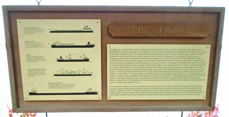
The mighty St. Lawrence River was first explored by Jacques Cartier in 1535. As early as 1680 settlers were talking about building canals on the St. Lawrence River to aid navigation. It was 150 years later that the first navigational work began. The present Seaway was completed in 1959. The natural waterway formed by the St. Lawrence River, the Great Lakes and their channels, stretches for more than 2300 miles from the Atlantic Ocean to Duluth, Minnesota in the heartland of North America. Oceangoing vessels enter the inland waterway from the Atlantic at the Gulf of St. Lawrence and travel 1000 miles inland to Montreal where the Seaway actually begins. Between Lake Ontario and Montreal, the water drops 266 feet in a distance of 182 miles. Normally an oceangoing vessel will navigate the Seaway in 25 hours. In so doing it will transit seven locks, 5 of which are operated in Canada by the St. Lawrence Seaway Authority. The other two are operated by the St. Lawrence Seaway Development Corp. of the United States. The U.S.-Canadian operation of the Seaway over the past quarter of a century ranks as one of the most outstanding examples of international cooperation in the world. The largest ships that ply the waters of the Seaway are the "Lakers." These ships average 620 feet long with a cargo capacity of 16,000 tons with the largest at 1000
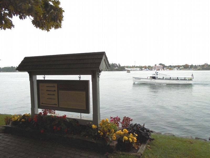
feet and a capacity of 50,000 tons. The "Salties" or seagoing ships average 450 feet long with the largest being 709 feet long. The total tonnage moved through the Seaway's Montreal-Lake Ontario section has averaged over 55 million tons during the past ten years. Since 1971, the shipping season has averaged 265 days or nearly nine months from late March to mid-December. Today the annual direct income benefits to the U.S.-Canadian Great Lakes Ports are estimated to be over $1 billion from commerce moving through the Seaway's Montreal-Lake Ontario section.Across the main channel you can see the village of Alexandria Bay, New York. At the turn of the century, Alexandria Bay was a bustling community with many grand hotels and busy commercial docks. It was here that the rich and famous sailed to their islands in "Millionaire's Row." It is still a fascinating spot where on the waterfront, you can watch the coming and goings of a conglomeration of luxury cabin cruisers, speed boats, sail boats, fishing boats and tour boats. It is said that Alexandria Bay is the Times Square of water craft. You can still stroll through the village streets and enjoy many marvelous restaurants and shops.
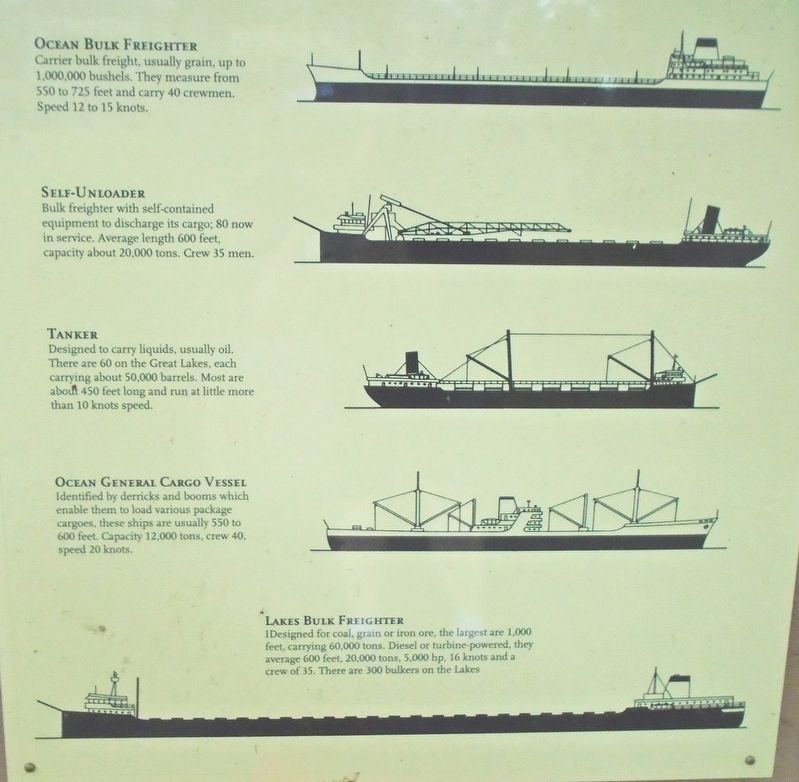
[Freighter Types, from top to bottom]
• Ocean Bulk Freighter - Carrier bulk freight, usually grain, up to 1,000,000 bushels. They measure from 550 to 725 feet and carry 40 crewmen. Speed
12 to 15 knots.• Self-Unloader - Bulk freighter with self-contained equipment to discharge its cargo; 80 now in service. Average length 600 feet, capacity about 20,000 tons. Crew 35 men.
• Tanker - Designed to carry liquids, usually oil. There are 60 on the Great Lakes, each carrying about 50,000 barrels. Most are about 450 feet long and run a little more than 10 knots speed.
• Ocean General Cargo Vessel - Identified by derricks and booms which enable them to load various package cargoes, these ships are usually 550 to 600 feet. Capacity 12,000 tons, crew 40, speed 20 knots.
• Lakes Bulk Freighter - Designed for coal, grain or iron ore, the largest are 1,000 feet, carrying 60,000 tons. Diesel or turbine-powered, they average 600 feet, 20,000 tons, 5,000 hp, 16 knots and a crew of 35. There are 300 bulkers on the Lakes
Erected by Thousand Islands Bridge Authority.
Topics. This historical marker is listed in these topic lists: Agriculture • Industry & Commerce • Man-Made Features • Waterways & Vessels. A significant historical year for this entry is 1535.
Location. 44° 20.64′ N, 75° 55.329′ W. Marker is on Heart Island, New York, in Jefferson County. Marker is on the Boldt Castle grounds, only accessible by boat as it sits on
Other nearby markers. At least 8 other markers are within walking distance of this marker. Grand Entrance (within shouting distance of this marker); Alster Tower & Peristyle (within shouting distance of this marker); Dovecote & Garden (about 300 feet away, measured in a direct line); Swan Pond (about 300 feet away); Power House (about 400 feet away); Boldt Castle (about 500 feet away); Yacht House & Wellesley Island (about 500 feet away); Cornwall Brothers Store (approx. 0.4 miles away). Touch for a list and map of all markers in Heart Island.
Also see . . .
1. St. Lawrence Seaway in The Canadian Encyclopedia. (Submitted on November 22, 2018, by William Fischer, Jr. of Scranton, Pennsylvania.)
2. Saint Lawrence Seaway Development Corporation. (Submitted on November 22, 2018, by William Fischer, Jr. of Scranton, Pennsylvania.)
3. St. Lawrence Seaway Management Corporation. (Submitted on November 22, 2018, by William Fischer, Jr. of Scranton, Pennsylvania.)
Credits. This page was last revised on November 22, 2018. It was originally submitted on November 22, 2018, by William Fischer, Jr. of Scranton, Pennsylvania. This page has been viewed 260 times since then and 14 times this year. Photos: 1, 2, 3, 4. submitted on November 22, 2018, by William Fischer, Jr. of Scranton, Pennsylvania.


