Natchez in Adams County, Mississippi — The American South (East South Central)
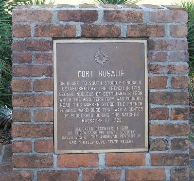
Fort Rosalie
Dedicated December 11, 1988
by the Mississippi State Society
Daughters of the American Revolution
Mrs. D. Kelly Love, State Regent
Erected 1988 by Mississippi State Society, Daughters of the American Revolution.
Topics and series. This historical marker is listed in these topic lists: Colonial Era • Settlements & Settlers • War, French and Indian. In addition, it is included in the Daughters of the American Revolution series list. A significant historical date for this entry is December 11, 1909.
Location. 31° 33.588′ N, 91° 24.515′ W. Marker is in Natchez, Mississippi, in Adams County. Marker can be reached from Orleans Street near South Canal Street (Business U.S. 84). Touch for map. Marker is at or near this postal address: 100 Orleans St, Natchez MS 39120, United States of America. Touch for directions.
Other nearby markers. At least 8 other markers are within walking distance of this marker. Rosalie Cemetery (here, next to this marker); The Parsonage (within shouting distance of this marker); Intersection of South Broadway and Washington streets (about 300 feet away, measured in a direct line); Silver Street and Natchez Under-the-Hill (about 400 feet away); Bernardo de Gálvez (about 500 feet away); Ft. Rosalie (Ft. Panmure) (about 500 feet away); Fort Rosalie Revisited (about 600 feet away); A Canal Street Neighborhood (about 600 feet away). Touch for a list and map of all markers in Natchez.
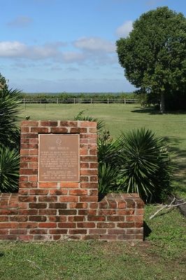
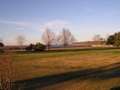
More about this marker. Marker location is approximate. The marker is located in the Bicentennial Garden at Rosalie overlooking the area of Old Fort Rosalie. The marker is located near the site of a tobacco warehouse that stood in the environs of the original Fort Rosalie area.
Related markers. Click here for a list of markers that are related to this marker. Fort Rosalie
Credits. This page was last revised on November 29, 2018. It was originally submitted on February 4, 2008, by Kevin W. of Stafford, Virginia. This page has been viewed 4,736 times since then and 43 times this year. Last updated on November 28, 2018, by Cosmos Mariner of Cape Canaveral, Florida. Photos: 1, 2. submitted on February 4, 2008, by Kevin W. of Stafford, Virginia. 3. submitted on February 3, 2008, by Mike Stroud of Bluffton, South Carolina. 4, 5. submitted on February 4, 2008, by Kevin W. of Stafford, Virginia. • Andrew Ruppenstein was the editor who published this page.
