Santiago de Querétaro in Querétaro, Mexico — The Central Highlands (North America)
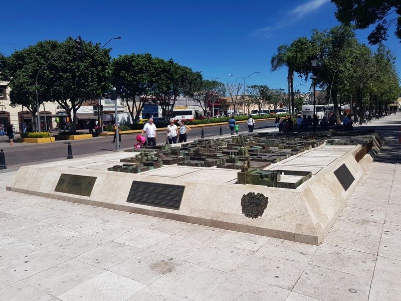
Bronze Map of the City of Santiago de Querétaro
Photographed By J. Makali Bruton, October 5, 2018
1. Bronze Map of the City of Santiago de Querétaro Marker
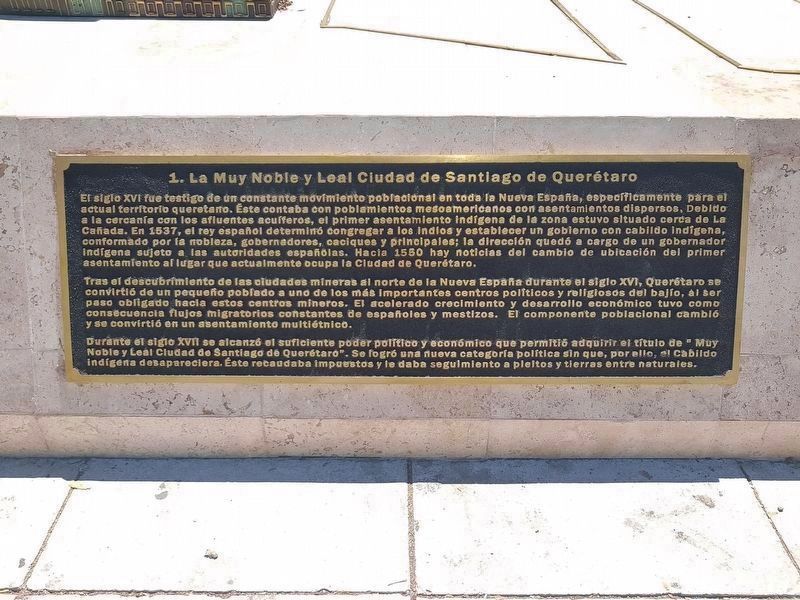
The monument includes four markers with text and also various maps of the city of Querétaro. All are mounted to the base of a large bronze map of the city. This photo shows the first of the four markers with text, "1. La Muy Noble y Leal Ciudad de Santiago de Querétaro." (1. The Very Noble and Loyal City of Santiago de Querétaro ).
El siglo XVI fue testigo de un constante movimiento poblacional en toda la Nueva España, específicamente para el actual territorio queretano. Éste contaba con poblamientos mesoamericanos con asentamientos dispersos. Debido a la cercanía cơn los afluentes acuíferos, el primer asentamiento indígena de la zona estuvo situado cerca de La Cañada. En 1537, el rey español determinó congregar a los Indios y establecer un gobierno con cabildo indígena, conformado por la nobleza, gobernadores, caciques y principales; la dirección quedó a cargo de un gobernador indígena sujeto a las autoridades españolas. Hacia 1550 hay noticias del cambio de ubicación del primer asentamiento al lugar que actualmente ocupa la Ciudad de Querétaro.
Tras el descubrimiento de las ciudades mineras al norte de la Nueva España durante el siglo XVI, Querétaro se convirtió de un pequeño poblado a uno de los más importantes centros politicos y religiosos del bajío, al ser paso obligado hacia estos centros mineros. El acelerado crecimiento y desarrollo económico tuvo como consecuencia flujos migratorios constantes de españoles y mestizos. El componente poblacional cambió y se convirtió en un asentamiento multiétnico.
Durante el siglo XVII se alcanzó el suficiente poder político y económico que permitió adquirir el título de "Muy Noble y Leal Ciudad de Santiago de Querétaro". Se logró una nueva categoría política sin que, por ello, el Cabildo indígena desapareciera. Éste recaudaba impuestos y le daba seguimiento a pleitos y tierras entre naturales.
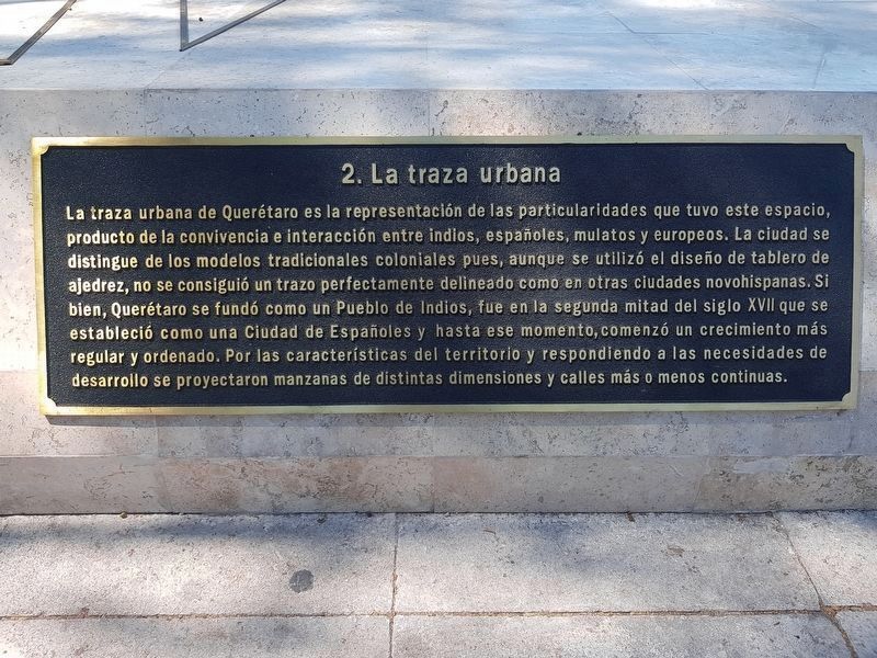
2. La traza urbana
La traza urbana de Querétaro es la representación de las particularidades que tuvo este espacio, producto de la convivencia e interacción entre indios, españoles, mulatos y europeos. La ciudad se distingue de los modelos tradicionales coloniales pues, aunque se utilizó el diseño de tablero de ajedrez, no se consiguió un trazo perfectamente delineado como en otras ciudades novohispanas. Si bien, Querétaro se fundó como un Pueblo de Indios, fue en la segunda mitad del siglo XVIII que se estableció como una Ciudad de Españoles y hasta ese momento, comenzó un crecimiento más regular y ordenado. Por las características del territorio y respondiendo a las necesidades de desarrollo se proyectaron manzanas de distintas dimensiones y calles más o menos continuas.
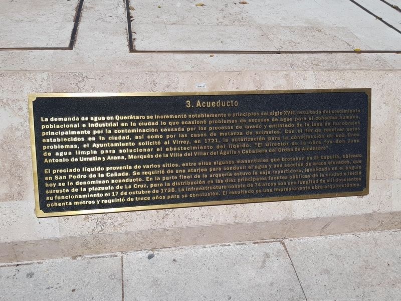
3. Acueducto
La demanda de agua en Querétaro se incrementó notablemente a principios del sigto XVII, resultado
del crecimiento poblacional e industrial en la ciudad lo que ocasionó problemas de escases de agua para el consumo humano principalmente por la contaminación causada por los procesos de lavado y entintado de la lana en los obrajes establecidos en la ciudad, así como por las casas de matanza de animales Con el fin de resolver estos problemas, el Ayuntamiento solicitó al Virrey, en 1721, la autorización para la constrcción de una línea de agua limpia para solucionar el abastecimiento del líquido. “El director de la obra fue don Juan Antonio de Urrutia y Arana, Marqués de la Villa del Villar del Águila y Caballero del Orden de Alcántara”.
El preciado líquido provenía de varios sitios, entre ellos algunos manantiales que brotaban en El Capulín, ubicado en San Pedro de la Cañada. Se requirió de una atarjea para conducir el agua y una sección de arcos elevados, que hoy se le denominan acueducto. En la parte final de la arquería sureste de la plazuela de La Cruz, para la distribución en las diez principales fuentes públicas de la ciudad e inició su funcionamiento el 17 de octubre de 1738. La infraestructura consta de 74 arcos con una longitud de mil doscientos ochenta metros y requirió de trece años para su conclusión. El resultado es una impresionante obra arquitectónica.
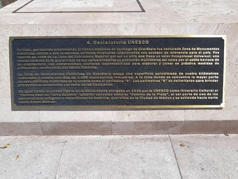
4. Declaratoria UNESCO
En 1981, por decreto presidencial, el Centro Histórico
de Santiago de Querétaro fue declarado Zona de Monumentos Históricos debido a sus numerosos edificios virreinales relacionados con sucesos de relevancia para el país. Fue inscrito en 1996 en La Lista del Patrimonio Mundial por ser unsitio que tiene un valor Excepiconal Universal; una
ciudad virreinal en la que el trazo de sus calles simboliza su población multiétnica así como por el estilo barroco de su arquitectura. Las declaraciones confieren responsablidad para elaborar y poner en práctica medidas de protección y revaloración del Centro Histórico.
La Zona de Monumentos Históricos de Querétaro ocupa una superficie aproximada de cuatro kilómetros cuadrados y cuenta con más de 1,400 monumentos inmuebles. A la zona donde se concentra la mayor parte de esos edificios históricos se le conoce como el perímetro “A”. Los perímetros “B” se delimitaron para brindar protección al Acueducto y el Cerro de las Campanas.
De igual forma la ciudad figura en la declatoria otorgada en 2010 por la UNESCO como Itinerario Cultural al “Camino de la Plata”, al ser parte de uno de los senderos más antiguos e importantes de América que inicia en la Ciudad de México y se extiende hacia norte hasta Nuevo México.
1. The Very Noble and Loyal City of Santiago de Querétaro
The 16th century witnessed
a constant movement of people throughout New Spain, specifically in what is the current territory of Querétaro. It originally had Mesoamerican settlements. Due to the proximity to water sources, the first indigenous settlement in the area was located near La Cañada. In 1537, the Spanish king decided to gather the Indians and establish a government with an indigenous council, consisting of the nobility, governors, caciques and other important indigenous families. An indigenous governor subject to the Spanish authorities was in charge of the council. Around 1550 the location is changed to that of the current City of Querétaro.
After the foundation of cities in the north of New Spain during the 16th century dedicated to mineral mining, Querétaro changed from a small town to one of the most important political and religious centers of the Bajío Region, being an obligatory route to these mining centers. The accelerated growth and economic development resulted in constant migratory flows of Spaniards and those of mixed race. The population component changed and it became a multi-ethnic settlement.
During the 17th century, sufficient political and economic power was achieved that allowed the acquisition of the title of the "Very Noble and Loyal City of Santiago de Querétaro". A new political category was therefore achieved without dissolving the indigenous Cabildo.
The indigenous government collected taxes and litigated lawsuits and land disputes among the natives.
2. The Urban Layout
The urban layout of Querétaro is the representation of the particularities that this space had and is a product of the coexistence and interaction between Indians, Spaniards, mulattoes and Europeans. The city is distinguished from the traditional colonial models because, although the chessboard design was used, a perfectly delineated layout was not achieved as in other cities of New Spain. Although Querétaro was founded as an indigenous town, in the second half of the 18th century it was established as a City of Spaniards. Since that time a more regular and orderly growth began. Due to the characteristics of the area, and responding to the needs of development, properties were planned with different dimensions and more or less continuous streets.
3. The Aqueduct
The demand for water in Queretaro increased notably at the beginning of the 17th century as a result of population and industrial growth in the city, which caused shortages of water for human consumption. This was caused mainly due to pollution from wool processing established in the city, as well as pollution from slaughterhouses. In order to solve these problems, the City Council requested to the Viceroy, in 1721, the authorization for the construction of a aqueduct. "The director of the work was Don Juan Antonio de Urrutia y Arana, Marquis of the Villa del Villar del Águila and Knight of the Order of Alcántara".
The precious liquid came from several places, including some springs in the area of El Capulín, located in San Pedro de la Cañada. It required an elevated tank and a section of raised arches, which today are known locally as the aqueduct. It arrives at the southeast arcade of the plaza of La Cruz, where water was distributed in the ten main public fountains of the city. It began its operation on October 17, 1738. The infrastructure consists of 74 arches with a length of 1,280 meters and it took thirteen years for it to be completed. The result is an impressive architectural work.
4. The UNESCO Declaration
In 1981, by Presidential Decree, the Historical Center of Santiago de Querétaro was declared a Historical Monument Area due to its numerous buildings from the Viceregal Period related to events of relevance for Mexico. It was inscribed in 1996 in the World Heritage List because it is a site that has an Exceptional Universal Value: it is a Viceregal Period city in which the outline of its streets symbolizes its multiethnic population as well as the Baroque style of its architecture. The declaration confers the responsibility to elaborate and implement measures for the protection and revaluation of the Historic Center.
The Historical Monuments Zone of Querétaro covers an area of approximately four square kilometers and includes more than 1,400 properties. The area where most of these historic buildings are concentrated is known as the "A" perimeter. The "B" perimeter was also delimited to provide protection to the Aqueduct and the Cerro de las Campanas.
Likewise, the city is included in the declaration issued in 2010 by UNESCO as part of the Cultural Route known as "Camino de la Plata", one of the oldest and most important trails in the Americas that starts in Mexico City and extends north to New Mexico.
Erected 2018 by La Administración Municipal de Querétaro 2015-2018.
Topics. This historical marker is listed in these topic lists: Colonial Era • Man-Made Features • Native Americans. A significant historical date for this entry is October 17, 1738.
Location. 20° 35.35′ N, 100° 23.3′ W. Marker is in Santiago de Querétaro, Querétaro. Marker is on Calle Ignacio Zaragoza just east of Calle Corregidora, on the right when traveling east. Touch for map. Marker is in this post office area: Santiago de Querétaro QUE 76000, Mexico. Touch for directions.
Other nearby markers. At least 8 other markers are within walking distance of this marker. Professor Eduardo Loarca Castillo (about 120 meters away, measured in a direct line); The Alameda Hidalgo (about 120 meters away); Fountain of the Hanged (about 150 meters away); Miguel Hidalgo (about 150 meters away); José López Alavés (about 180 meters away); Temple and former convent of Teresitas (about 180 meters away); Saint Junípero Serra (about 180 meters away); House of José María Sánchez (approx. 0.3 kilometers away). Touch for a list and map of all markers in Santiago de Querétaro.
Credits. This page was last revised on November 29, 2018. It was originally submitted on November 28, 2018, by J. Makali Bruton of Accra, Ghana. This page has been viewed 105 times since then and 6 times this year. Photos: 1, 2, 3, 4. submitted on November 28, 2018, by J. Makali Bruton of Accra, Ghana. 5. submitted on November 29, 2018, by J. Makali Bruton of Accra, Ghana.
