Wantagh in Nassau County, New York — The American Northeast (Mid-Atlantic)
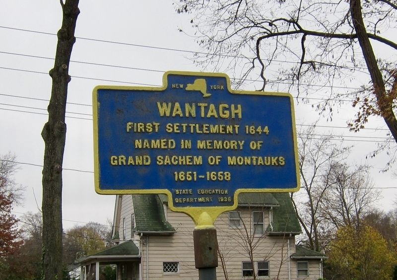
Wantagh
First settlement 1644
Named in memory of
Grand Sachem of Montauks
1651-1658
Erected 1936 by State Education Department.
Topics. This historical marker is listed in these topic lists: Native Americans • Settlements & Settlers. A significant historical year for this entry is 1644.
Location. 40° 40.835′ N, 73° 30.6′ W. Marker is in Wantagh, New York, in Nassau County. Marker is at the intersection of Wantagh Avenue and Emeric Avenue, on the left when traveling north on Wantagh Avenue. Touch for map. Marker is in this post office area: Wantagh NY 11793, United States of America. Touch for directions.
Other nearby markers. At least 8 other markers are within 2 miles of this marker, measured as the crow flies. Jackson House (approx. ¼ mile away); Robert Jackson (approx. 0.6 miles away); Quaker Cemetery (approx. 1.1 miles away); Washington Tour 1790 (approx. 1.1 miles away); Wantagh Baptist Church (approx. 1.1 miles away); Jerusalem (approx. 1.2 miles away); Indian Trail (approx. 1.4 miles away); Red House (approx. 1.8 miles away). Touch for a list and map of all markers in Wantagh.
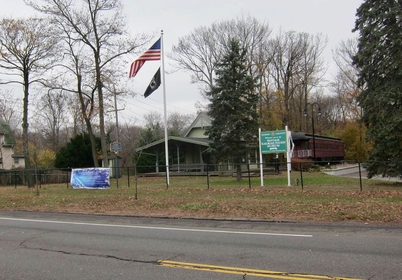
More about this marker. The marker is on the grounds of the Wantagh Railroad Station Museum
Also see . . . Wantagh, New York (Wikipedia). "The Wantagh area was inhabited by the Merokee (or Merikoke) tribe of the Metoac Indians prior to the first wave of European settlement in the mid-17th century. The Merokee were part of the greater Montauk tribe that loosely ruled Long Island's Native Americans. Wantagh was the sachem (chief) of the Merokee tribe in 1647, and was later the grand sachem of the Montauk tribe from 1651-1658. The Dutch settlers came east from their New Amsterdam colony, and English settlers came south from Connecticut and Massachusetts settlements. When the English and Dutch settled their competing claims to Long Island in the 1650 treaty conducted in Hartford, the Dutch partition included all lands west of Oyster Bay and thus the Wantagh area. Long Island then was ceded to the Duke of York in 1663-64, but then fell back into Dutch hands after the Dutch regained New York in 1673. The Treaty of Westminster in 1674 settled the land claims once and for all, incorporating Long Island into the now-British colony of New York." (Submitted on November 29, 2018.)
Credits. This page was last revised on November 29, 2018. It was originally submitted on November 29, 2018, by Andrew Ruppenstein of Lamorinda, California. This page has been viewed 447 times since then and 29 times this year. Photos: 1, 2. submitted on November 29, 2018, by Andrew Ruppenstein of Lamorinda, California.

