St. Augustine in St. Johns County, Florida — The American South (South Atlantic)
Fort Mose II
Fort Mose Historic State Park
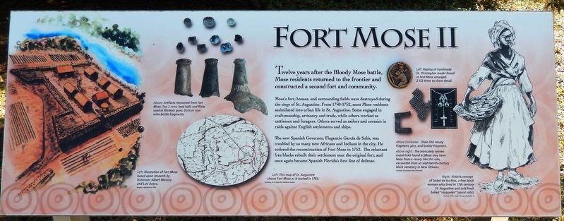
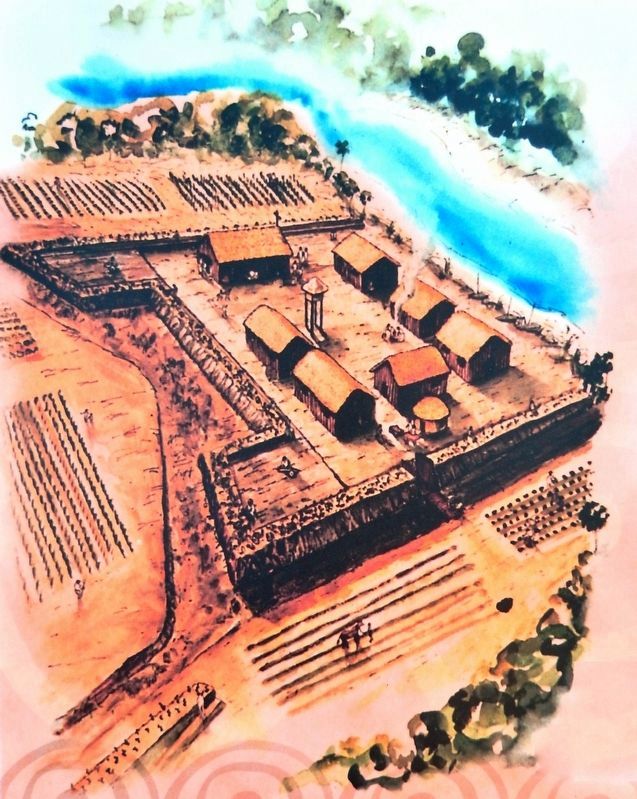
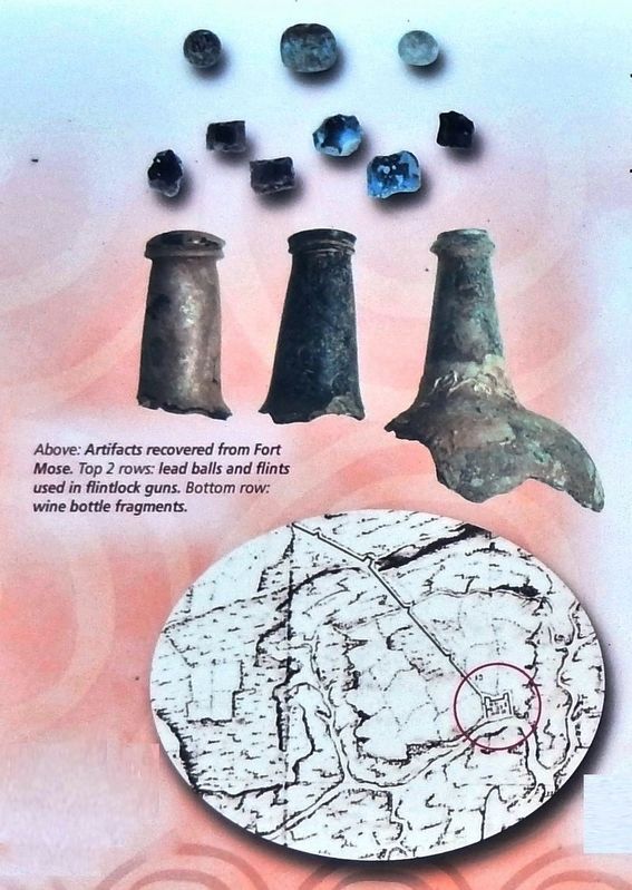
Mose's fort, houses, and surrounding fields were destroyed during the siege of St. Augustine. From 1740-1752, most Mose residents assimilated into urban life in St. Augustine. Some engaged in craftsmanship, artisanry and trade, while others worked as cattlemen and foragers. Others served as sailors and corsairs in raids against English settlements and ships.
The new Spanish Governor, Flugencio Garcia de Solís, was troubled by so many new Africans and Indians in the city. He ordered the reconstruction of Fort Mose in 1752. The reluctant free blacks rebuilt their settlement near the original fort, and once again became Spanish Florida's first line of defense.
Erected by Fort Mose Historic State Park.
Topics. This historical marker is listed in these topic lists: African Americans • Colonial Era • Forts and Castles • Native Americans. A significant historical year for this entry is 1752.
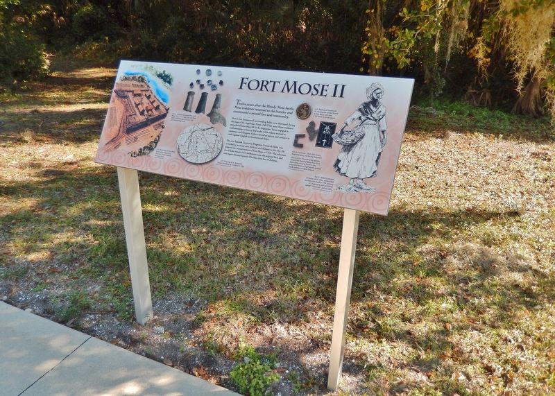
Location. 29° 55.738′ N, 81° 19.51′ W. Marker is in St. Augustine, Florida, in St. Johns County. Marker is on Fort Mose Trail, 0.2 miles east of North Ponce De Leon Boulevard (U.S. 1), on the right when traveling north. Marker located in Fort Mose Historic State Park, beside the sidewalk leading from the parking lot to the visitor center. Touch for map. Marker is at or near this postal address: 15 Fort Mose Trail, Saint Augustine FL 32084, United States of America. Touch for directions.
Other nearby markers. At least 8 other markers are within walking distance of this marker. Bloody Mose (here, next to this marker); El Pueblo de Gracia Real de Santa Teresa de Mose (a few steps from this marker); Evacuation (a few steps from this marker); Fort Mose I (a few steps from this marker); Fort Mose Site (within shouting distance of this marker); Escape & Flight (within shouting distance of this marker); British Enslavement (within shouting distance of this marker); Middle Passage (within shouting distance of this marker). Touch for a list and map of all markers in St. Augustine.
Related markers. Click here for a list of markers that are related to this marker. Fort Mose Historic State Park
Also see . . .
1. The journey of Africans to St. Augustine: Fort Mose. Rebuilt in 1752, the new Fort housed mostly African-American soldiers and their families until abandoned for the last time when Florida became an English colony in 1763. Fort Mose’s inhabitants were mainly runaway black Gullah slaves from the British colonies of South Carolina and Georgia, who escaped to freedom to Spanish, Florida in small groups at least as early as 1687. (Submitted on December 2, 2018, by Cosmos Mariner of Cape Canaveral, Florida.)
2. Fort Mose Historic State Park
. Florida Department of Environmental Protection (Submitted on December 3, 2018.)
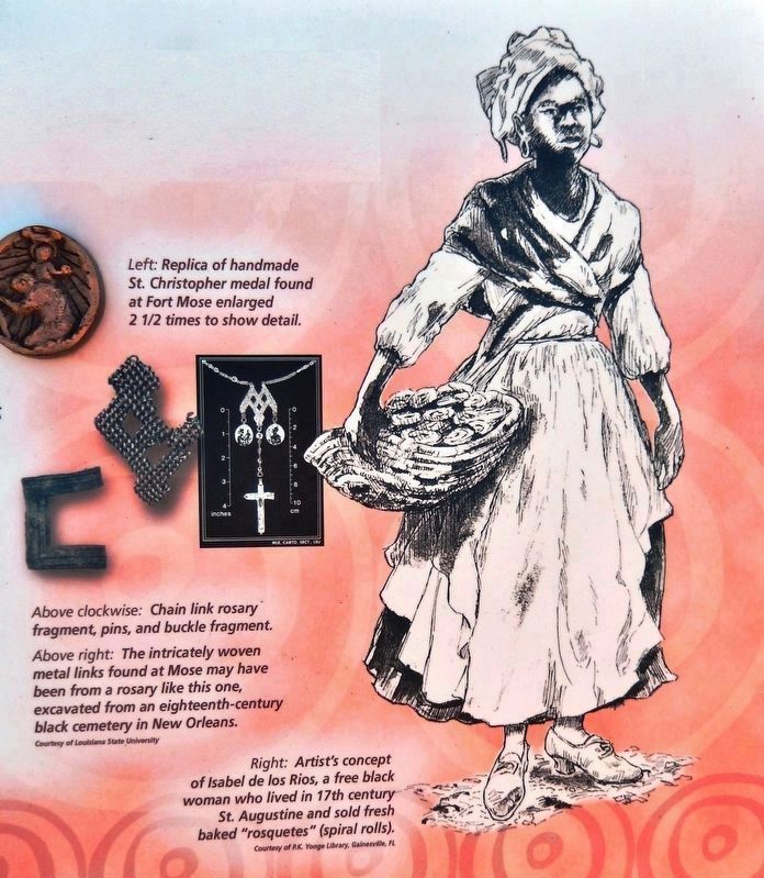
Courtesy of P.K. Yonge Library, Gainesville, Florida
4. Marker detail: Artist's concept of Isabel de los Rios
Isabel de los Rios was a free black woman who lived in 17th century St. Augustine and sold fresh baked "rosquetes, (spiral rolls).
Top: Replica of handmade St. Christopher medal found at Fort Mose enlarged 2 1/2 times to show detail.
Middle: Chain link rosary fragment pins, and buckle fragment. The intricately woven metal links found at Mose may have been from a rosary like this one, excavated from an eighteenth-century black cemetery in New Orleans. [Courtesy of Louisiana State University]
Credits. This page was last revised on October 28, 2020. It was originally submitted on December 1, 2018, by Cosmos Mariner of Cape Canaveral, Florida. This page has been viewed 467 times since then and 33 times this year. Photos: 1. submitted on December 1, 2018, by Cosmos Mariner of Cape Canaveral, Florida. 2, 3, 4, 5. submitted on December 2, 2018, by Cosmos Mariner of Cape Canaveral, Florida. • Bernard Fisher was the editor who published this page.
